Three Additional Tornadoes Confirmed Across Alberta From Earlier in 2023

After each tornado season, the Northern Tornadoes Project (NTP) reviews satellite imagery of treed areas across the country to find evidence of tornado damage that may have been missed due to a lack of reports or poor radar coverage.

After completing their review of Alberta, the NTP has catalogued three new tornadoes for the 2023 season. With the additional confirmed tornadoes, the overall 2023 tornado count for Alberta stands at 19.


GOOGLE AD (NOT ENDORSED BY INSTANT WEATHER)

The first new tornado was an EF1 that touched down near Lawrence Lake, to the east of Hondo, at approximately 4:00 pm on May 23rd, with an estimated maximum wind speed of 145km/h.

The second tornado was also an EF1 and this one touched down near McGregor Lake, northeast of Nordegg, on June 17th at approximately 1:10 pm with estimated maximum wind speeds of 145km/h.

The third tornado was an EF0 west of Cynthia. This particular tornado was found as a result of a private drone survey that showed tornadic tree damage in a forest that had recently been impacted by a fire. Further investigation established that this tornado had touched down at approximately 6:05 pm and had maximum wind speeds of 105km/h.


GOOGLE AD (NOT ENDORSED BY INSTANT WEATHER)

EF0 Tornado Confirmed South of Hamilton, Ontario on Saturday Morning

The Northern Tornadoes Project (NTP) has officially verified the occurrence of a tornado near Caledonia, Ontario, during the morning hours of Saturday (August 12, 2023, at 10:15 AM EDT). The tornado's impact resulted in EF0 damage, primarily affecting trees within the vicinity.


The visual evidence captured by witnesses, including images and videos of the funnel cloud, prompted the NTP to launch an investigation into the event. Their findings unveiled a narrow path of damage situated to the northeast of Caledonia. This affected area showcased characteristics of snapped stems and broken branches, along with indications that the tornado had lifted larger branches.


In terms of intensity, the tornado's maximum wind speed was estimated at 115 km/h. It followed a track length of 5 kilometres, with its maximum path width spanning 150 meters.

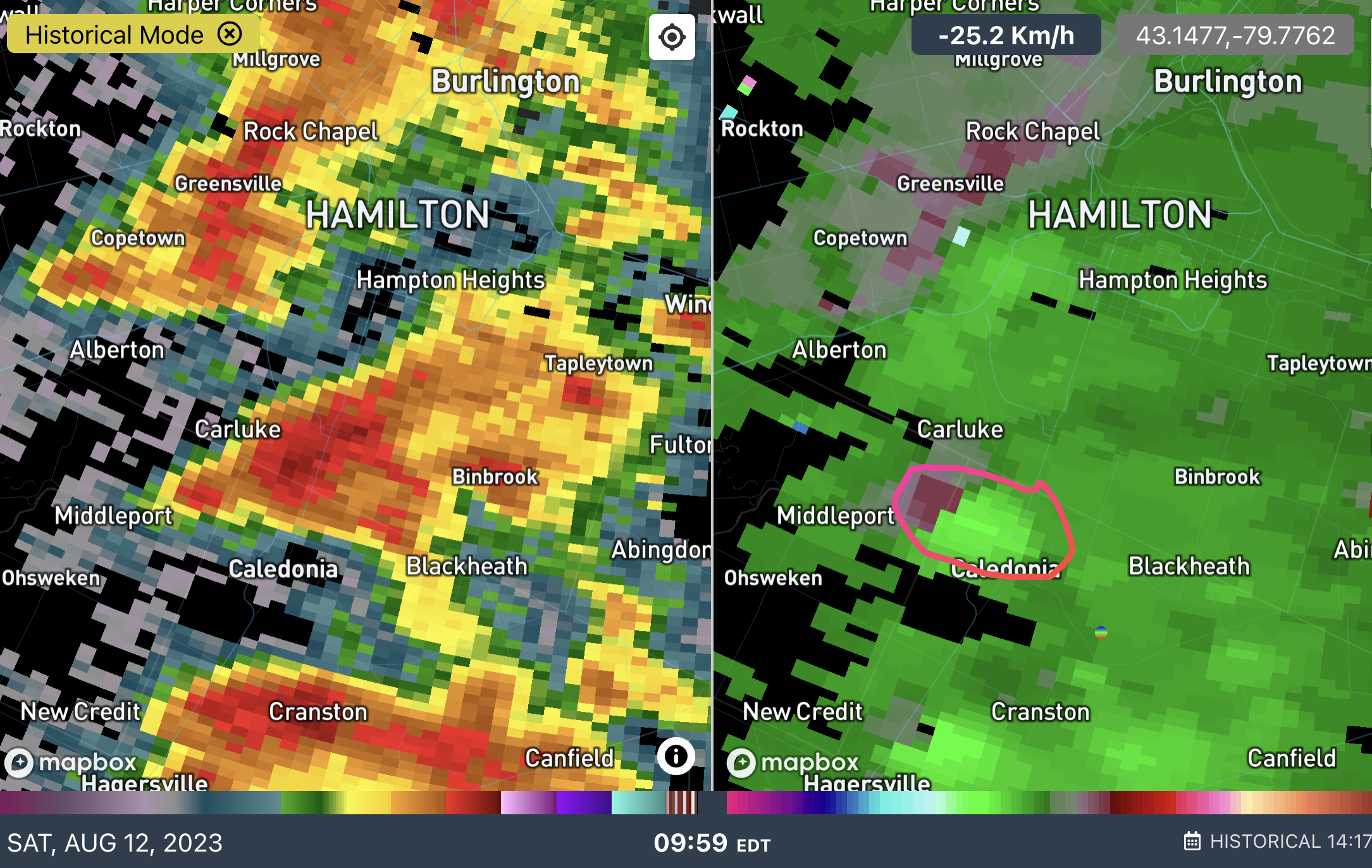
This radar scan at 9:59 AM from the King City radar as shown on IW Pro provided an early indication of potential tornado activity to the northwest of Caledonia. This rotation eventually materialized into the confirmed tornado, which touched down approximately 15 minutes later northeast of Caledonia.


Based on the radar-detected rotation, Instant Weather sent out a ‘Tornado Potential’ notification at 9:53 AM. This advance notification specifically identified Caledonia as an area potentially at risk where the tornado eventually touched down around 20 minutes later:

We've detected tornado potential with this storm near #Middleport, tracking east towards the #Caledonia and #MountHope region. Significant damaging winds are present on radar as well.

Tornado potential means this storm could produce an isolated tornado.

Environment Canada issued a severe thunderstorm warning at 10:18 AM which included Caledonia, however, it didn’t mention any tornado risk.

UPDATE: Now Three EF1 Tornadoes Confirmed From June 20th, Including a 1.2 KM Wide Tornado

UPDATE: The Northern Tornadoes Project has now confirmed three EF1 tornadoes in Southern Manitoba that occurred on Tuesday, June 20th, 2023. Our thoughts remain with those affected.

The NTP initially wrote:

”Two NTP ground/drone survey teams have been busy in SW Manitoba after the intense evening storms of June 20th there. Initial results are that two tornadoes occurred, each rated EF1.”

And have since followed that up with:

”An NTP survey has turned up a third EF1 tornado from the June 20th storms in southwest Manitoba…”

Below are some highlights from the NTP’s summary:

”Structural and tree damage reported in (Sidney/MacGregor) area. No injuries were reported. An NTP ground and drone survey was completed in the area… …documenting the structural damage along with grain bin damage and tree damage along a track appox. 7 km long and 800 m wide at maximum. Damage assessed as EF1 tornado (over land), with an estimated max. wind speed of 135 km/h.”

”Satellite imagery review revealed a tornado damage path in a forested area that likely started approximately 100 m south of the Canadian border near Carpenter, ND, with most of the damage (including the worst) occurring in Canada. An NTP drone survey of the Canadian portion of the tornado track was completed on June 23, 2023. A preliminary analysis of the Canadian portion of the track was completed by NTP. Event was assessed as EF1 tornado, with an estimated max. wind speed of 145 km/h, track length of 6.50 km and max. path width of 210m.

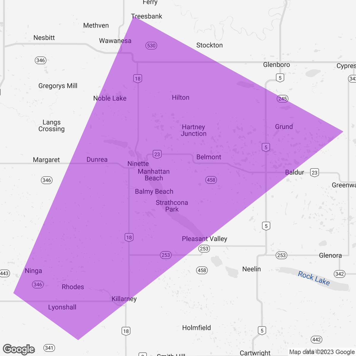
“Structural and tree damage was reported in the Killarney - Ninette area following a storm passing though. An NTP ground and drone survey was completed on June 21 and 22, 2023…” “…Event was assessed as EF1 tornado, with an estimated max. wind speed of 155 km/h, track length of 17.5 km and max. path width of 1.2 km.” “…Further investigation is pending, including satellite imagery review and additional drone imagery review.”


Below is a timeline of the event regarding forecasts, alerts and custom notifications:


On Monday, June 19th at 2:04 PM, Environment Canada issued a timely “Moderate” forecast that mentioned the risk for a tornado in Southern Manitoba. They mentioned; “Severe thunderstorms tomorrow in the yellow area. Very large hail, very strong wind gusts, and very heavy rain are the main threats with risk of tornado. Stay up to date with watches and warnings.”


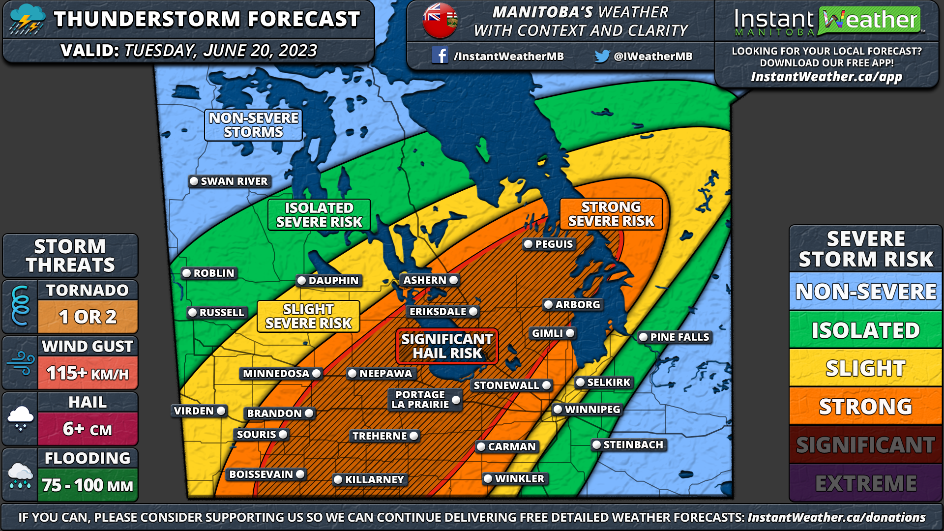
On Tuesday, June 20th at 12:18 AM during our livestream of the severe weather event the night before, we debuted our custom forecast and initially went with a “Significant” forecast for “Several Tornadoes”.


Environment Canada updated their forecast to a “High” risk on Tuesday, June 20th at 11:44 AM, which still included a tornado risk on the map. ”An update for the orange area. Winnipeg and Brandon are in a new yellow area. Very large hail, strong wind gusts, and very heavy rain are possible in this new yellow region.”


Later that afternoon at 12:55 PM, we updated our forecast to a “Strong” forecast but added a Significant Hail Risk region to the map and shared it with the headline; ”Potential Significant Severe Threat in Southern Manitoba for Tuesday Evening With the Risk of Tornadoes”.


At 3:27 PM, Environment Canada issued a Severe Thunderstorm Watch for parts of Southwestern Manitoba and wrote: "Conditions are favourable for the development of severe thunderstorms this afternoon and this evening in parts of Southern and Eastern Manitoba. The main threats from these thunderstorms will be: - hail to the size of baseballs - wind gusts in excess of 100 km/h - rainfall in excess of 50 mm. Thunderstorms will continue well into the evening hours.”


At 4:27 PM, we at Instant Weather launched what would end up being an eight hour livestream (one of our longest) with the title “MANITOBA LIVESTREAM: Tornado Risk” to cover these storms in real-time and we linked this video to roughly when these storms coming across the international border began to strengthen on radar before ultimately producing two EF1 tornadoes with one area of damage still under investigation.


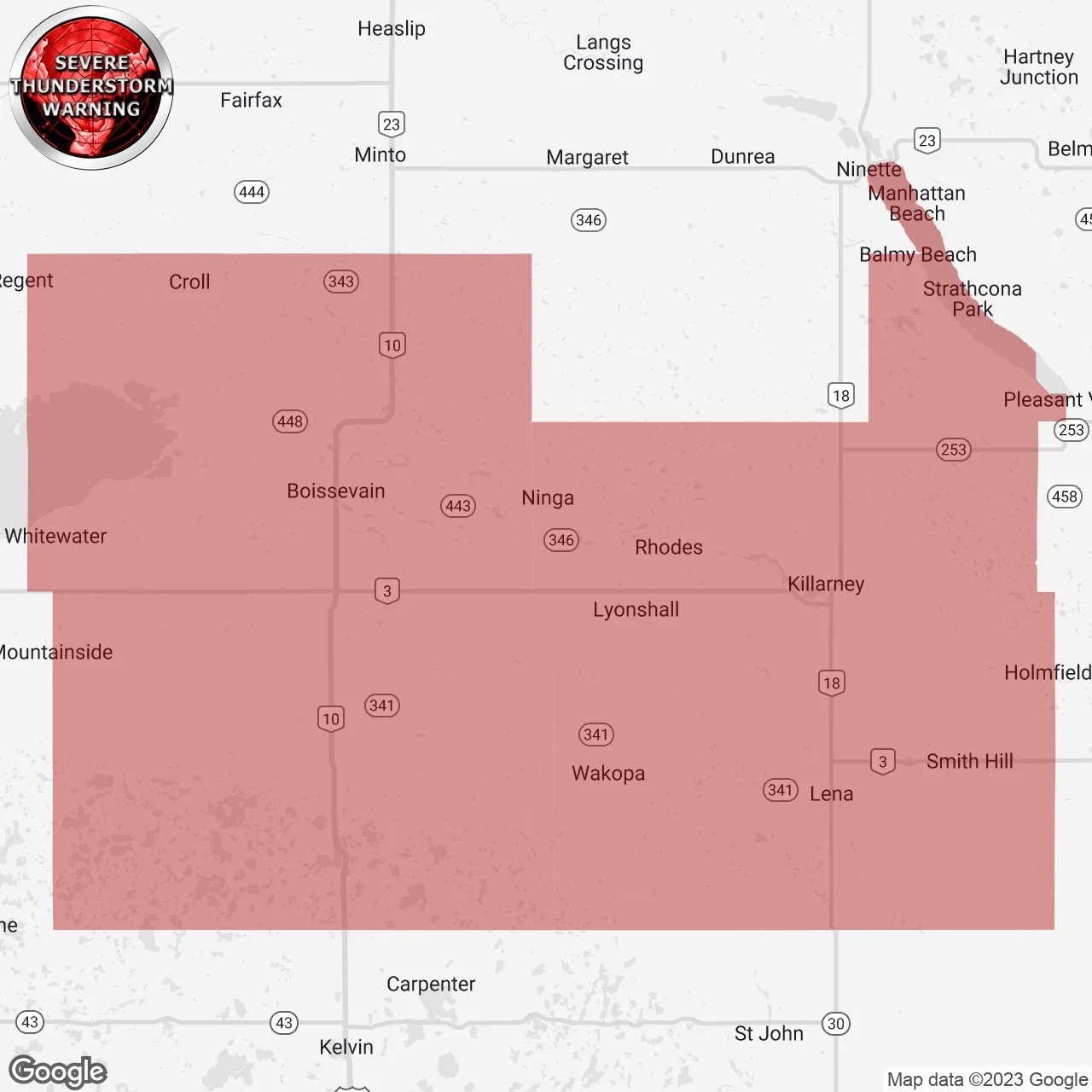
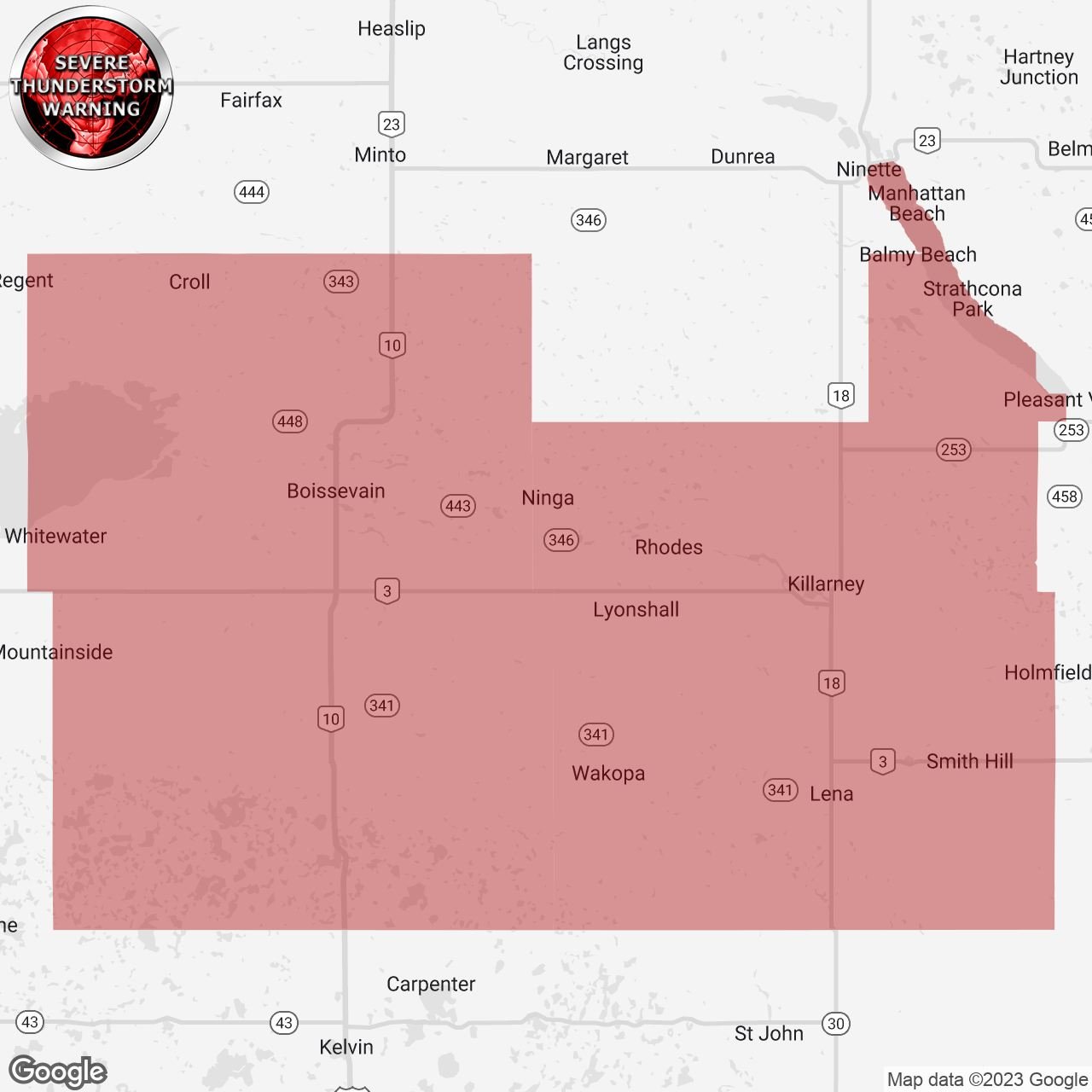
At 8:52 PM, 43 minutes in advance of the first touchdown, Environment Canada issued a Severe Thunderstorm Warning for the affected areas that mentioned “Environment Canada meteorologists are tracking a severe thunderstorm capable of producing loonie-sized hail and wind gusts in excess of 90 km/h.”


At 8:53 PM (42 minutes before touchdown), we sent out a custom notification regarding the storms that were tracking across the border which said; “Minor Rotation Detected: We've detected minor rotation on this storm just crossing the international border, heading northeast towards #Boissevain, #Ninga, etc." Upper level rotation is much stronger than surface based rotation but strong damaging winds are also possible. In rare cases, minor rotation can produce a tornado in its lifespan.”


At 8:55 PM (40 minutes before touchdown), we sent out another custom notification to the same region that said “TORNADO POTENTIAL: We've detected tornado potential with this storm just crossing the international border, heading northeast towards #Boissevain, #Ninga, etc. Significant hook-echo and strong rotation now evident on US radar. Tornado potential means this storm is likely to produce an isolated tornado. Damaging wind gusts, hail, isolated flooding, and frequent lightning are also likely. Please be safe in the path of this storm!”


At 9:01 PM (34 minutes before touchdown), we shared a radar image of the storms tracking to the northeast towards the affected regions and wrote “Shelter NOW on this storm about to cross into Manitoba south of Boissevain. Very strong signs of rotation.”


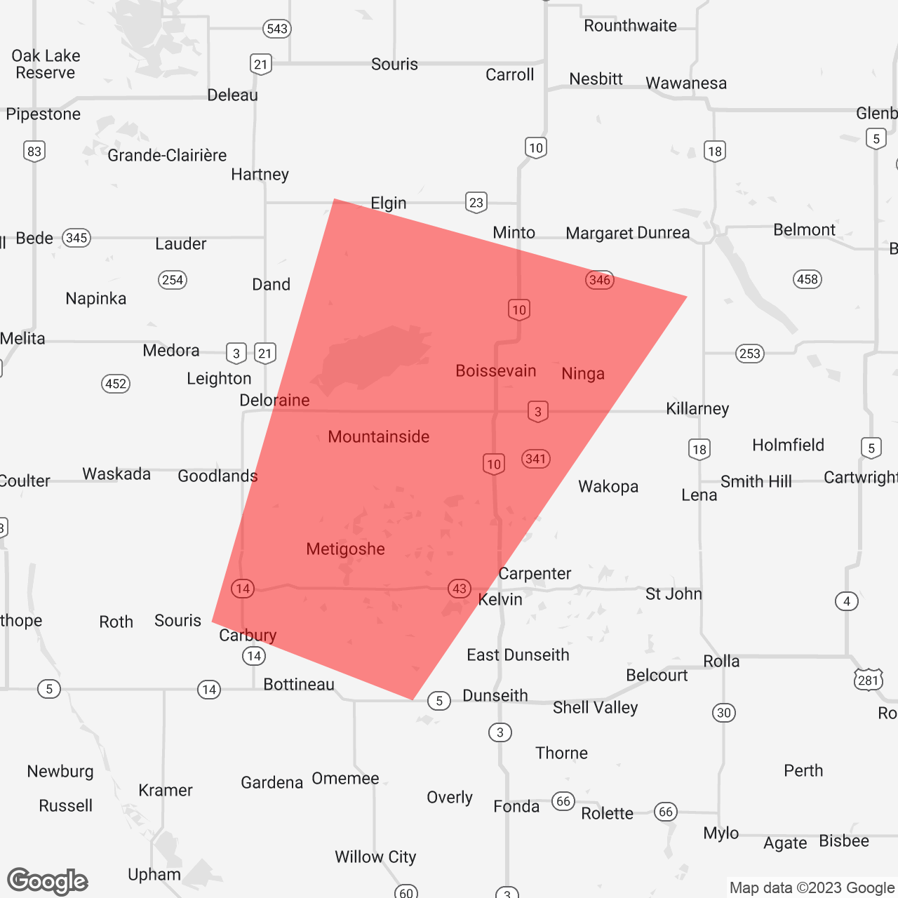
At 9:11 PM, Environment Canada continued the Severe Thunderstorm Warning which mentioned “Environment Canada meteorologists are tracking a severe thunderstorm capable of producing loonie-sized hail and wind gusts in excess of 90 km/h. At 9:10 P.M. CDT doppler radar indicated that this severe thunderstorm was located South of Deloraine and Turtle Mountain Provincial Park and was moving toward the Northeast at 40 km/h.”

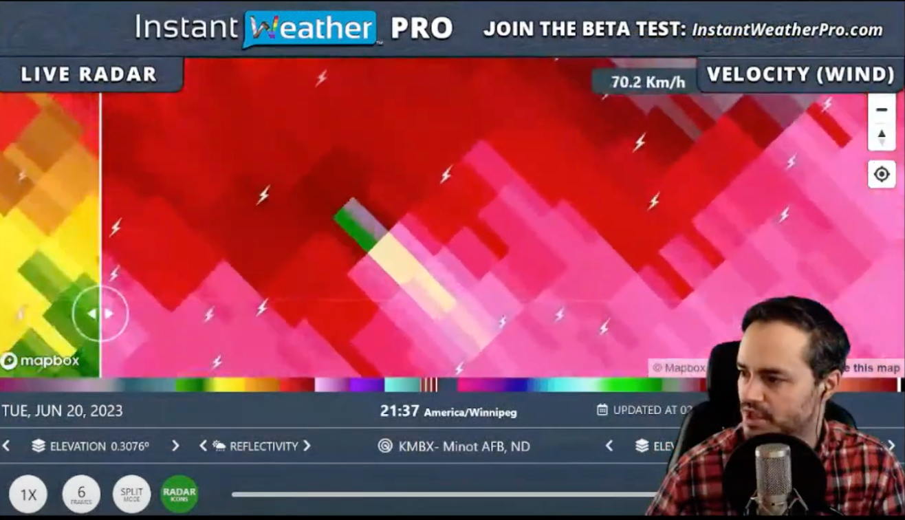
At 9:44 PM, we noticed a very small rotation couplet on radar during our livestream which ended up being the signature for the first EF1 tornado as it crossed into Canada.


At 9:57 PM, we sent out a custom notification that said; “DEBRIS SIGNATURE: There is a debris signature on US radar near #Wakopa, tracking northeast into #Killary area. Take shelter in the path of this storm. Tornado potential means this storm is likely to produce an isolated tornado. Damaging wind gusts, hail, isolated flooding, and frequent lightning are also likely. Please be safe in the path of this storm!”


At 10:00 PM, we sent out a custom notification on a new area of rotation as the second tornado was beginning its 17.5km journey and wrote: “TORNADO RISK: A tornado is possible with this storm west of #Killarney, tracking to the northeast. If you are in the path, get to the lowest level (preferably a basement) of a sturdy structure and get to the most interior room that has as many walls between you and the outside as possible. Damaging wind gusts, hail, isolated flooding, and frequent lightning are also possible with severe thunderstorms. Please be safe in the path of this storm!”


In summary, we’re so thankful that there were no reported injuries from these two dangerous tornadoes and super grateful that we were able to help those in the path get to safety by send out custom notifications via our free app Instant Weather. Our thoughts remain with those who were affected and a huge thank you to the NTP for their timely and detailed survey.

Canada's First Tornado of 2023 Confirmed Near Regina, Saskatchewan

In what may seem like an unusually late start to Canada's tornado season, the nation's first tornado of 2023 touched down near Regina, Saskatchewan on May 27. The tornado, confirmed by both the Northern Tornadoes Project (NTP) and Environment and Climate Change Canada (ECCC), caused significant localized damage but resulted in no reported injuries.

DAMAGE CAUSED BY TORNADO - Photo courtesy of the Northern Tornadoes Project (NTP)

The tornado occurred southeast of Regina at 8:55 p.m., initially rated as EF0, the lowest rating on the Enhanced Fujita Scale used to rate tornado strength. However, an NTP survey team later upgraded the rating to EF1, indicating more significant damage with an estimated maximum wind speed of 150 km/h.

The major impact was on a farm near Rowatt, where a large machine shed suffered roof damage. Witnesses reported debris blown up to 2.5 km NNE of the damage site. The owner of the farm, Jennifer Kreklewich, described the scene as a "disaster" and said the damage was more severe than what photos could show.


In addition to the tornado, the supercell storm also brought heavy rain, flooding, and severe hail to Regina that same night. Flash flooding led to water backlogs and multiple stranded vehicles in Regina's underpasses, with water damage reports pouring into insurance companies the next day. One notable business closure due to flooding was the Shoppers Drug Mart on Broad Street. There were also reports of toonie-sized hail across Regina.

According to Terri Lang, a meteorologist with ECCC, the size of a tornado doesn't necessarily indicate its strength. A tornado's strength is determined by the damage it causes, not its physical appearance. This is why many tornadoes are rated EF0, especially those that touch down in remote areas where their ability to cause damage can't be accurately analyzed. And was later upgraded once the damage was uncovered.

At the time of the storm, a local radar station near Regina was down, making it challenging for meteorologists to track the storm. ECCC meteorologists used radar near Saskatoon, western Manitoba, and northern Montana, as well as satellite photos, surface observations, and lightning detectors, to track the storm. The lack of a functioning local radar may have led to a delay in the tornado warning, which was issued seven minutes after the tornado touched down. There was a thunderstorm warning issued just after 8 p.m., following reports of heavy rain and hail.

Despite the challenges faced due to the radar outage, the tornado was quickly detected thanks to reports sent into Instant Weather from community members including from Stephanie W. that shared a picture that showed a clear funnel with debris on the ground

Additional tornado reports were received from storm chaser Craig Boehm which led Environment Canada to issue a tornado warning after touchdown. The Bethune radar station, which was down at the time, has returned to service.

SOURCES

  1. First tornado of the year touches down near Regina, CTV News
  2. NTP survey team report, Twitter
  3. South Saskatchewan storm leads to first confirmed tornado of 2023, Global News
  4. Meteorologists challenged after local radar station down during Regina tornado, Toronto Star

ON THIS DAY: Canada's Only Confirmed F5 Tornado - Elie, Manitoba - June 22, 2007

On June 22, 2007, Canada’s only F5 rated tornado destroyed parts of Elie, Manitoba. Canada adopted the Enhanced Fujita scale in 2013 so this will be the only F5 rated tornado in our history. With wind speeds in excess of 420 km/h, it caused $39 million dollars ($48 million in 2020 dollars) of damage destroying several houses, vehicles, and the town’s flour mill.

The tornado was narrow, given its strength, reaching a width of only 300 metres. It was on the ground for roughly 40 min and travelled about 6 km. The tornado winded its way through part of the town as can be seen in the figure below from Mccarthy, Patrick & Carlsen, Dave & Slipec, Jim. (2008). Elie, Manitoba, Canada, June 22, 2007: Canada's first F5 tornado. Houses were torn completely off of their foundations and a Chrysler Fifth Avenue was reportedly tossed onto a neighbour’s roof.

elietrack.png

Fortunately, no was killed and there were no seriously injuries. According to ECCC “Many residents were out of town attending a high school graduation ceremony, and those who were home knew what to do, seeking shelter in basements and placing mattresses over their head.”

Below are two videos from Justin Hobson’s channel who witnessed this historic event. The first one was taken by Justin and the second by the residents of Elie:

Events like this remind us that we must stay alert when there is severe weather in our region and, of course, have a plan! Also, we love your reports but please only take videos or photos if it safe to do so!

References and more information:

Canada’s First F5 Tornado, ECCC

2007 Elie, Manitoba tornado, Wikipedia

10 years later, Canada’s only F5 tornado remains in a class of its own, Washington Post

BREAKING: At Least One Death Reported After Tornado Causes Significant Damage in Montréal Suburb

Je vien de voir une tornade à mascouche souffler une maison....j'espère que les gens sont ok!

Posted by Nicolas Dubreuil on Monday, June 21, 2021

Video of tornado in Mascouche, Québec (EXPLICIT LANGUAGE WARNING)

A devastating story is unfolding just outside Montréal, Québec as what appears to be a very strong tornado has torn through the community of Mascouche (around 40km north of Montréal) during the afternoon hours on Monday. Based on radar data and local reports, it appears the tornado touched down around 3:30 PM ET and stayed on the ground for several minutes as it tracked through residential areas and resulted in severe structural damage to several houses.

No severe thunderstorm or tornado warning was issued by Environment Canada before the tornado touched down in Mascouche. Only a severe thunderstorm watch was in effect at the time. A tornado warning was only issued at 4:50 PM ET for the cluster of storms outside Québec City over an hour after the initial touchdown. All tornado warnings have since ended as of 7:00 PM ET.

According to CBC News, at least one person from Mascouche has died as a result of the tornado. There are currently no other reports of fatalities or injuries related to this event although it’s still very preliminary.

Shortly after the event, reports of damage flooded social media showing debris spread throughout a neighbourhood and some structural damage including what appears to be a house under construction that was torn apart.

Posted by Marco Paquette on Monday, June 21, 2021

We’ll be updating the article with more details as we receive any further information and our thoughts and condolences are with those who were affected by today’s storms.