Winter's Last Hurrah? Prairies Brace for Up to 15cm of Snow as Atmospheric River Arrives Tuesday
/
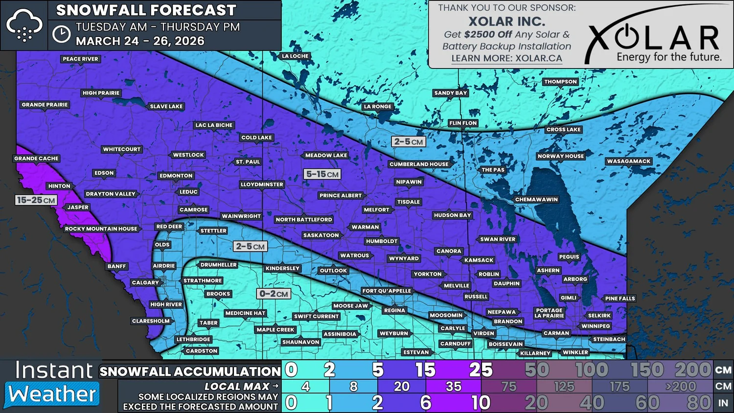
NOTE: YOU CAN CLICK ON THE MAP TO OPEN A ZOOMABLE IMAGE
The calendar may say that it’s Spring, but it appears that Mother Nature may have missed the memo. An incoming system, courtesy of the atmospheric river funnelling moisture into British Columbia, will blast across the Prairies on Tuesday and Wednesday, dumping 5-15cm over a considerable swath of the region. It’s still too early to be certain, but this could very well be the last significant snowfall of the season for some parts of the Prairies.
The snow will begin to fall in the Rockies during the early morning hours of Tuesday. It will remain isolated to this area until the late morning/early afternoon, at which point the snow will start to spread deeper into Alberta.
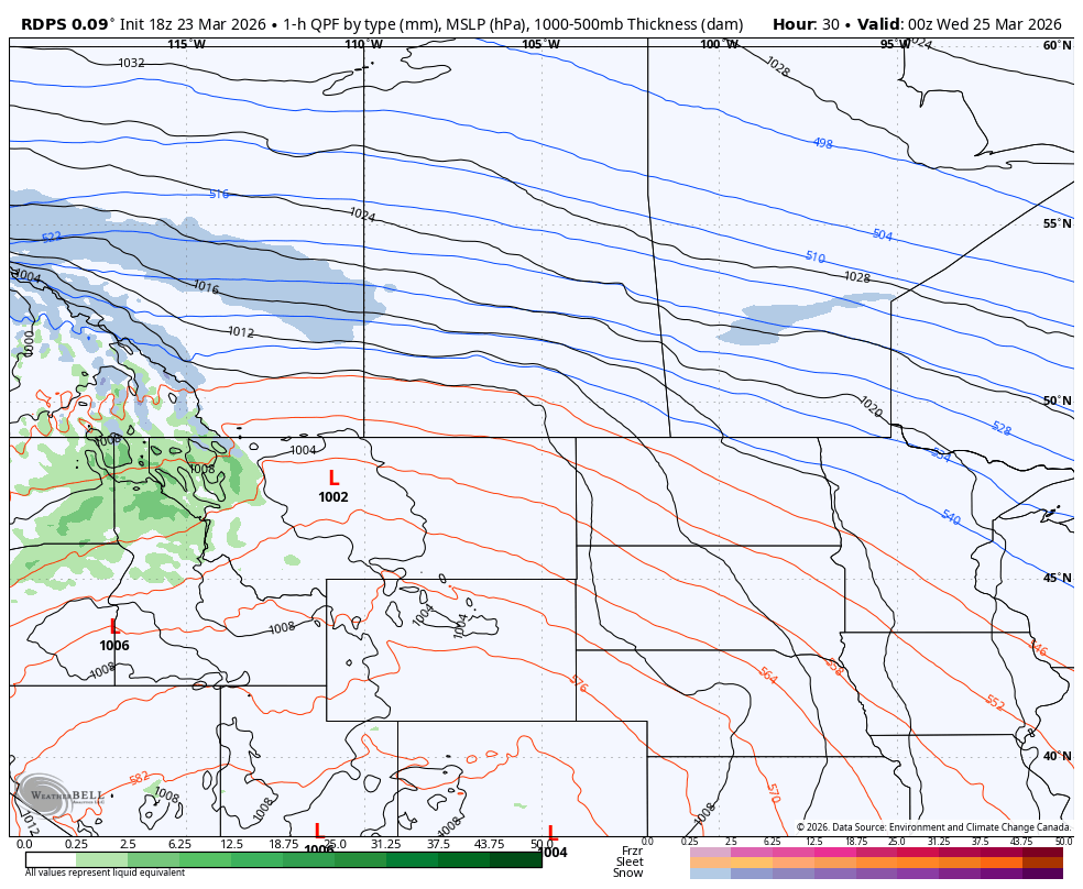
The rdps model showing precipitation type and intensity at 6Pm MT/7pm CT on Tuesday, courtesy of WeatherBell.
Through the afternoon and into the evening, the snowfall will orient along a rough northwest-southeast axis, stretching approximately from Grande Prairie to Lloydminster.
The leading edge of the snow will cross into Saskatchewan early Tuesday evening, spreading southeastward across the province throughout the rest of the evening and reaching the Manitoba border around midnight. It’s likely that there will be some light snow falling in parts of Southern Manitoba Tuesday evening, ahead of the main system, which could result in a few centimetres of accumulation before the majority of the accumulation arrives later.
There is the possibility of isolated pockets of freezing rain along the southern edge of the snow in Southern Saskatchewan and Manitoba throughout the day Wednesday, as the moisture interacts with areas with above freezing temperatures. The threat from the freezing rain is minimal overall, with only a millimetre or so expected, but it could be enough to make untreated surfaces a bit slippery.
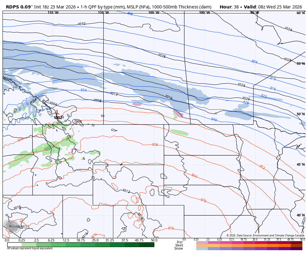
The rdps model showing precipitation type and intensity at 2m MT/3pm CT on Wednesday, courtesy of WeatherBell.
The snow will begin to taper off in Alberta Wednesday morning, ending from west to east throughout the day. There could be some lingering light snow in Southern Manitoba overnight and into Thursday morning, but it is expected to end by the lunch hour.
This system will bring upwards of 15cm of snow across all three Prairie provinces, from Grande Prairie to Pine Falls. The snow isn’t expected to be too heavy, falling at rates up to 2cm/hr, but the possibility of some localized intensification may result in snowfall totals exceeding 15cm, especially in East Central Saskatchewan.
In the Rockies, the snow will fall continuously for the longest period of time, which will lead to accumulations of 15-25cm by Thursday afternoon. The greatest amount of snowfall occurring here poses a unique issue as it compounds the preexisting avalanche risk through the region and it also hinders the cleanup from avalanche control efforts that happened over the weekend.
Those who are south of the snow won’t be completely unaffected by the system as it moves through the region. On Wednesday, strong winds are expected to develop in Southeastern Alberta and Southwestern Saskatchewan. Wind gusts in the 60-80km/h range are likely for a few hours before they weaken later in the afternoon and into the evening.
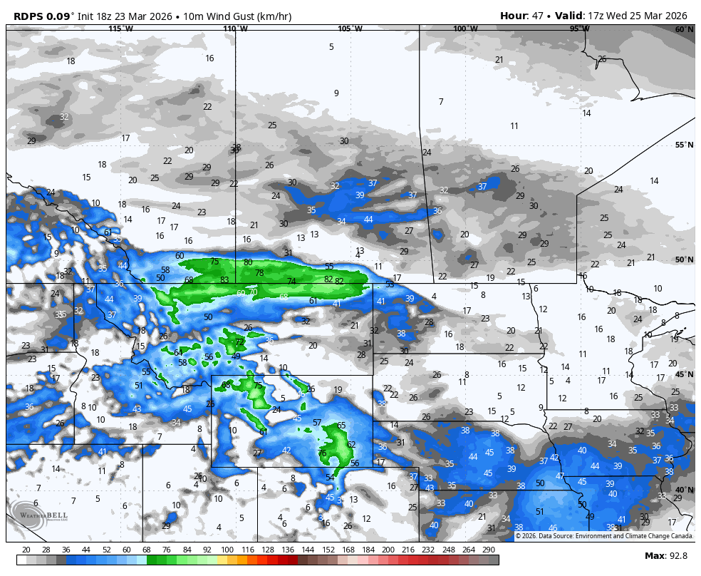
The rdps model showing wind gusts at 11am MT/12pm CT on Wednesday, courtesy of WeatherBell.
We will be watching how this system develops through the day on Tuesday because a slight shift in the track could lead to significant changes to the forecast downstream, especially as it tracks into Manitoba. In the event that the path of the storm deviates from what is anticipated as of Monday evening, we’ll be sure to keep you updated.


