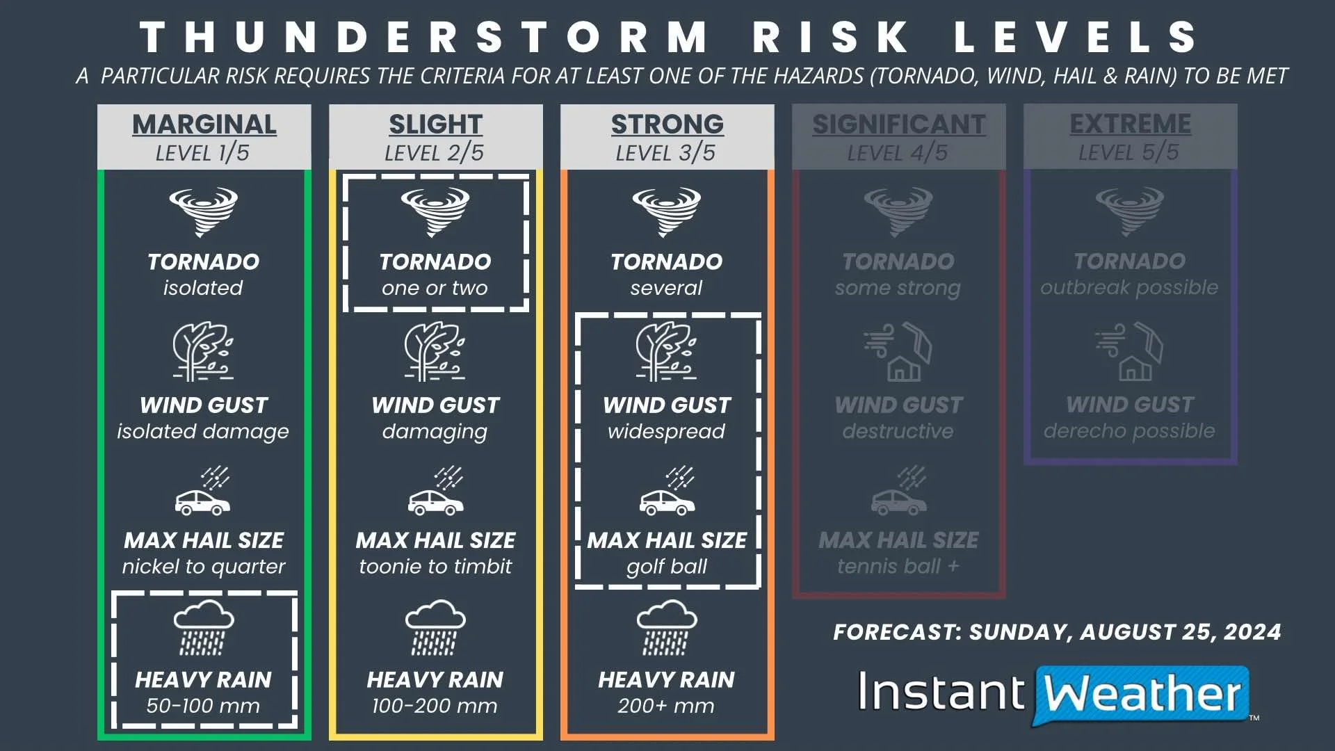
Threat of Massive Hail is the Driving Force Behind a Widespread Strong Severe Risk in Southeast Manitoba Sunday Afternoon IF Storms Develop

NOTE: YOU CAN CLICK ON THE MAP TO OPEN A ZOOMABLE IMAGE

It’s been a very active few days across the Prairies and this morning was no exception, with destructive wind gusts pummelling parts of East Central Saskatchewan and the Westman and Parkland Regions.

Unfortunately, this trend of dangerous severe weather will likely continue this afternoon, but this time the target will be Southeastern Manitoba. The possibility for massive hail across the region has resulted in this being a widespread Strong Risk for severe thunderstorms for this afternoon.


GOOGLE AD (NOT ENDORSED BY INSTANT WEATHER)

Once again, weather models are struggling with pinpointing these storms, but the ingredients for severe weather should all be in place and there is a potential for severe storm development, which warrants a forecast. Today will be an “IF day” in the sense that IF storms end up developing, they are expected to be very strong and widespread across the region. With the intense heat and temperatures feeling into the low 40s, along with ample moisture and instability, the environment will be primed for storms, but a strong enough trigger will be necessary for them to occur.

This storm development could begin early this afternoon, as the existing line of storms pushes northeastward through the Interlake Region. Behind this, additional storms could develop along a cold front and make their way eastward through the Red River Valley and Interlake Region during the afternoon and the Eastman and North Eastman Regions in the evening and overnight hours. Whether or not this development actually occurs is still uncertain.


GOOGLE AD (NOT ENDORSED BY INSTANT WEATHER)

If the severe thunderstorms end up developing this afternoon, the major threat will be very large hail. Golf ball-sized hail appears to be likely with these potential storms, with even up to tennis ball-size possible. Widespread damaging wind gusts over 100km/h would also be associated with these storms, as well as up to 100mm of rain resulting in localized flooding and the possibility of a tornado.

This could very well end up being a bust, but the threats involved in the event that storms do develop are quite significant and it’s important to be prepared.

Strong Risk for Severe Thunderstorms in Southeast Saskatchewan This Evening and Through Sunday Morning

NOTE: YOU CAN CLICK ON THE MAP TO OPEN A ZOOMABLE IMAGE

Southeastern Saskatchewan is in the crosshairs for severe weather once again, with some storms firing up along the American border later this evening followed by another round of strong storms early Sunday morning. The hail, wind, and tornado risk between the evening and morning storms makes this a Strong Risk along the southern border and a Slight Risk stretching through Southeast Saskatchewan and into East Central Saskatchewan.


GOOGLE AD (NOT ENDORSED BY INSTANT WEATHER)

The activity will begin this evening with the development of supercell storms along the Montana border that will push northeastward through the late evening. These storms could be quite strong and will be followed by even more development from south of the border after midnight. This second round is expected to be more organized and bringing more widespread impacts as they follow the northeastward trend across Southeastern Saskatchewan through the morning.


These storms could be quite impactful with very large hail that will likely be golf ball-sized, possibly even larger, and widespread damaging wind gusts upwards of 120km/h, as well as one or two tornadoes. There is also the concern of localized flooding with heavy downpours that could bring up to 100mm of rain.

Greatest Severe Thunderstorm Threat for Saturday Afternoon Shifted West; Still Slight Risk for Southern Manitoba

NOTE: YOU CAN CLICK ON THE MAP TO OPEN A ZOOMABLE IMAGE

Following this morning’s thunderstorms, we are still expecting more severe weather for Southern Manitoba later today, however the anticipated strength of those storms has diminished and the area they’re expected to hit has also changed. The strongest storms of the day are now expected in Southern Saskatchewan, but the potential for damaging winds, large hail. and localized flooding still result in a Slight Risk for severe thunderstorms in the Westman, Parkland and Northern Interlake Regions.


GOOGLE AD (NOT ENDORSED BY INSTANT WEATHER)

The exact timing of these storms is tricky to establish due to uncertainty between weather models, leaving three possible scenarios.

Scenario 1

Large storms could begin to develop in the mid-afternoon just east of the Saskatchewan border in the Parkland Region as isolated supercells which would travel northeastward across the province. Development of additional storms would continue through the evening and early overnight, following the same northeastward trajectory. These storms would then be followed by a more organized cluster of storms crossing through the region Sunday morning.

Scenario 2

Smaller storms could start to develop in the Parkland Region in the mid to late afternoon and quickly become more organized into a strong line that spreads into the Northern Interlake and travels southeastward through the evening before starting to fall apart approaching the Central Plains overnight. In this scenario, the storms Sunday morning would be weak, if they occur at all.

Scenario 3

A handful of small storms could pop-up starting in the later in the afternoon, once again in the Parkland Region, and continuing into the late evening, but not amount to anything too concerning. Then, in the early morning hours, a large cluster of storms could push northeastward into the region from Saskatchewan, followed by a second round of strong storms later in the morning.


GOOGLE AD (NOT ENDORSED BY INSTANT WEATHER)

Regardless of which of the three scenarios unfolds, it is likely that there will be strong storms in Manitoba over the next 24 hours. The threats from these storms will be the large hail, with up to toonie-size likely and damaging wind gusts that could exceed 100km/h, as well as one or two tornadoes . There is also the concern of localized flooding because these storms are expected to occur over the same area. It’s important to note that the level of uncertainty between weather models means that this could very well end up being a classic “bust” day, but we believe that it is better to be prepared in the event that any one of these scenarios materializes.

Slight and Strong Risk for Severe Thunderstorms Across Southern Manitoba Saturday, Hitting in Multiple Rounds

NOTE: YOU CAN CLICK ON THE MAP TO OPEN A ZOOMABLE IMAGE

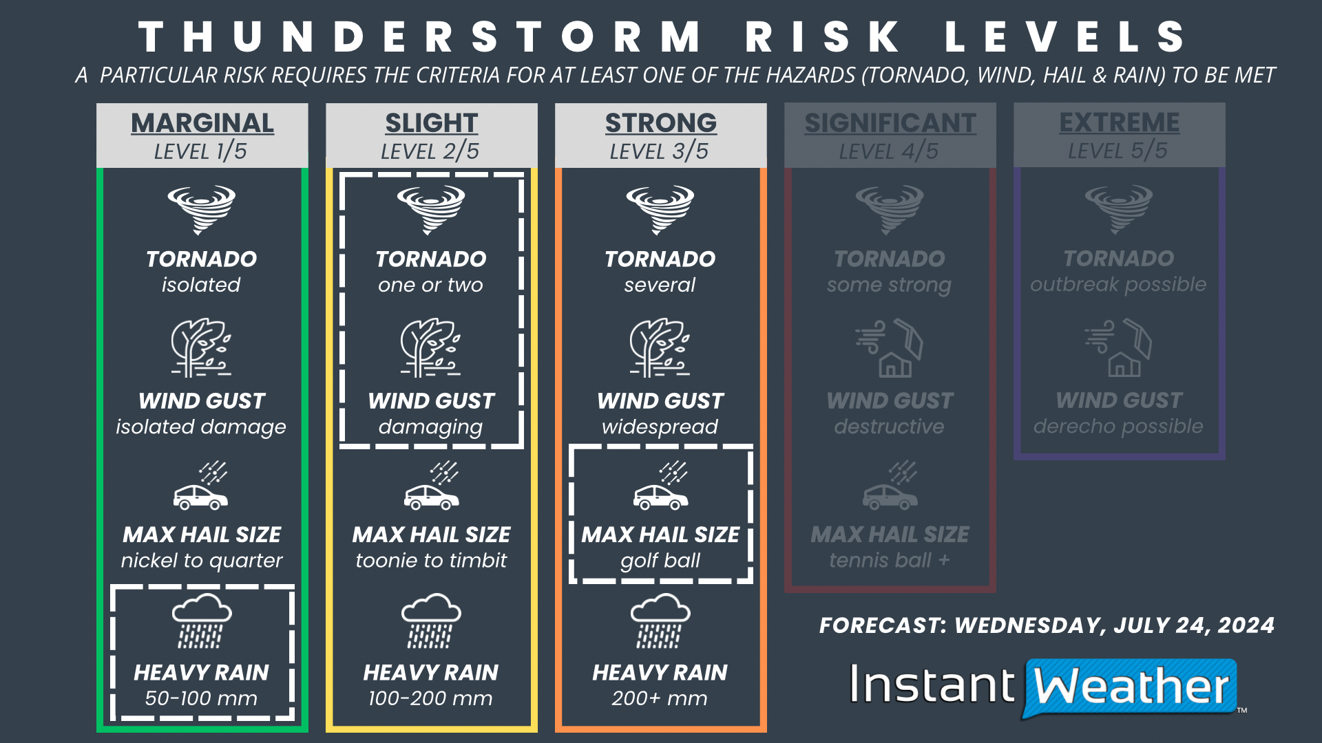
It will be a hot day across Southern Manitoba on Saturday, but there will be some active weather, in the form of a line of severe thunderstorms, to contend with before the temperatures start to climb. More storms will hit the region later in the day, but the timing remains a little unclear. Regardless, the risk of large hail and damaging wind gusts, along with the possibility of a tornado makes this a Strong Risk for severe thunderstorms in Southwestern Manitoba, including Brandon, and a Slight Risk across much of the rest of Southern Manitoba.


GOOGLE AD (NOT ENDORSED BY INSTANT WEATHER)

The first line of storms will make their way into Southwestern Manitoba around sunrise Saturday morning, packing a punch with strong winds and large hail. These storms will lose steam as they travel eastward across the width of the province throughout the morning and into the early afternoon. Following this line of storms, it will be a hot day across the region, feeling closer to 40°C with the humidity, which should provide ample fuel for another wave of storms. The exact timing of this second line of storms is still uncertain. Some models are suggesting that the additional storms could start Saturday evening and make their way across Southern Manitoba overnight and into Sunday morning. On the other hand, there are other models that show the second line of storms developing in the early morning hours of Sunday and continuing into the early afternoon, followed by a third line of storms beginning Sunday evening. Due to this uncertainty, we will likely have a revised forecast for the secondary storm development posted Saturday afternoon.


The threats from these storms will be the large hail, with up to golf ball-size possible, as well as widespread damaging wind gusts that could exceed 100km/h and approach 120km/h, along with the possibility of a tornado or two touching down. There will also be a flooding risk, with these storms expected to bring up to 100mm, particularly to areas that will experience multiple rounds of storms.

UPDATE: Slight Risk for Severe Thunderstorms for Friday Now Extends into Calgary

NOTE: YOU CAN CLICK ON THE MAP TO OPEN A ZOOMABLE IMAGE

In an update to the forecast that was posted yesterday evening, we have extended the boundaries of the Slight Risk region to include Calgary and the entire Highway 2 corridor south of the city. The combination of damaging wind gusts, large hail, and the possibility of an isolated tornado from today’s has resulted in the Slight Risk for this area, along with Lethbridge, Medicine Hat, and Drumheller.


GOOGLE AD (NOT ENDORSED BY INSTANT WEATHER)

Thunderstorms have already begun to develop in Montana, moving northward towards the border. They will start to cross into Alberta later this afternoon and early evening, spreading across Southern Alberta throughout the rest of the evening and overnight. It’s possible that the storms could become organized into a line that will push northeastward starting later in the evening which will impact a more widespread area than just isolated storms.


The main threat from these storms will be the hail, with up to toonie to timbit-size likely, as well as damaging wind gusts that could exceed 100km/h and even approach 130km/h. At this time, there does not appear to be too much of a flooding risk, with these storms expected to bring less than 50mm of rain over the span of a few hours. An isolated tornado can also not be completely ruled out.

Slight Risk for Severe Storms in Southern Alberta to Finish the Week; Forecast Could be Upgraded

NOTE: YOU CAN CLICK ON THE MAP TO OPEN A ZOOMABLE IMAGE

Friday will be another hot day across Southern Alberta and along with that heat comes severe thunderstorms. A combination of damaging wind gusts, large hail, and the possibility of an isolated tornado means that there will be a Slight Risk in an area that includes Lethbridge, Medicine Hat and north towards Drumheller.


GOOGLE AD (NOT ENDORSED BY INSTANT WEATHER)

The storms will cross into Alberta from Montana in the south starting in the late afternoon and early evening, spreading across the region throughout the evening and overnight hours. It’s possible that the storms could become organized into a line that will push northeastward starting later in the evening that will impact a more widespread area than just isolated storms.


The main threat from these storms will be the hail, with up to toonie-size likely, as well as damaging wind gusts that could exceed 100km/h. At this time, there does not appear to be too much of a flooding risk, with these storms expected to bring less than 50mm of rain over the span of a few hours. An isolated tornado can also not be completely ruled out. The risk level could change with more data from short-range models so stay tuned for any updates to this forecast.

UPDATE: Isolated Strong Risk for Severe Storms in Southern Saskatchewan Beginning Wednesday Evening

NOTE: YOU CAN CLICK ON THE MAP TO OPEN A ZOOMABLE IMAGE

It will be another stormy day in Southern Saskatchewan on Wednesday, with active weather beginning later in the day and continuing through to Thursday morning. A combination of very large hail, damaging wind gusts and the possibility of tornadoes has led to us upgrading this forecast to a Strong risk, surrounded by a Slight Risk in the Southeastern region of the province.


GOOGLE AD (NOT ENDORSED BY INSTANT WEATHER)

The storms are anticipated to start in the early evening Wednesday in the southwest as some isolated cells. These individual storms will quickly merge and become large clusters of storms that will move northeastward across Southern Saskatchewan throughout the rest of the evening and into the early morning hours of Thursday. The storms will become more organized as they move across the province, as well as becoming more intense, thus increasing the threat from Marginal, Slight and in an isolated area that includes Regina, a Strong risk.


The main threat from these storms will be the hail, with toonie to timbit size with isolated hail up to golf ball size, as well as damaging wind gusts that could exceed 100km/h. Heavy downpours will be associated with these storms and some areas, particularly in Southeast Saskatchewan, could see over 50mm of rainfall. There is also the risk of these storms producing one or two tornadoes so be sure to keep an eye out for watches and warning being issued by Environment Canada later in the day.

Heavy Rain and Moderate Winds Will Mark Ernesto's Passage South of Newfoundland Monday

NOTE: YOU CAN CLICK ON THE MAP TO OPEN A ZOOMABLE IMAGE

While tracking Hurricane Ernesto for the past few days, there was some uncertainty between models when it came to the path that the storm would take either through or around Newfoundland. Thankfully, it became clearer, as the storm continued its approach, that it would pass south of the Avalon Peninsula, greatly limiting the impacts to land.


GOOGLE AD (NOT ENDORSED BY INSTANT WEATHER)

Ernesto restrengthened to a Category 1 Hurricane on Sunday and it will maintain that intensity as it makes its final push into Canadian waters later Monday morning. Precipitation from its outer bands will spread across most of Newfoundland as light to moderate rain starting in the mid-morning along the South Coast and moving northward across the province into the afternoon. Total rainfall amounts will be 5-20mm from this early rainfall.

By the time the storm travels to south of the Avalon Monday evening, it will have weakened to a tropical storm with wind gusts at its centre of 110km/h. The intensity of the winds will decrease further away from the centre and the strongest winds on land are expected in the Southeast Avalon, topping out at 70-90km/h. Across the rest of the Avalon and through the Burin Peninsula, wind gusts will be in the 50-70km/h range during the evening and into the overnight hours.

This is also the time frame in which Ernesto will bring the most precipitation to Southeast Newfoundland. The rain could be very heavy at times during this 6 hour window and up to 50mm could easily fall across most of the Avalon Peninsula and up to 30mm for the Burin Peninsula, with higher amounts locally. The rain and large waves from the storm could result in some coastal flooding, particularly along southwest-facing shorelines so be sure to exercise caution in these areas. By Tuesday, the storm will be well east of the island and the large waves will start to subside, marking another hurricane in the books for Newfoundland.


Forecast track for hurricane Ernesto from the Canadian Hurricane Centre - August 18th at 9Pm


Rainy Start to the Week Across the Maritimes as Hurricane Ernesto Passes Offshore

NOTE: YOU CAN CLICK ON THE MAP TO OPEN A ZOOMABLE IMAGE

While tracking Hurricane Ernesto for the past few days, it was been clear that the storm would stay well offshore of Nova Scotia. This has been good news because it means that there would be very little impact from the storm across the Maritimes. The greatest threat will be moderate to heavy surf, along with riptides, that have already begun to arrive along the Atlantic Coast of Nova Scotia this evening which will continue through the day Monday and into early Tuesday. Despite the storm staying over open water, the Maritimes can expect a wet start to the week.


GOOGLE AD (NOT ENDORSED BY INSTANT WEATHER)

A band of thunderstorms will make its way northward from Ernesto and cross in Nova Scotia shortly after midnight tonight along the length of the province, but more concentrated to the eastern mainland and Cape Breton. This will be followed by a secondary band in the mid-morning, once again focused more along the eastern half of the province. These storms will bring localized downpours and could bring up to 30mm by the lunch hour. The threat of isolated onshore storms will continue throughout the afternoon and into overnight which could push into Southern New Brunswick and across PEI with some light rain.

Meanwhile, a secondary tropical air mass will bring rain to Northern New Brunswick beginning Monday afternoon, lasting until late in the day Tuesday. This rain will be quite heavy at times, especially in the Edmundston area, and could lead to up to 50mm falling. These two rounds of precipitation make for a very interesting looking rainfall map!


Forecast track for hurricane Ernesto from the Canadian Hurricane Centre - August 18th at 9Pm


Hurricane Ernesto's Track Through Atlantic Canada Becoming Clearer; Could Maintain Category 1 Strength Deep into Canadian Waters

Forecast track for hurricane Ernesto from the Canadian Hurricane Centre - August 17th at 9Am

Hurricane Ernesto made landfall on Bermuda early this morning as a Category 1 Hurricane. The storm luckily weakened from a Category 2 in the few hours before landfall, but it still packed a punch with 135km/h winds. Now the storm will continue to churn northeastward into Atlantic Canada for the beginning of next week.


GOOGLE AD (NOT ENDORSED BY INSTANT WEATHER)

The Canadian Hurricane Centre is now issuing their own forecast track and there has been very little change in their prediction with their 9am update compared to the maps from the past two days. They maintain that the centre of Ernesto will stay well offshore of Nova Scotia and pass south of the Avalon Peninsula. Major weather models have made a shift since yesterday morning and now there is agreement that the centre of the storm will stay off the coast of Newfoundland. This is certainly good news because this will keep the strongest winds from hitting land, but it will still be an impactful storm.

Now that we’re starting to see a clearer picture of Hurricane Ernesto’s path through Atlantic Canada, we can more accurately forecast the impacts of the storm, especially for the Maritimes. Pounding surf will hit the Atlantic Coast of Nova Scotia beginning late Sunday and continuing through Monday. Rip currents will also be a concern in these coastal areas. Light rain from the storm will spread across Nova Scotia and even into PEI and Southern New Brunswick, with rainfall totals at this point expected to be in the 5-30mm range across the region for Monday. Exact amounts and locations will become clearer by this time tomorrow. Since the storm will be passing so far offshore, winds will not be a concern in the Maritimes.

Newfoundland, particularly the Burin and Avalon Peninsulas, will get hit harder than the Maritimes since Ernesto will be passing much closer. Southwest-facing coastlines can expect to begin seeing the ocean swell from the storm beginning late Sunday with large waves and hazardous surf starting late Monday and continuing into Tuesday. These waves and the storm surge will likely result in coastal flooding along these southwest-facing shores. Since Ernesto is expected to pass close to the Avalon late Monday, the winds won’t be as strong on land as they will be closer to the centre of the storm. Nonetheless, wind gusts of up to 100km/h can be expected along the southern shores of the Avalon, especially from Saint Vincent’s to Cape Race, and weakening further inland. Rainfall will be heavy for a brief period of time late in the day Monday for Eastern Newfoundland, including into Bonavista. Light rain will spread across the rest of the Island ahead of the storm Monday afternoon. It is still a bit too early to predict exact totals, but at this point the Avalon could see 30-50mm of rain in a 6 hour period.


Model Forecast Tracks for Hurricane Ernesto, Courtesy of Tomer Burg.

While the track of Ernesto through Atlantic Canada has become clearer, the intensity at which it will travel through the region appears to have also become clearer. The Canadian Hurricane Centre predicts that Ernesto will maintain hurricane strength up to its final approach of Newfoundland, with winds of 120km/h, which is just above the threshold for a storm to be considered a hurricane. Then, just as it passes south of the Avalon, it will transition to a post-tropical storm.


GOOGLE AD (NOT ENDORSED BY INSTANT WEATHER)

Previous forecasts from the CHC/NHC showed that Ernesto would weaken somewhere between being offshore of Nova Scotia and around the Avalon, with no indication of where this transition may take place. This has now become clearer now that the storm has passed over Bermuda. Ernesto will experience a decrease in shear, giving the storm a chance to recover from ingesting so much dry air and it will undergo a short period of restrengthening tomorrow before hitting the point in which sea surface temperatures drop below 26°C and it begins to lose fuel. The image below shows that wind speeds at the storm’s centre will increase between Hour 24 and Hour 48, indicating this window of restrengthening. As a result of this strengthening in the storm, it will then take a bit longer to weaken to a post-tropical storm and it will maintain its status as Category 1 Hurricane deeper into Canadian waters. We will continue to monitor the storm and we will have our own rain and wind forecasts coming later tomorrow.


Forecast Track and Intensity of Hurricane Ernesto with Sea Surface Temperatures, courtesy of Tomer Burg.

Wet & Unsettled Weekend Brings Threat of Severe Storms and Significant Rainfall to Southern Ontario

NOTE: YOU CAN CLICK ON THE MAP TO OPEN A ZOOMABLE IMAGE

As we approach the final weeks of summer, with the back-to-school season around the corner and the arrival of astronomical autumn just under a month away, it seems Mother Nature is continuing the trend of a wet summer. The upcoming weekend is set to bring multiple rounds of rainy weather, and by early next week, we might even get a taste of early fall-like conditions, with possible single-digit lows for parts of Southern Ontario.

Rain over the next few days will come in waves, starting Friday afternoon in Southwestern Ontario and lingering through the weekend. Thunderstorm activity will play a significant role in this weekend’s rainfall, potentially leading to localized totals approaching 80mm. The rain should taper off by early Monday, with Eastern Ontario seeing the last of the precipitation.


GOOGLE AD (NOT ENDORSED BY INSTANT WEATHER)

MODEL IMAGE FROM WEATHERBELL

As of Friday afternoon, the first wave of rain is already moving into Southwestern Ontario, extending into regions around Lake Huron and Georgian Bay. This cluster of rain and embedded thunderstorms is expected to gradually track eastward into the Golden Horseshoe and Central Ontario by Friday evening.

Rainfall amounts will be highly variable due to the thunderstorm component, but widespread totals of 5-15mm are expected by Saturday morning. Localized amounts could reach 25-50mm for areas that experience thunderstorm activity, though it’s difficult to pinpoint exactly where this will occur.


GOOGLE AD (NOT ENDORSED BY INSTANT WEATHER)

NOTE: YOU CAN CLICK ON THE MAP TO OPEN A ZOOMABLE IMAGE

Moving into Saturday, the rain will become less widespread, with a focus on Eastern Ontario and Southwestern Ontario during the morning hours. Eastern Ontario is expected to see lingering precipitation from Friday night’s first wave of rain.

We are also closely monitoring the risk of pop-up thunderstorms in Southwestern Ontario, extending into the Golden Horseshoe through late morning and early afternoon on Saturday. While these storms are expected to be mostly non-severe and primarily a rainfall risk, we can’t rule out a marginal severe threat, as the environment could potentially support some hazards, including hail and damaging wind gusts. An isolated tornado can’t be ruled out, though the risk is relatively low.


GOOGLE AD (NOT ENDORSED BY INSTANT WEATHER)

MODEL IMAGE FROM WEATHERBELL

More isolated pop-up thunderstorms are expected across Southwestern Ontario, the Golden Horseshoe, and Central Ontario throughout Saturday afternoon and evening. There is concern that these storms will be slow-moving, with some areas experiencing multiple rounds of storms in a short time frame. This could lead to a heightened flash flooding risk, particularly in more urban parts of Southern Ontario, such as the Greater Toronto Area.

Due to the localized nature of the rain on Saturday, some areas may not see a drop, while others could receive upwards of 50-75mm of rain. The heaviest rain appears to be concentrated along the Hwy 401 corridor between London and Toronto, with other pockets of heavy rain in Central Ontario. However, this is just a general idea from one model and could shift depending on where the storms develop.

There should be a break in the rainfall overnight Saturday for most areas, although a few localized showers are possible, particularly around Southwestern Ontario and the Golden Horseshoe.


GOOGLE AD (NOT ENDORSED BY INSTANT WEATHER)

MODEL IMAGE FROM WEATHERBELL

Similar to Saturday, pop-up thunderstorms are expected to return across Southern Ontario on Sunday morning and continue throughout the afternoon. These storms could bring additional heavy rainfall to the same regions affected by Saturday’s storms. Again, actual rainfall totals will vary significantly depending on where the storms hit, but some areas could see another 25-50mm (or more) by the end of Sunday.


NOTE: YOU CAN CLICK ON THE MAP TO OPEN A ZOOMABLE IMAGE

We are also closely monitoring the risk of severe storms in Eastern Ontario later in the afternoon and early evening on Sunday. Storms that develop here could bring damaging wind gusts, large hail, and potentially an isolated tornado. It’s still two days away, so much can change, but it appears that the Ottawa Valley, extending along the international border in Eastern Ontario, could see some marginally severe storms.


GOOGLE AD (NOT ENDORSED BY INSTANT WEATHER)

Rain is expected to continue overnight into Monday morning for Central and Eastern Ontario, with pockets of heavy rain and embedded thunderstorms. Southwestern Ontario and the Golden Horseshoe should finally see the rain taper off by late Sunday evening, with the rain ending in Eastern Ontario sometime Monday morning. This will give way to clear conditions for Monday afternoon and evening.

However, the calm weather will bring much colder air, with overnight temperatures plummeting into the single digits across much of Southern Ontario on Monday and Tuesday nights. Daytime highs will struggle to reach the 20°C mark on Tuesday and Wednesday, making for a much cooler week compared to what we’ve experienced this summer.

Hurricane Ernesto Still on Track to Impact Atlantic Canada; Could Pass Through Newfoundland

Forecast track for hurricane Ernesto from the Canadian Hurricane Centre - August 16th at 6Am

Ernesto is continuing to barrel towards Bermuda, now as a Category 2 Hurricane, with wind speeds up to 160km/h. The centre of the storm is expected to pass near or over the island on Saturday while maintaining its strength at a Category 2.


GOOGLE AD (NOT ENDORSED BY INSTANT WEATHER)

The Canadian Hurricane Centre and the National Hurricane Center have made very little change to their track forecast for Ernesto in the 6am update as it travels northeastward towards Atlantic Canada beyond Bermuda. There is still a large degree of uncertainty since we are still a few days out and this is reflected in the size of the cone on the forecast map.

Individual weather models, on the other hand, have begun to show a western shift. There still are a few models that are more in line with the NHC forecast that keeps Ernesto passing offshore of the Avalon. However, just as many are now suggesting that the storm could pass over the Peninsula instead and one outlier still has it tracking through Central Newfoundland. We may see a change in the official forecasts from the CHC and NHC that reflects this western shift in the models.

There is definitely more agreement in the path of Ernesto as it passes offshore of Nova Scotia on Monday. The amount of rain it brings to the Maritimes will be entirely dependent on just how far offshore it stays. Nova Scotia will most likely see rain, but if the storm passes closer to the province, we could see rain move into New Brunswick and PEI as well. Given its offshore track, strong winds likely won’t be much of an issue, but pounding surf is expected to begin for the Atlantic Coast of Nova Scotia ahead of the storm on Sunday and continuing until after its passing on Tuesday.

The exact impacts to Eastern Newfoundland will be entirely dependent on the path that Ernesto takes either around or through the province. The strongest winds will be found around the centre of the storm and at that point in the storm’s life, gusts are projected to be around 110km/h so hopefully it will stay offshore. Rainfall across the province will also vary, with higher amounts expected closer to the middle of the storm. These impacts will become clearer once there is more consensus in the track. The hazardous surf will hit south-facing shores of Newfoundland beginning late Sunday and large waves should impact the Avalon and Burin Peninsulas throughout the day Monday. The large waves, combined with storm surge. could result in coastal flooding so be sure to exercise caution in these areas.


Model Forecast Tracks for Hurricane Ernesto, Courtesy of Tomer Burg.

Ernesto strengthened into a Category 2 late yesterday and further strengthening stalled overnight, despite being in warm water, likely due to continued ingestion of dry air. It is expected to continue to strength through today, but that could be limited by an increase in wind shear, which works against hurricanes. At this point, Ernesto will top out at a Category 2.


GOOGLE AD (NOT ENDORSED BY INSTANT WEATHER)

Hurricane Ernesto will begin to lose strength after it hits Bermuda and pushes northward into cooler waters and experiences increased shear. It will enter Canadian waters as a weak Category 1 Hurricane and it should rapidly weaken into a post-tropical storm as it approaches Newfoundland mostly due the much cooler sea surface temperatures, but also even more wind shear. Hurricanes need water temperatures of at least 26°C to survive and Ernesto will lose that as it tracks into Atlantic Canada. Nonetheless, winds at the centre of the storm are still expected to be in the 110-150km/h range as it moves through the region.


Forecast Track and Intensity of Hurricane Ernesto with Sea Surface Temperatures, courtesy of Tomer Burg.

Hurricane Ernesto Likely to Impact Atlantic Canada; Uncertainty Looms on Exact Track

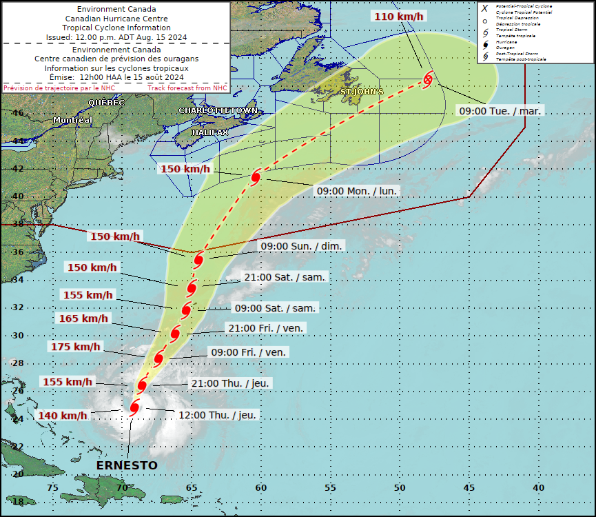
Forecast track for hurricane Ernesto from the Canadian Hurricane Centre - August 15th at 12pm

Hurricane Ernesto is currently a Category 1 Hurricane and is still moving northeastward towards Bermuda. While it is fairly certain that the island nation will take a direct hit from the storm, its track as it continues northward into Canadian waters is much more uncertain.


GOOGLE AD (NOT ENDORSED BY INSTANT WEATHER)

In the 12pm update from the Canadian Hurricane Centre, in conjunction with the National Hurricane Center in the US, Ernesto is still expected to have some sort of impact to the Maritimes and Newfoundland, despite the uncertainty in the exact track.

Guidances from different individual weather models, as shown below, indicate potential paths that the centre of the storm may take over the next few days. In some cases, the storm may stay well offshore and only sideswipe Newfoundland with heavy rain and wind while missing the Maritimes completely. On the other hand, one model has the storm tracking straight though Central Newfoundland, which would not only greatly impact the island, but this track would also bring rain and wind further west into the Maritimes.

However, we are starting to see some agreement between some of these models that would see Ernesto stay well offshore of Nova Scotia, with only a bit of rain hitting the province, before passing just south of the Avalon Peninsula, bringing strong winds and heavy rain to Eastern Newfoundland and strong surge to coastal areas across Atlantic Canada. The swells are expected to arrive in the Maritimes beginning Saturday, with more dangerous surf starting Sunday, ahead of the storms arrival to the region early Monday.


Model Forecast Tracks for Hurricane Ernesto, Courtesy of Tomer Burg.

So what are we looking at strength wise? Ernesto is currently a Category 1 in 29°C waters. This sea surface temperature will certainly help the storm strengthen, however, dry air is being pulled into the centre of the storm which is limiting its organization. The warm waters and dry air, combined with some moderate vertical shear (which needs to be low in order for a hurricane to survive and strengthen), means that Ernesto will strengthen to a strong Category 2 Hurricane.


GOOGLE AD (NOT ENDORSED BY INSTANT WEATHER)

As the storm continues to travel north-northeastward beyond Bermuda, it will encounter cooler waters and shear will increase, which will work to weaken it back down to a Category 1. As it moves into Canadian waters, the sea surface temperatures fall below 26°C. This is the magic number for hurricane development and growth so at this point, it will weaken even further. Ernesto expected to travel through the region starting as a low-end Category 1 and weakening to a post-tropical storm, with winds in the centre of the storm in the range of 110-150km/h.


Forecast Track and Intensity of Hurricane Ernesto with Sea Surface Temperatures, courtesy of Tomer Burg.

Slight Risk for Severe Storms in Southern Saskatchewan for Tuesday into Wednesday

NOTE: YOU CAN CLICK ON THE MAP TO OPEN A ZOOMABLE IMAGE

In a repeat of Monday, storms will be likely in Saskatchewan again Tuesday and continuing into early Wednesday. This time, however, the threat has increased to a slight risk across a large swath of Southern Saskatchewan which could see as much as 100mm of rain, the occasional wind gust exceeding 90km/h, up to toonie-size hail and the possibility of an isolated tornado.


GOOGLE AD (NOT ENDORSED BY INSTANT WEATHER)

The initial storm activity is anticipated to start mid-afternoon Tuesday in the west with some isolated cells, but things will begin to ramp up as we approach the evening hours. This is when we expect these individual storm cells to begin to merge, creating clusters of storms that will push eastward across the southern half of the province throughout the evening and overnight and into the early morning hours of Wednesday.


The main threat from these storms will be the hail, with up to toonie-size likely, as well as wind gusts that could reach 100km/h. There is also the possibility of training thunderstorms, multiple storms that follow the same track, so flooding will be a concern as some areas could see up to 100mm of rain in only a few hours. It seems unlikely based on the data, but an isolated tornado can not be completely ruled out.

Post-Tropical Depression Debby Will Bring Up to 50mm to New Brunswick, Lesser Amounts to Nova Scotia and PEI Over the Weekend

NOTE: YOU CAN CLICK ON THE MAP TO OPEN A ZOOMABLE IMAGE

After tracking the shifts in the potential path for Tropical Storm Debby over the past few days, the storm will finally make its way into the Maritimes beginning Friday morning with the outer bands of rain. Thankfully, the impacts of this storm will be limited, as opposed to some of the late season post tropical storms we’ve seen in the recent past, like Fiona two years ago.


GOOGLE AD (NOT ENDORSED BY INSTANT WEATHER)

Rain will move into the region from the southwest beginning mid-morning Friday as light showers. Steady light rain can be expected across Nova Scotia and Prince Edward Island throughout much of Friday and Saturday and into Sunday morning.

The precipitation, however, will intensify to heavy rain in Northern and Western New Brunswick starting Friday afternoon and continuing into Saturday afternoon before starting to taper off. This area of heavier rain will coincide with the path of the center of the storm as it tracks through the region. The Canadian Hurricane Centre’s track forecast from 6pm Thursday is included below. Embedded thunderstorms are expected from the remnants of Debby and this will likely locally increase rainfall totals closer to 50mm along the western edge of the province.

Winds are expected to increase across the entire region in the early morning hours Saturday and lasting for approximately 18 hours before calming. Gusts are expected to top out in the 70-80km/h range, not nearly as strong as we’ve seen in past post-tropical storms.


The Canadian Hurricane Centre Track Forecast for Debby Issued on August 8, 2024 at 6pm ADT


GOOGLE AD (NOT ENDORSED BY INSTANT WEATHER)

Debby to Bring Flooding Threat to Parts of Southern Ontario on Friday With Up to 50-100mm of Rain Possible

NOTE: YOU CAN CLICK ON THE MAP TO OPEN A ZOOMABLE IMAGE

After making landfall in Florida earlier this week, what was Tropical Storm Debby has brought significant rainfall along the US East Coast. Now a post-tropical system, Southern Ontario is on track to feel the effects of the remnants of Debby over the next few days.

Significant rainfall is in the forecast with a particular focus on Eastern Ontario, which could see up to 100mm by the end of the week. This is not what many across Southern Ontario will want to hear, considering this year's unusually wet summer.


GOOGLE AD (NOT ENDORSED BY INSTANT WEATHER)

There is still some uncertainty about the exact track of the system, as it won’t arrive until Friday. A more eastern track would shift the heavier rain across the border into the Northeastern US and Quebec.

On the other hand, if the system tracks further to the west, we could be talking about more widespread significant rainfall totals, potentially extending into Central Ontario and the Golden Horseshoe. Hence, it’s important to note that the forecast may change as we get closer to the arrival of the system.

MODEL IMAGE FROM WEATHERBELL

At this point, we are expecting to see some isolated pop-up showers and non-severe thunderstorms develop throughout the day on Thursday across Southern Ontario. This is in advance of the system on Friday, which is when we expect the bulk of the rainfall to occur.

Due to the localized nature of these storms, the rainfall totals will be extremely variable, ranging from a few millimetres to up to 15-20mm in the heaviest pockets by the end of Thursday.


MODEL IMAGE FROM WEATHERBELL

One thing we are closely monitoring is the potential for a persistent band of precipitation with embedded thunderstorms to develop late Thursday and carry into Friday. Current data suggests it will set up somewhere around Woodstock/Kitchener, stretching across Lake Simcoe and into Central Ontario.

This line could produce locally significant rainfall totals overnight and Friday morning as it essentially locks in place as the remnants of Debby approach from the southeast. Keep in mind that this line could shift and will be extremely localized, so not everyone will see the heavy rain. Local rainfall totals could approach 25-50mm by Friday morning, perhaps even higher if a particular area sees multiple rounds of thunderstorms.


GOOGLE AD (NOT ENDORSED BY INSTANT WEATHER)

The precipitation associated with the system is expected to spread across Eastern Ontario by Friday morning, which is when we expect to see the bulk of the forecasted rainfall. This will only heighten the flooding threat since it will all happen within the span of a few hours.

In addition to the rain, we are also likely to see some embedded thunderstorm activity within the bands of precipitation throughout the morning and afternoon on Friday.

These storms should stay mostly non-severe, but we’ve seen in the past that these tropical systems have a tendency to present a tornado threat, especially along the western side of the system, which is where Southern Ontario will be positioned.

This is certainly not a guarantee for tornadoes, but we will be closely watching this aspect of the system and will issue a more detailed forecast if it becomes more likely.


GOOGLE AD (NOT ENDORSED BY INSTANT WEATHER)

MODEL IMAGE FROM WEATHERBELL

Rain is expected to taper off in the west through Central Ontario into the Golden Horseshoe by early afternoon on Friday. For Eastern Ontario, heavy rain is expected to continue throughout the afternoon and early evening hours on Friday.

We should begin to see some clearing in the west by dinner time, with the rain finally coming to an end around midnight for the Ottawa Valley and those along the St. Lawrence.

As we’ve mentioned, the highest impact of this system is expected in Eastern Ontario, which will be closest to the track of the system. Rainfall totals are likely to generally range from 50-100mm, but some localized pockets could even exceed the 100mm mark based on some of the latest model data.

It is important to keep in mind that thunderstorm activity will play a big role in the rainfall totals, so the actual totals could vary significantly between locations. That’s why we have a large range of 50mm - it’s hard to nail down the exact totals due to the localized nature of thunderstorms.


GOOGLE AD (NOT ENDORSED BY INSTANT WEATHER)

The forecasted rainfall totals drop off quite fast once you head further west. We are projecting between 25 to 50mm of rain for the Golden Horseshoe and parts of Central Ontario around Lake Simcoe.

At this point, we are expecting 15-30mm of rain for the Greater Toronto Area (GTA) along the Lake Ontario shoreline into the Niagara region. That could change if that line of rain overnight Thursday shifts into the GTA, as the latest models suggest should develop just to the northwest.

Less than 20mm of rain is expected for Southwestern Ontario, with even lower totals for Deep Southwestern Ontario, which may see barely a drop of rain from this system.

Mid-Week Strong Severe Risk for Southern Ontario on Wednesday; Tornadoes Possible in the Ottawa Valley

NOTE: YOU CAN CLICK ON THE MAP TO OPEN A ZOOMABLE IMAGE

It has been a relatively quiet month for severe weather across Southern Ontario, aside from the significant rain that caused flash flooding in parts of the Greater Toronto Area last week. To put it into perspective, we have only seen two confirmed tornadoes this month, both occurring on July 10th in London.

However, the quiet period might be coming to an end with a potent storm threat for parts of Central and Eastern Ontario on Wednesday. All severe hazards are possible, including large hail, damaging wind gusts, and maybe even one or two tornadoes.


GOOGLE AD (NOT ENDORSED BY INSTANT WEATHER)

The storm threat will kick off quite early, with developing storms over Georgian Bay during the mid to late morning hours on Wednesday. Based on the latest models, these storms are likely to track into regions east of Georgian Bay, such as Parry Sound, Muskoka, and Simcoe County, between 10 AM and 1 PM. They could present some marginal severe threats, including strong wind gusts and hail up to the size of quarters. An isolated tornado can’t be ruled out.

By early afternoon, we expect these morning storms to begin merging into one main cluster of storms somewhere around Lake Simcoe. This cluster will be tracking into a more established environment through Bancroft and extending into the Ottawa Valley. As a result, the storm will likely intensify throughout the early to mid-afternoon hours.

There is some disagreement on the exact placement of this storm, but almost all models agree on the intensity. This is where we believe the tornado threat is the strongest.


GOOGLE AD (NOT ENDORSED BY INSTANT WEATHER)

Further storm development is possible to the southwest of the cluster, extending through Peterborough into parts of the Greater Toronto Area during the afternoon hours. These storms will gradually track to the east or northeast, although they could move quite slowly, leading to a potential flash flooding threat. Hail and strong wind gusts are also possible. An isolated tornado can’t be ruled out.

The storm risk will come to an end by early evening for those around Lake Simcoe and the Greater Toronto Area. For Eastern Ontario and the Ottawa Valley, expect the storms to fizzle out around 9 to 10 PM.


The focus of this severe risk will be on the Ottawa Valley, including Bancroft, Barry’s Bay, Smiths Falls, Renfrew, and the City of Ottawa. This is where we have a 'strong' (level 3) severe risk driven by the potential for large hail up to the size of golf balls. One or two tornadoes and damaging wind gusts are also possible with any storms that develop in this area.

The rest of Eastern Ontario, including Brockville, Kingston, Peterborough, and regions around Lake Simcoe, have a 'slight' (level 2) severe risk. Hail up to the size of toonies, damaging wind gusts, and heavy rainfall are possible threats. An isolated tornado is possible, but the strongest tornado risk should be contained to the Ottawa Valley.


GOOGLE AD (NOT ENDORSED BY INSTANT WEATHER)

For regions east of Georgian Bay into the Greater Toronto Area, there is a 'marginal' (level 1) severe risk. We don’t expect widespread severe weather here, but a few storms could bring isolated strong wind gusts and quarter-sized hail.

We will be closely following this threat and will post an updated forecast if there are any significant changes in the model data.

Early Morning Strong Severe Risk Followed by Widespread Threat Later in Day on Monday for Southern Ontario

NOTE: YOU CAN CLICK ON THE MAP TO OPEN A ZOOMABLE IMAGE

A complex weather situation is set to unfold across Southern Ontario over the next 24 hours as heat-fueled severe threats bring multiple rounds of storms on Monday.

We are already seeing the formation of what will be the first round of storms, expected to track into Southwestern Ontario early Monday morning. A cluster of intense storms began taking shape over Wisconsin and Illinois late Sunday evening. The Chicago area took a direct hit, prompting a tornado warning to be issued with multiple visible areas of rotation on radar over the city.


GOOGLE AD (NOT ENDORSED BY INSTANT WEATHER)

The environment is building ahead of the storms, and models agree that it will maintain its strength through the overnight hours as it tracks eastward through Michigan. Based on this, we feel that the Windsor and Chatham areas could face a strong risk of severe weather starting around 4-5 a.m. on Monday. The exact arrival of this storm and its strength remain somewhat uncertain.

The main concern is the potential for destructive wind gusts exceeding 100 km/h. As seen in Chicago, brief spin-ups aren’t out of the question, so an isolated tornado threat could also be present. The hail risk will be lower, likely maxing out at around nickel to quarter-sized hail.

The first round of storms will come to an end by the late morning hours as the decaying line of storms moves out over Lake Erie and south of the border. However, this won’t be the end of the risk for Monday. Additional storms could follow in the wake of that main line through Southwestern Ontario around the noon hour.


GOOGLE AD (NOT ENDORSED BY INSTANT WEATHER)

A more widespread threat of severe weather is expected to develop during the early afternoon hours in the Niagara region and to the northeast of Lake Simcoe. All severe hazards could be on the table, including hail up to the size of toonies, damaging wind gusts, and an isolated tornado.

Starting with the Niagara region, the latest model data shows the development of a cluster of strong storms somewhere around London and Brantford during the early afternoon. The environment is favourable for this cluster to become severe as it tracks along the Lake Erie shoreline into the Niagara region and crosses the border into New York by the mid to late afternoon.

Further north, storms are likely to bubble up along a corridor stretching from Lake Simcoe through Bancroft and into the Ottawa Valley starting around 2 to 4 p.m. and continuing into the early evening hours. This activity is expected to be fairly isolated, and not everyone will see a storm, but the potential is there for anywhere in Central and Eastern Ontario.


GOOGLE AD (NOT ENDORSED BY INSTANT WEATHER)

We have opted for a ‘strong’ (level 3 out of 5) severe risk for Deep Southwestern Ontario, including Windsor and Chatham. This is driven by the destructive wind gust threat early Monday morning with the expected line of storms around 4 to 6 a.m.

Outside of the strong risk, we have a ‘slight’ (level 2) severe risk for the Niagara region along with parts of Central and Eastern Ontario. A few storms could reach the severe threshold with toonie-sized hail, damaging wind gusts, and an isolated tornado.

The rest of Southern Ontario is in the ‘marginal’ (level 1) severe risk, as it can’t be ruled out that any storms that pop up could present some severe hazards. It’s important to note that it’s hard to pinpoint where these storms will appear, so you are not guaranteed a storm even if you are in a risk zone on our map.


GOOGLE AD (NOT ENDORSED BY INSTANT WEATHER)

We have our eyes on Tuesday, which could see a fairly strong risk of severe storms during the afternoon and evening hours. At this point, Central and Eastern Ontario appear to be in the bullseye for a second day, with the threat likely ranging from a ‘slight’ (level 2) to a ‘strong’ (level 3) risk. This could also extend into parts of the Golden Horseshoe. A more detailed forecast for Tuesday will be issued by late Monday.

Isolated Severe Threat to Cap Off the Weekend for Parts of Southern Ontario on Sunday

NOTE: YOU CAN CLICK ON THE MAP TO OPEN A ZOOMABLE IMAGE

Many across Southern Ontario enjoyed a beautiful start to the weekend on Saturday, with temperatures soaring into the upper 20s and even low 30s. This prompted Environment Canada to issue heat warnings in some parts of Southern and Northern Ontario, as this prolonged period of hot weather is expected to continue into the upcoming week.

As is typical, the hot temperatures are expected to fuel several rounds of potential severe weather over the next few days. This will begin on Sunday with an isolated severe risk for parts of Southwestern and Central Ontario, along with the Greater Toronto Area.


GOOGLE AD (NOT ENDORSED BY INSTANT WEATHER)

Current data suggests that there could be two separate rounds of storms on Sunday. The first round could lead to a noisy wake-up call during the morning hours as a decaying line of storms crosses over Lake Huron into Southwestern Ontario from Michigan.

We expect that the line will reach our region sometime between 8 and 10 a.m. However, there is some disagreement among the models on how strong this line will be by the time it crosses the border.

If it doesn’t fizzle out before reaching our region, it could feature marginally severe wind gusts ranging from 90 to 100 km/h along the Lake Huron shoreline and into Deep Southwestern Ontario. The tornado threat is fairly low due to the timing and storm mode, but as always, it can’t be fully ruled out.


GOOGLE AD (NOT ENDORSED BY INSTANT WEATHER)

This first round will be critical in setting the stage for the second round of storms later in the day during the afternoon. If the morning storms take longer than expected to clear out and linger into the early afternoon, this may prevent the daylight heating needed for further storm development.

Provided that the morning storms move out in a timely fashion, we expect isolated storms to pop up anywhere from Lake Huron extending to the northeast into areas around Lake Simcoe and parts of Central Ontario. This could begin as early as 2-3 p.m. with storm development possible through the early evening hours.


Due to the lower confidence in storm development, we are currently forecasting a marginal (level 1) severe risk. Any storms that do develop could present all severe hazards, including damaging wind gusts, large hail up to the size of quarters, and maybe even an isolated tornado.

We may need to consider an upgrade to a slight (level 2) risk in an updated forecast once we see how fast the morning storms clear out and allow for further daylight heating.

The storm threat will come to an end by the late evening hours on Sunday once the sun goes down. We are closely watching the potential for more storms on Monday; however, at this point, the threat is looking extremely isolated with limited storm development. Tuesday is looking a lot more active in terms of storms.