Strong Severe Thunderstorms with Tornado Risk Once Again Target Edmonton and Parts of Central & Northern Alberta Tuesday
/
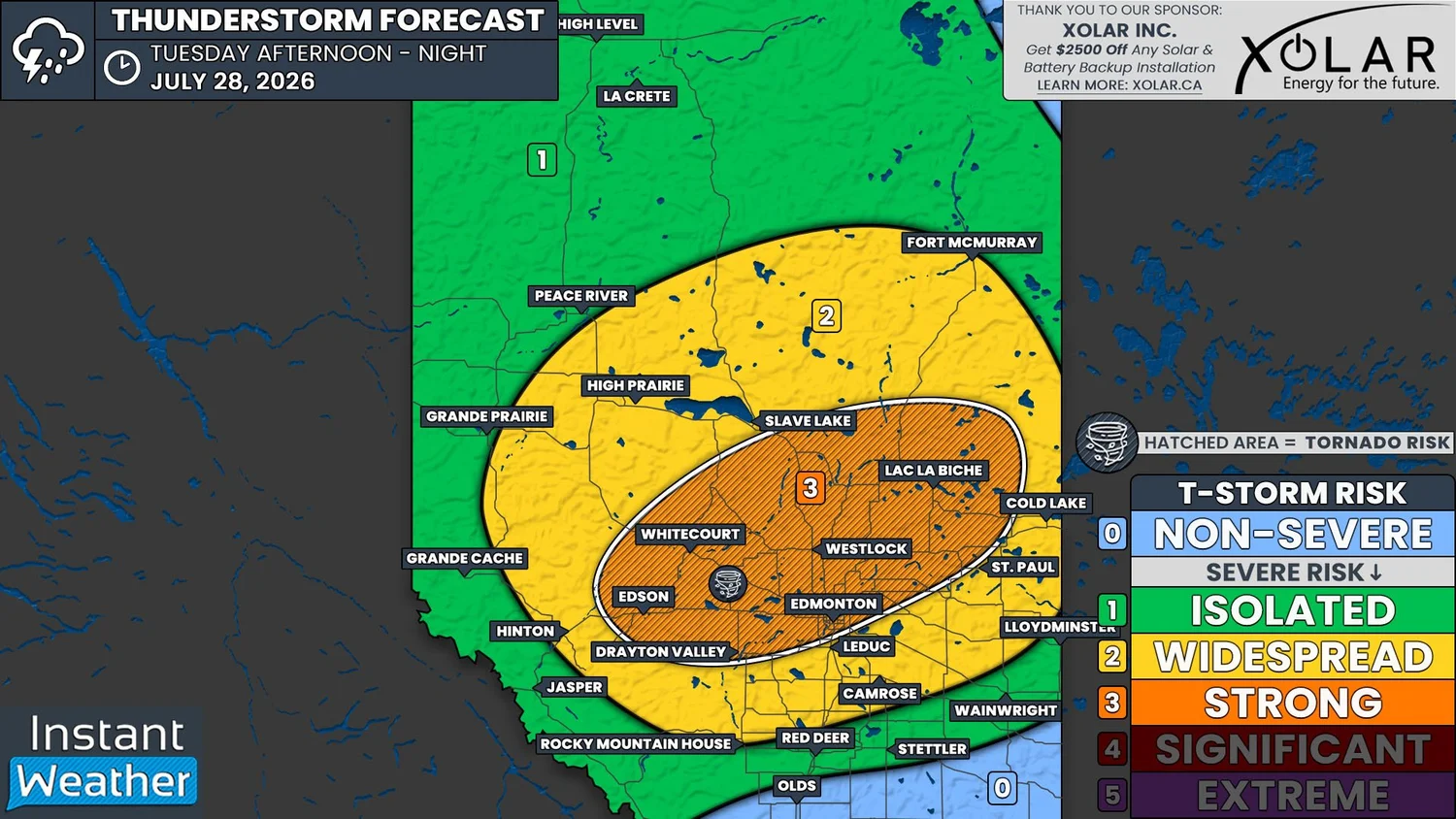
NOTE: YOU CAN CLICK ON THE MAP TO OPEN A ZOOMABLE IMAGE
It has been a seemingly never-ending pattern of severe weather for Central and Northern Alberta lately and unfortunately, that pattern will continue today. We are once again looking at the possibility of strong severe thunderstorms that could impact parts of Central and Northern Alberta, including Edmonton, beginning this afternoon and continuing through the evening.
The environment will be favourable for the development of supercell thunderstorms today. There will be plenty support for these storms, with CAPE values exceeding 2000J/kg in some areas, along with a considerable amount of shear and moisture. A low that will move through the province this afternoon will then be the trigger that causes the storms to develop.
Thunderstorms are expected to fire up early this afternoon in the Foothills. From there, they will track eastward, into the most favourable environment by the late afternoon and continuing through the evening. The greatest severe threat will be in the 5-10pm timeframe and those in the Edmonton area could see severe weather in the window of 6-9pm.
As we get later into the evening, after around 10pm, the storms are expected to weaken as they gradually continue east towards the Saskatchewan border and most thunderstorm activity should end by midnight.
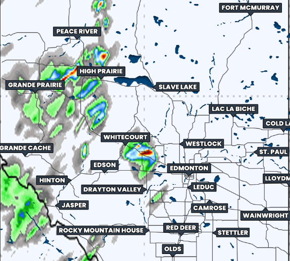
Hourly Precipitation at 5Pm MDt, courtesy of weatherbell.
The strong supercell storms this evening could have the potential to produce very large hail that could be as large as tennis balls, damaging wind gusts in excess of 100km/h, and very heavy rain. The rain will be a concern particularly in Edmonton, which is just inside the area at risk for the strongest storms, since there has been considerable flooding after every thunderstorm that has tracked through the city lately.
There will also be a widespread risk for severe thunderstorms that are expected to be slightly weaker, in an area that surrounds the highest risk. This covers Hinton, High Prairie, Slave Lake, Cold Lake, and Camrose, with Rocky Mountain House and Fort McMurray just inside the risk area.
The storms in this region will likely still be able to produce damaging wind gusts above 100km/h, but the hail associated with them is expected to be a bit smaller, maxing out at the size of a golf ball.
Beyond this region, there is a much more isolated severe risk in an area that covers Red Deer, Jasper, Grande Prairie, Peace River, and north to the Northwest Territories border.
It’s important to note that today’s thunderstorms will have a tornado risk associated with them, but this risk is the most significant for the area marked by hatching on our forecast map, where the strongest storms are expected. This includes Edmonton, Edson, Whitecourt, and Lac La Biche.
With the threat of tornadoes today, please make sure that you have a plan in place in the event that severe weather approaches your area. Make sure to have all of your devices charged and that you have more than one way to receive critical weather alerts.
It’s likely that we will be going live later this afternoon, as the storms start to strengthen, so be sure to tune in at instantweather.ca/live.