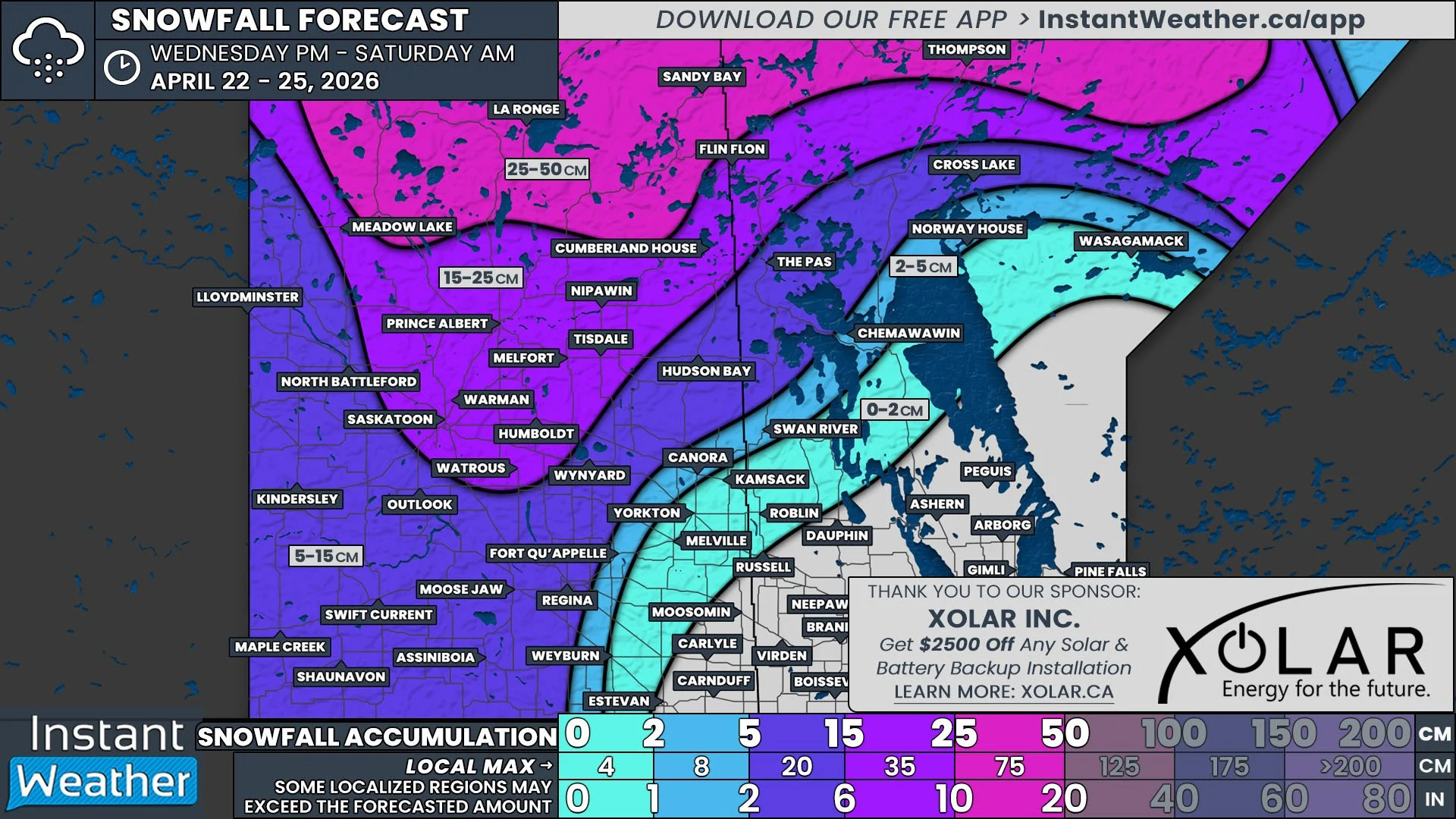
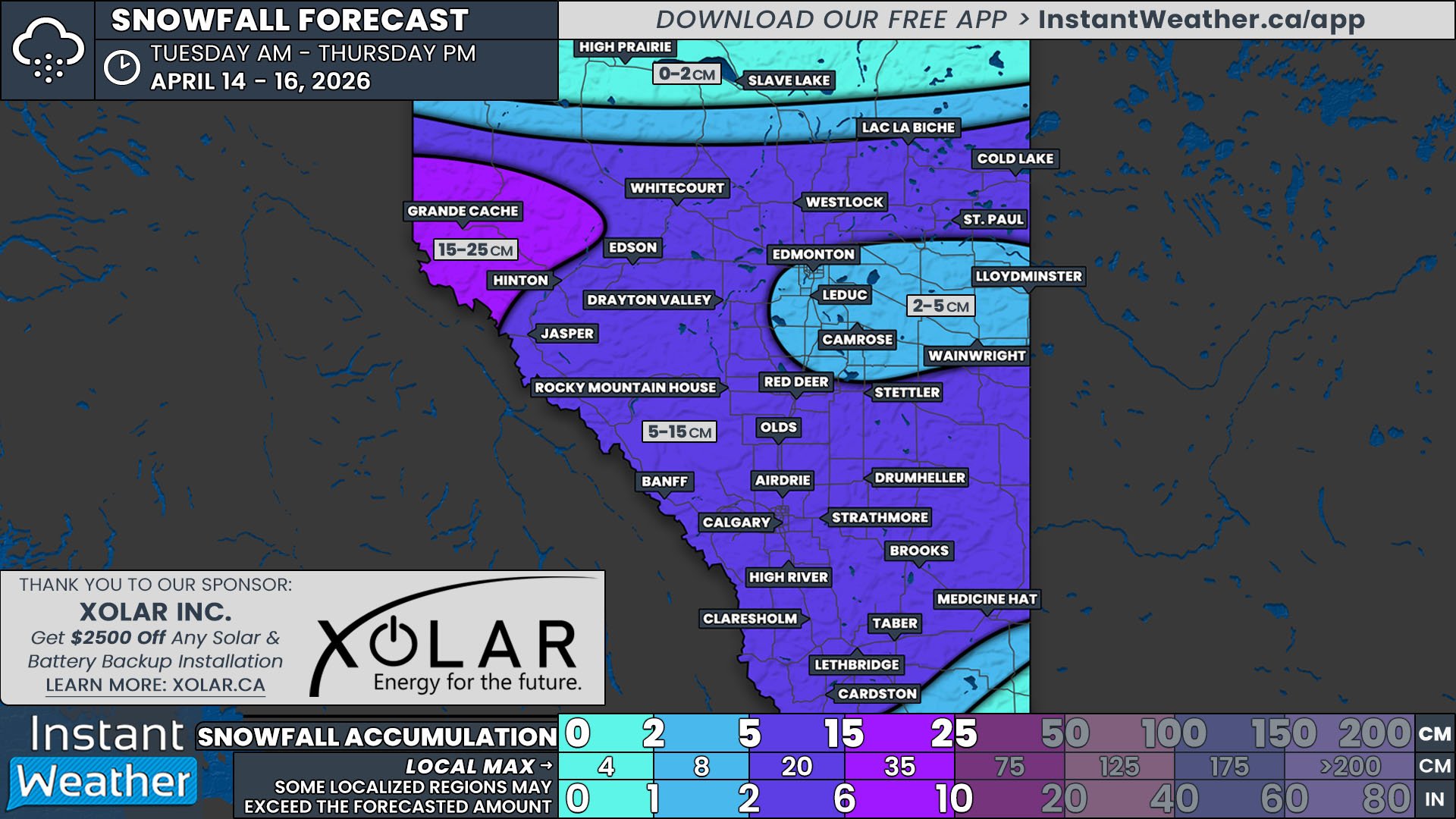
Second Day of Snowfall Expected to Bring Widespread 10-20cm of Snow Across the Prairies on Saturday
/The first day of our multi-day snow event brought light to moderate snow to all three Prairies provinces by Friday evening. Snowfall totals for the entire event are still expected to top 30cm across a significant portion of the region, with Saturday’s snowfall bringing over 10cm of accumulation to many.
Before discussing what is expected on Saturday, we first need to determine the positioning of the system at approximately midnight. As seen in the model image below for that point in time, snow will still be falling across most of Northern Alberta and along the Rockies. It will also continue to extend southeastward across Saskatchewan and into Southwestern Manitoba.
Model Image showing the Location and Intensity of the Snowfall at 11Pm MT Friday/12AM CT Saturday
Alberta
The snow will continue across Northern Alberta and the Rockies through the early morning hours of Saturday as the entire system continues to travel eastward. There’s expected to be a break in the snowfall for a few hours from Grande Prairie to Cold Lake through the early morning, but that will be followed by a secondary wave of heavier snowfall trailing closely behind.
This additional area of snow will stretch southward into Central Alberta, bringing more snow to Edmonton and possibly even some light flurries across Southern Alberta throughout the day. The snow will cross this part of the province during the morning and afternoon and by the evening, the band of snow will be almost entirely in Saskatchewan. Snowfall totals for Central and Southern Alberta won’t be too high, with most receiving less than 5cm by the end of the day and the last of the snow they can expected from this event.
Later in the morning, we’ll start to see the snow tapering off in parts of Northern Alberta from west to east, bringing accumulation for this area to 5-10cm. The snow will continue to fall further north; in areas like Peace River, High Level, and Fort McMurray; straight into the overnight hours, bringing snowfall accumulations here up to 30cm by the end of the day.
As the snow clears behind the second wave of snow, Arctic air will flood southward and the temperatures will start to fall into the -20°s,
Model Image showing the Location and Intensity of the Snowfall at 5Am MT/6AM CT Saturday
Saskatchewan
The snow will gradually end in Southern Saskatchewan, from west to east, throughout the early morning hours as the system continues to travel eastward. The same can be said further north in the province, but beginning a couple hours later, closer to sunrise, due to the northwest to southeast orientation of the large band of snow.
The second wave of snow from Alberta will cross into Saskatchewan several hours later, in the mid-morning, which will add to the earlier snowfall across much of the province. Southwest Saskatchewan can expect little to no snow from this, but isolated flurries can’t be completely ruled out. Snowfall is, however, anticipated in the southeast corner of the province as it appears this secondary line will see some southward development as it crosses the province.
By the end of the day, a majority of Saskatchewan will have received at least 5cm of snow, with a significant portion over 10cm. Snow will still be falling across most of the province overnight and into Sunday morning, which will add to the total amount received from the event and will be covered in the next forecast.
Model Image showing the Location and Intensity of the Snowfall at 11Am MT/12M CT Saturday
Manitoba
The snowfall isolated to Southwestern Manitoba late Friday will spread eastward across the southern portions of the province through Saturday morning. Snow will also gradually begin to fall moving northward along the Saskatchewan border as the main band of snow continues along the same eastward trajectory.
This snow may be heavy at times, leading to quick accumulation. The lightest snow will be along the southern edge, which can expect less than 5cm total by the end of the day.
In the late morning, areas in the southwest will see the snow start to taper off as the initial band of snow exits the region. There will be several hours of calm before the second wave moves in during the evening. This wave will only make it about halfway across the province before midnight, so only a small area can expect over 10cm of snow total for Saturday.
Model Image showing the Location and Intensity of the Snowfall at 11Pm MT Saturday/12AM CT Sunday
Sunday
On Sunday, the entire system starts to exit the Prairies followed by temperatures in the -20°s and -30°s across the entire region. There will still be some decent snowfall across the region throughout the day, which we will cover in the forecast that will be posted Saturday evening.


