First Look at the Major Snowstorm Set to Impact the Prairies This Week
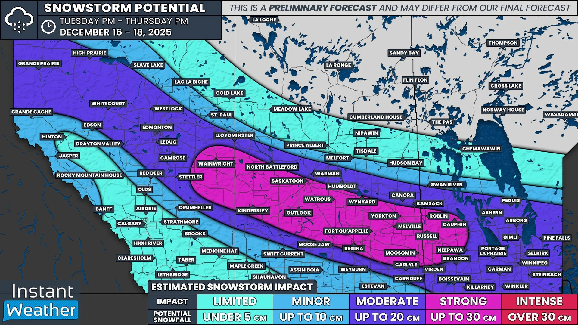
/After a seemingly constant stretch of back-to-back clippers bringing brief blasts of snow, we’re finally looking at a proper snowstorm across the Prairies this week. While this will be another clipper, it will be much more impactful, bringing periods of heavy snow to Edmonton, Saskatoon, Regina, and Winnipeg. Here’s a preliminary look at roughly what can be expected, but keep in mind that exact timing and snowfall amounts will likely change between now and the start of the event.
The snow is set to begin late Tuesday or very early Wednesday morning in the Rockies and Northern Alberta before gradually spreading eastward with the trajectory of the associated low. The leading edge of the snow will cross into Saskatchewan before sunrise Wednesday and then into Manitoba by the late morning or early afternoon.
The snowfall should be fairly moderate as it tracks across Alberta before it starts to taper off in the evening. To the east, on the other hand, the snow is expected to intensify Wednesday afternoon in Saskatchewan and in the evening in Manitoba, leading to a significant swath of up to 30cm of heavy snowfall by the noon hour on Thursday.
To complicate matters further, strong winds with gusts exceeding 100km/h are expected across the Southern Prairies beginning Wednesday afternoon and continuing overnight. This will very likely lead to white-out conditions, possibly even reaching the threshold to be considered a blizzard, in Southern Saskatchewan and Manitoba that will probably result in highway closures.
It’s also worth noting that in the warm sector, along the southern edge of the snow, there will be the possibility of a mixture of rain, freezing rain, and ice pellets which would be followed by snow as the temperatures fall. We will have more information on this risk, along with further details regarding the entire storm in our full forecast that will be posted Tuesday evening.


