Up to 5 to 10 cm of Snow and Wind Chills Near -15°C as ‘Third Winter’ Arrives in Southern Ontario This Week
/
Enter to Win a 7-Night Cruise for 2 with Celebrity Cruises, Including Airfare - Select Patricia Bootsma as your travel consultant
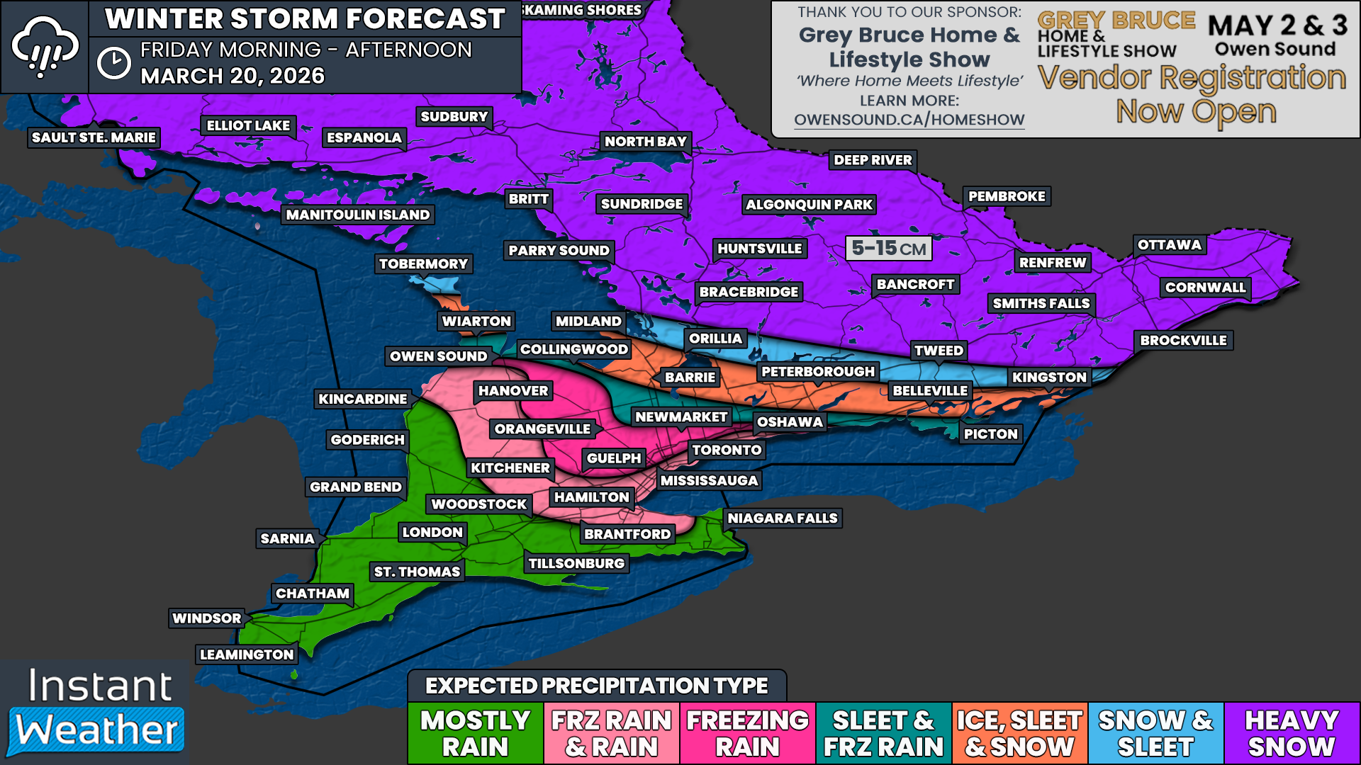
NOTE: YOU CAN CLICK ON THE MAP TO OPEN A ZOOMABLE IMAGE
Since the arrival of astronomical spring, the weather has certainly matched the season across Southern Ontario. We’ve seen multiple days of double digit temperatures along with the typical spring thunderstorms. However, as we head into the first full week of April, it appears that our ‘3rd winter’ is on the horizon, bringing with it a blast of cold and snowy weather that many thought was behind us for the season.
The good news is that there is light at the end of the tunnel. This blast of wintry weather will only be temporary, with a return to more seasonal conditions expected towards the end of the week.
It certainly isn’t going without a fight. A heavy burst of snow late Monday and continuing into Tuesday may lead to tricky travel conditions as people head back to school and work after the Easter long weekend. You’ll also need to dust off those winter coats again as temperatures plunge overnight Monday, bringing a brief return to wind chills near -15°C in some parts of Southern Ontario.
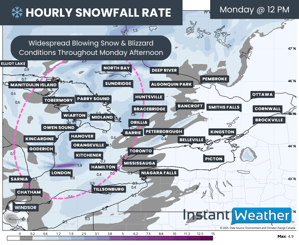
While we aren’t expecting widespread significant snowfall accumulation from this late season system, the timing could still leave roads snow covered and slushy ahead of the Tuesday morning commute. The snow will fall within a short timeframe and could be quite heavy at times, leading to reduced visibility and some blowing snow.
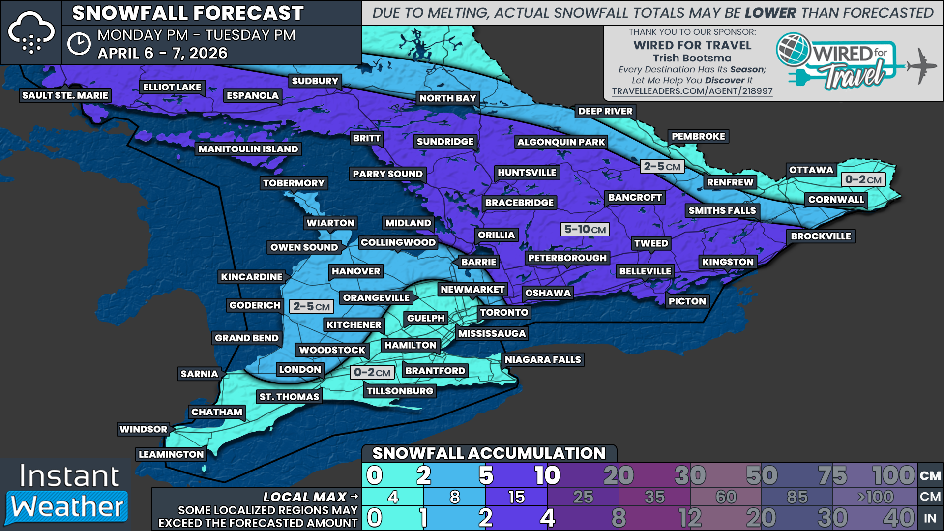
Most areas are only expecting to see a few centimetres of snow by the time it tapers off early Tuesday afternoon. However, some pockets, especially across parts of Central and Eastern Ontario, could exceed the 5 cm mark and end up seeing between 5 and 10 cm.
The main caveat is that temperatures will still be near the freezing mark when the bulk of the snow is falling late Monday into early Tuesday morning. This means some of it may melt on contact with the ground before being able to accumulate. As a result, actual totals will vary significantly and could fall short of the 5 to 10 cm mark in some areas if temperatures end up slightly warmer.
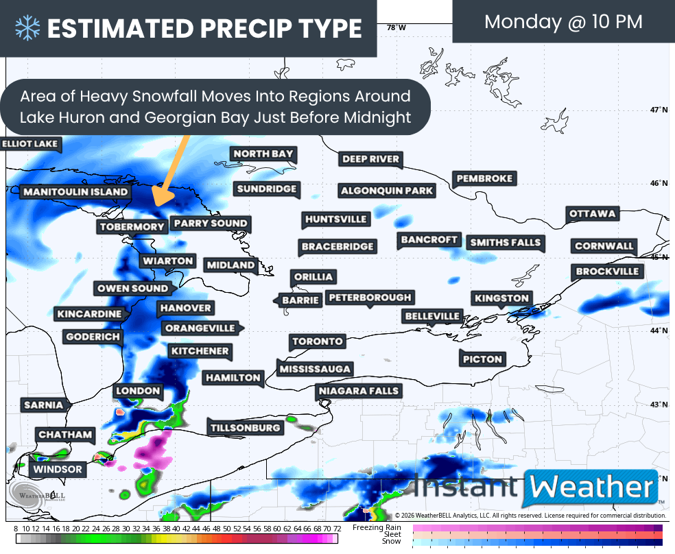
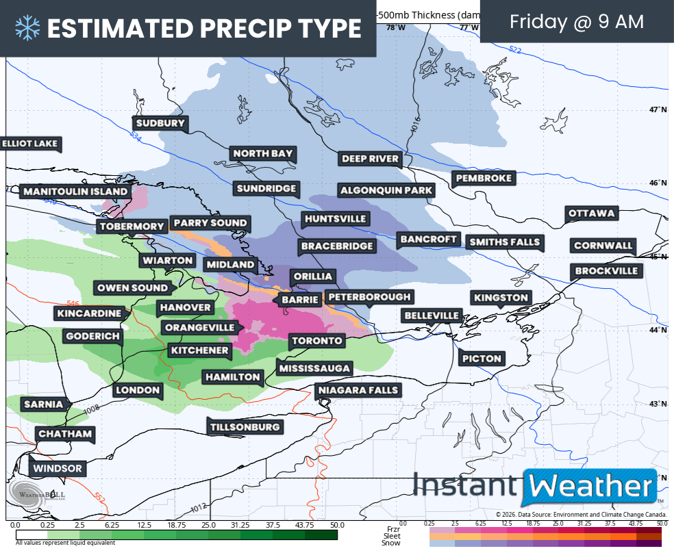
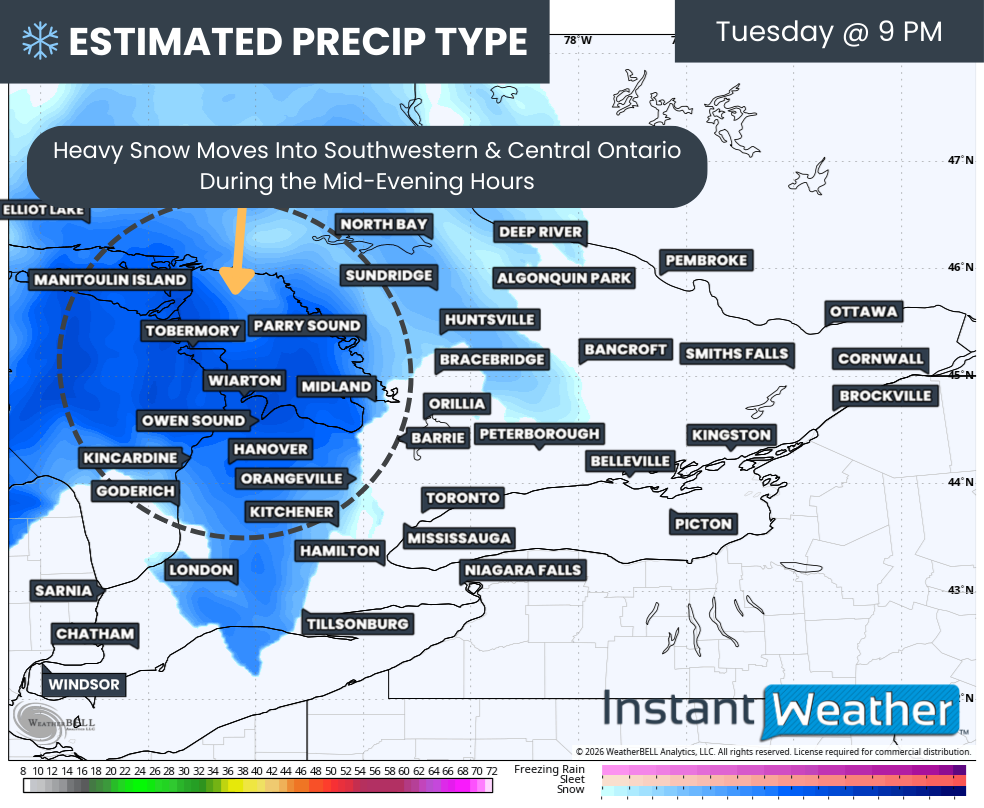
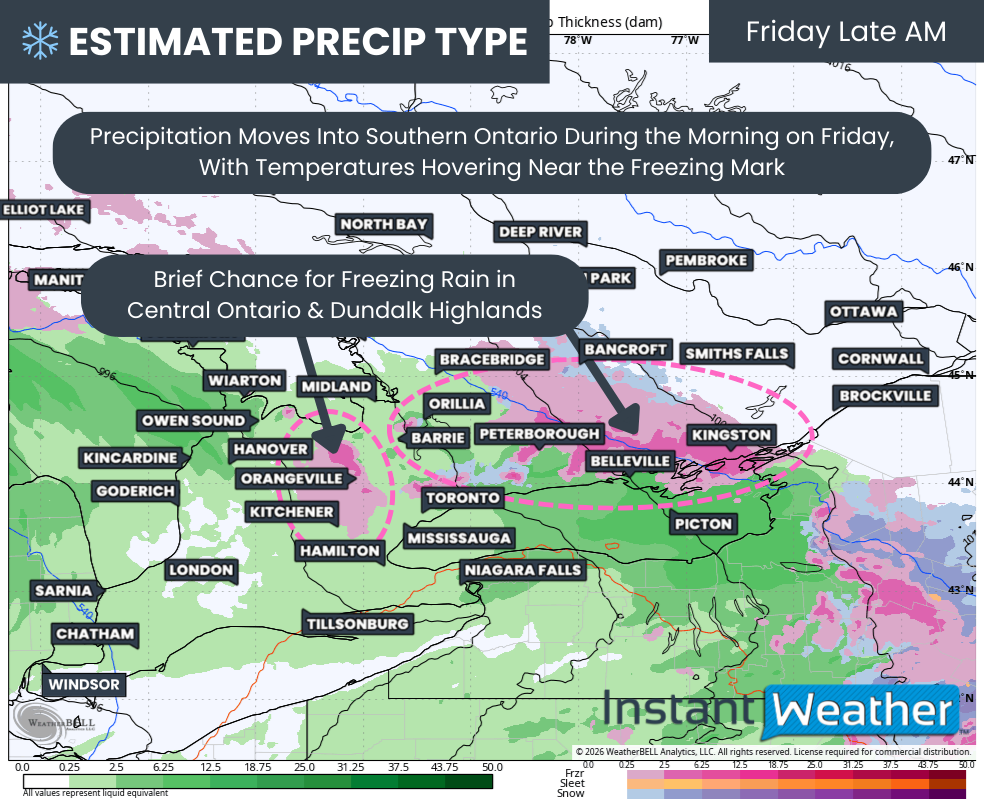
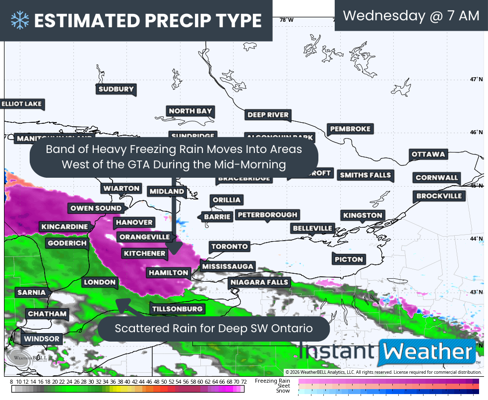
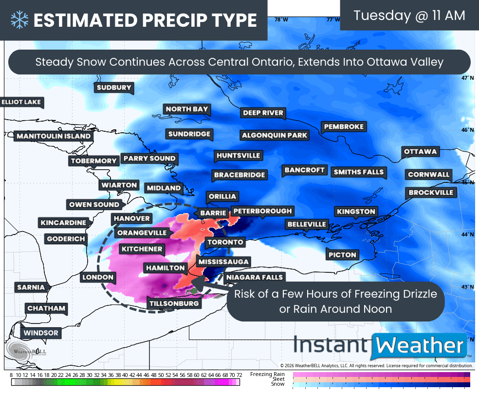
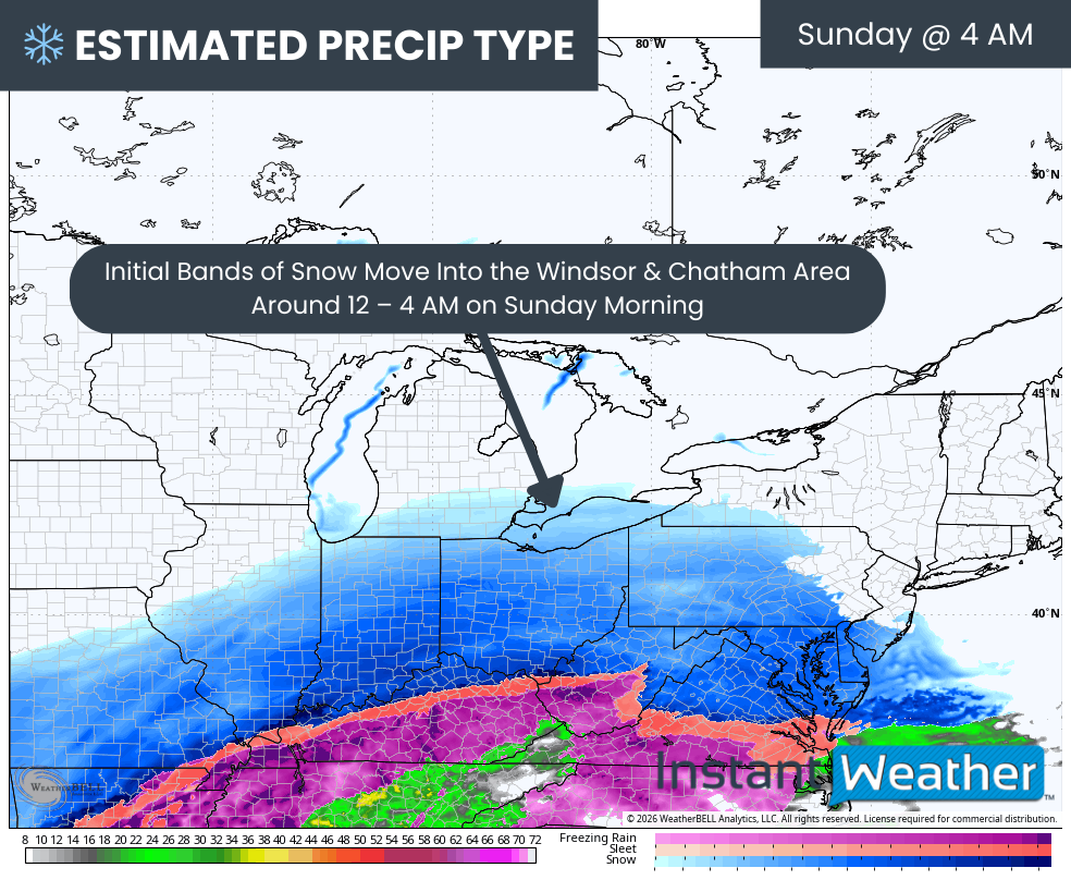
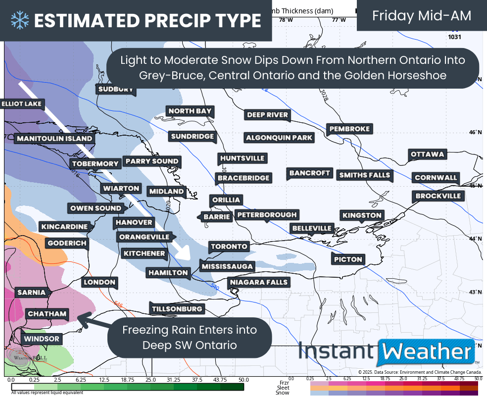
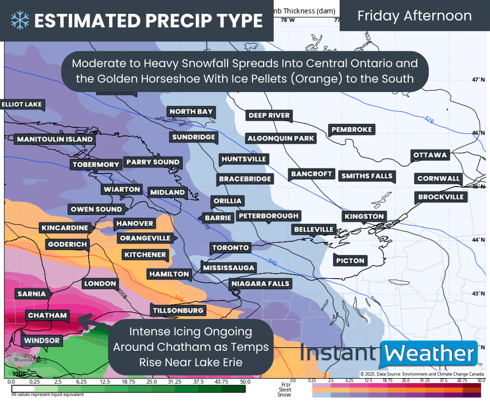
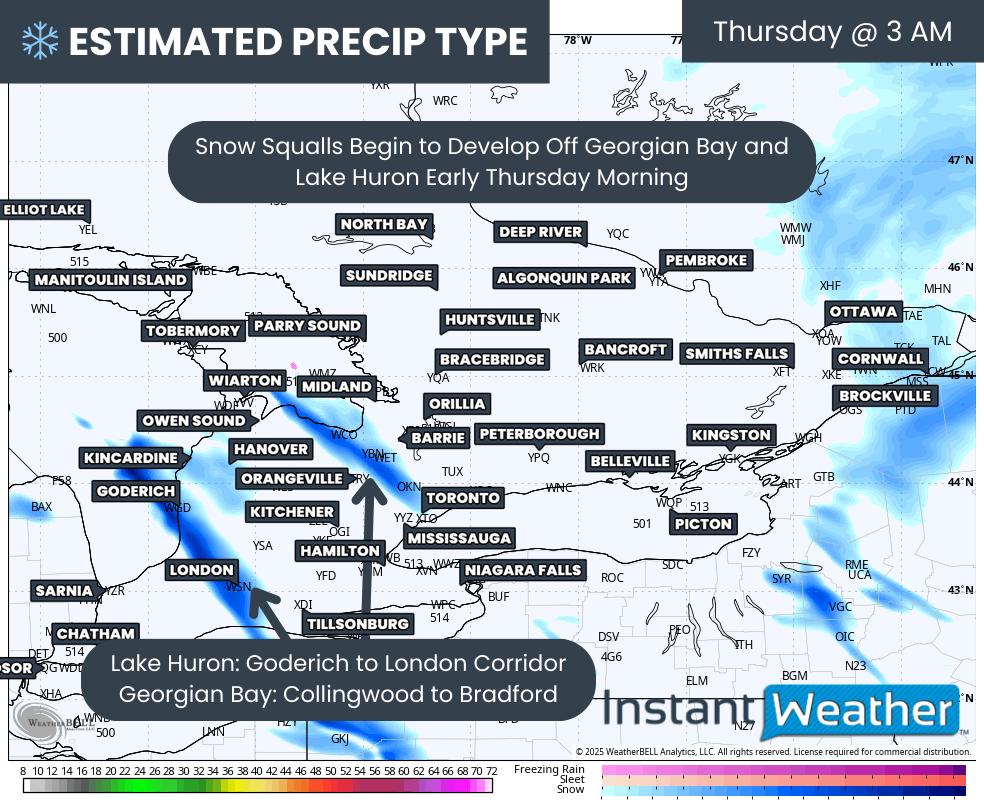
PRECIP TYPE - MAP FROM WEATHERBELL
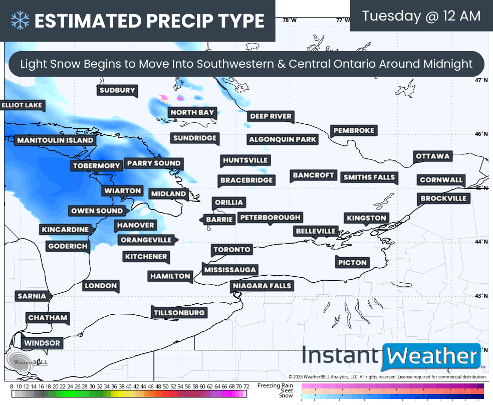
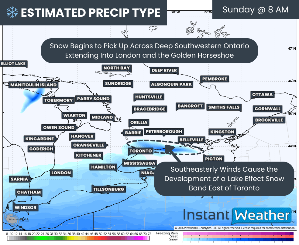
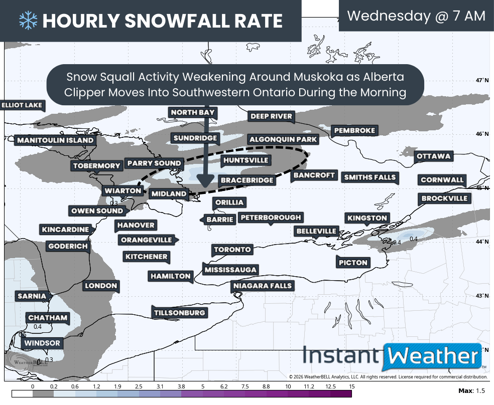
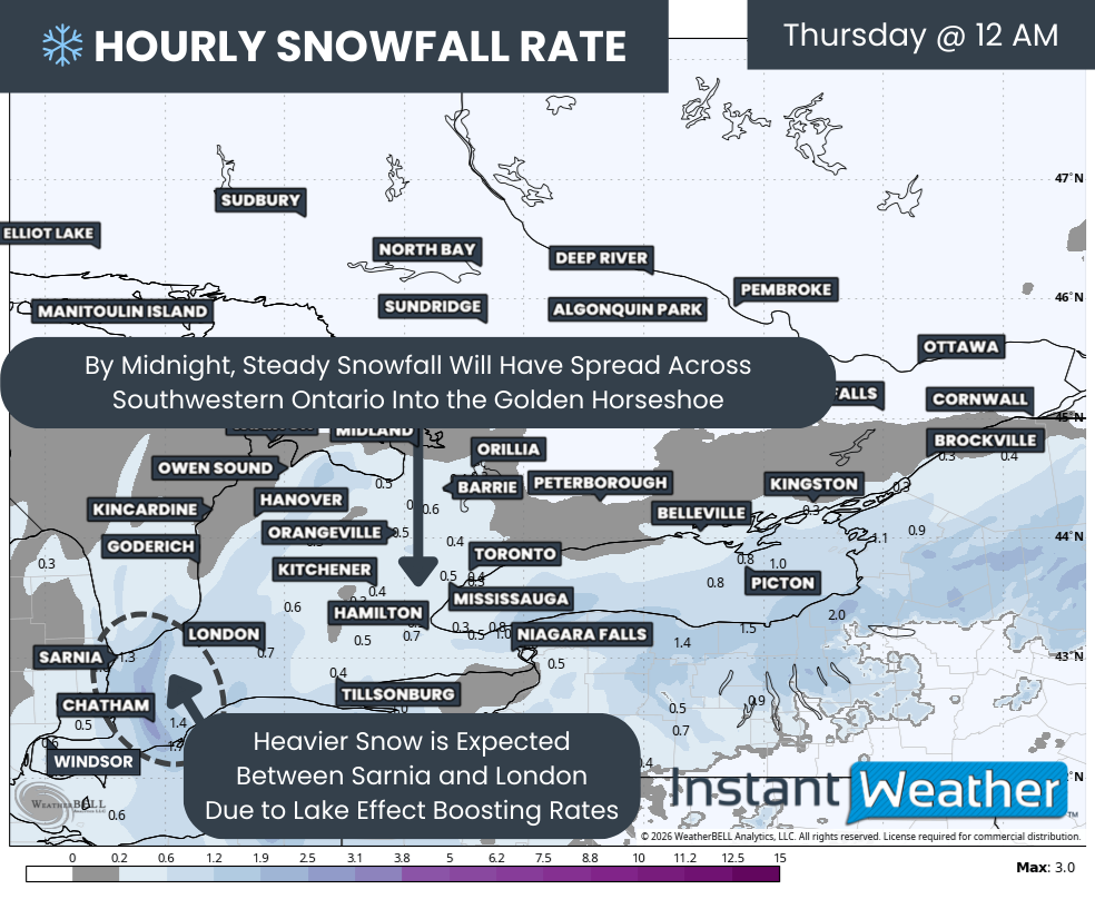
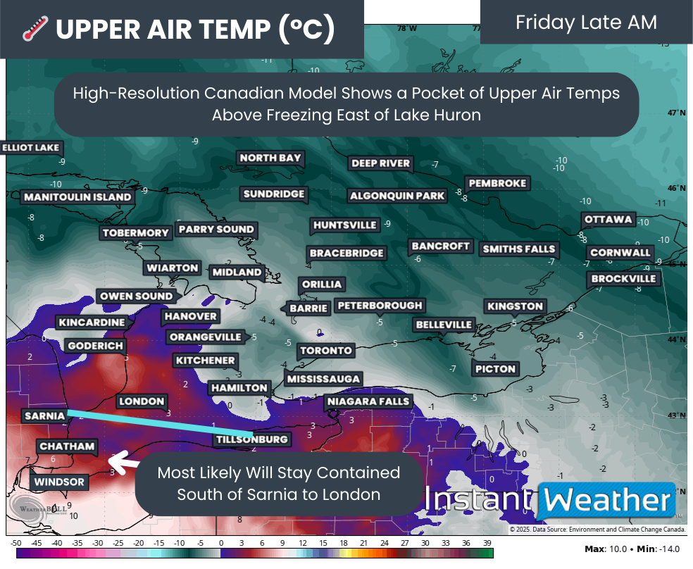
An area of heavier snow is expected to track into regions around Lake Huron and into Northeastern Ontario sometime during Monday evening. This could start as a rain and snow mix with temperatures still near freezing, especially near Lake Erie and Deep Southwestern Ontario, but should switch over to snow later in the evening.
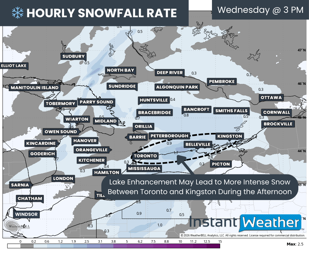
Even though we are less than six hours away from the start of the snow, models still disagree on the exact intensity and placement. There also appear to be dry slots within the precipitation, which could lead to some areas getting completely missed. At the same time, some moisture from the lakes may enhance snowfall rates in localized areas.
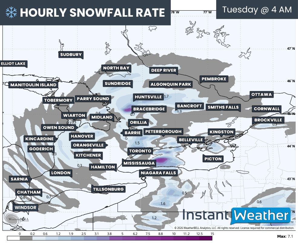
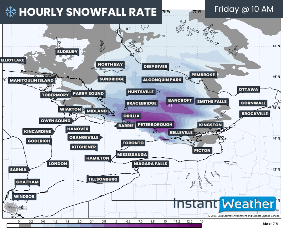
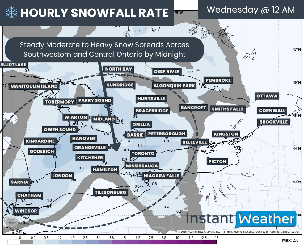
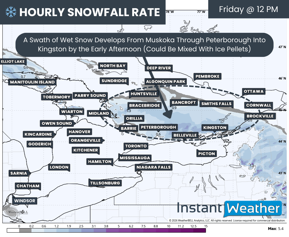
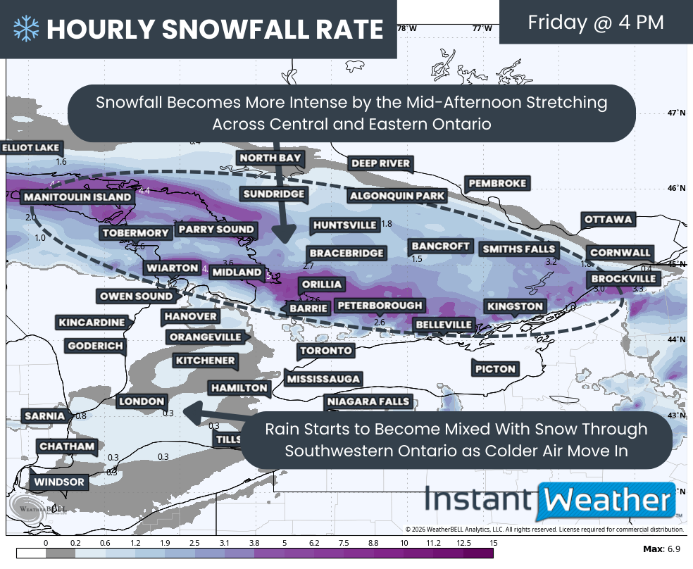
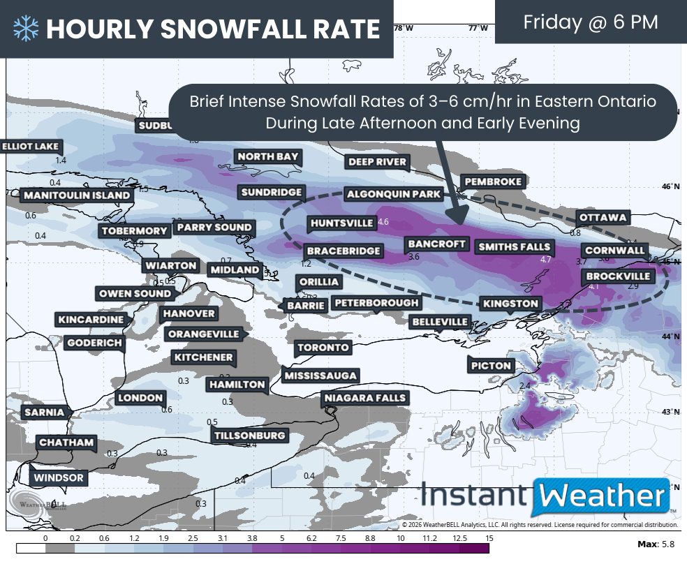
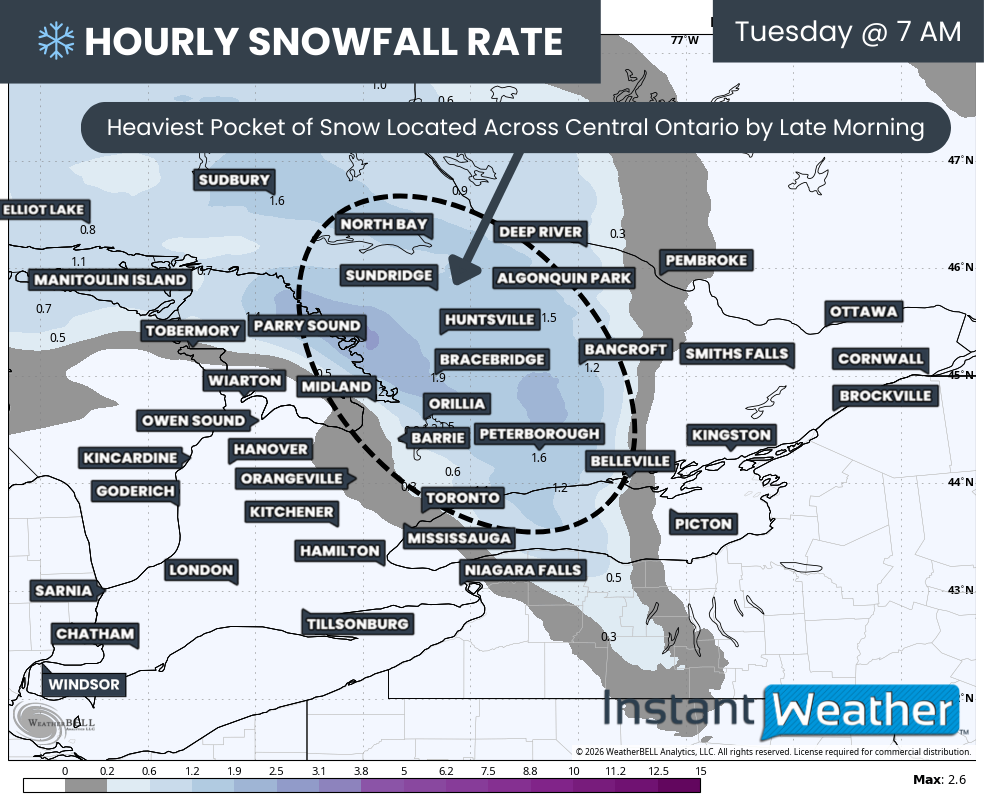
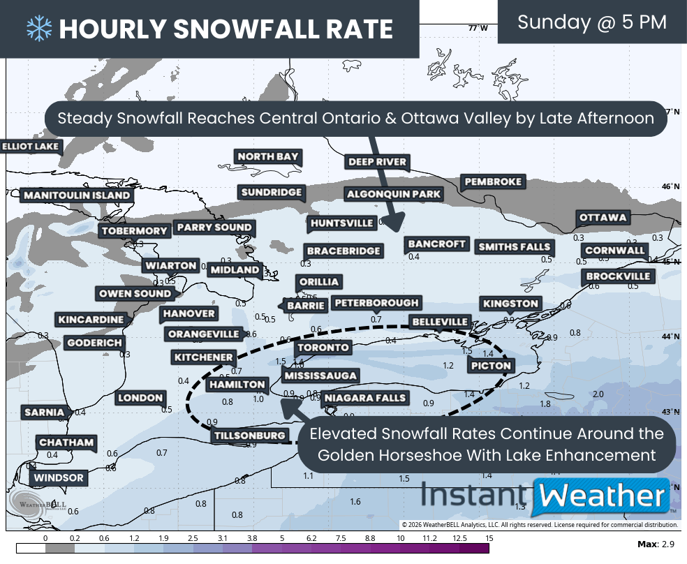
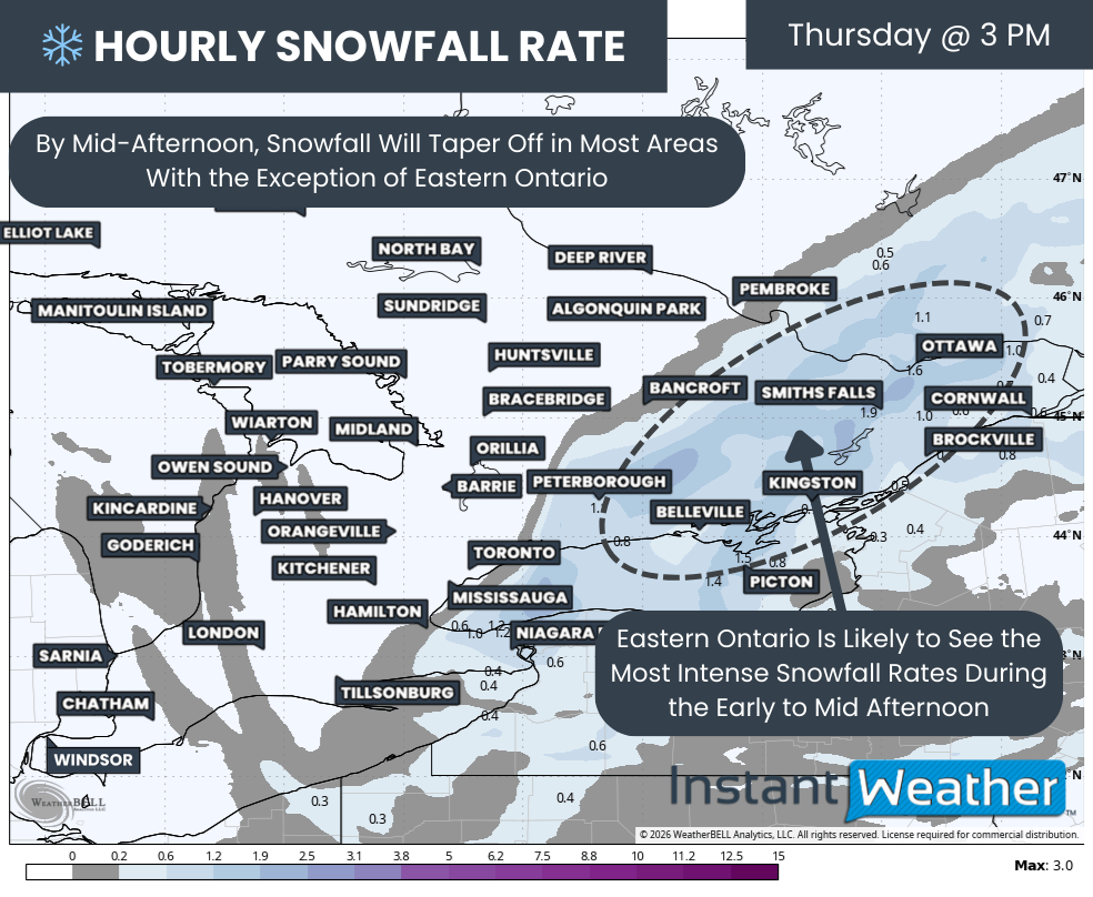
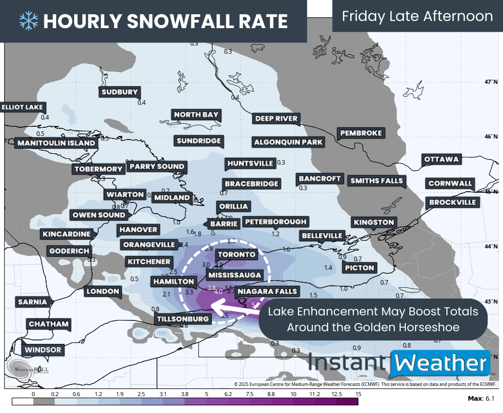
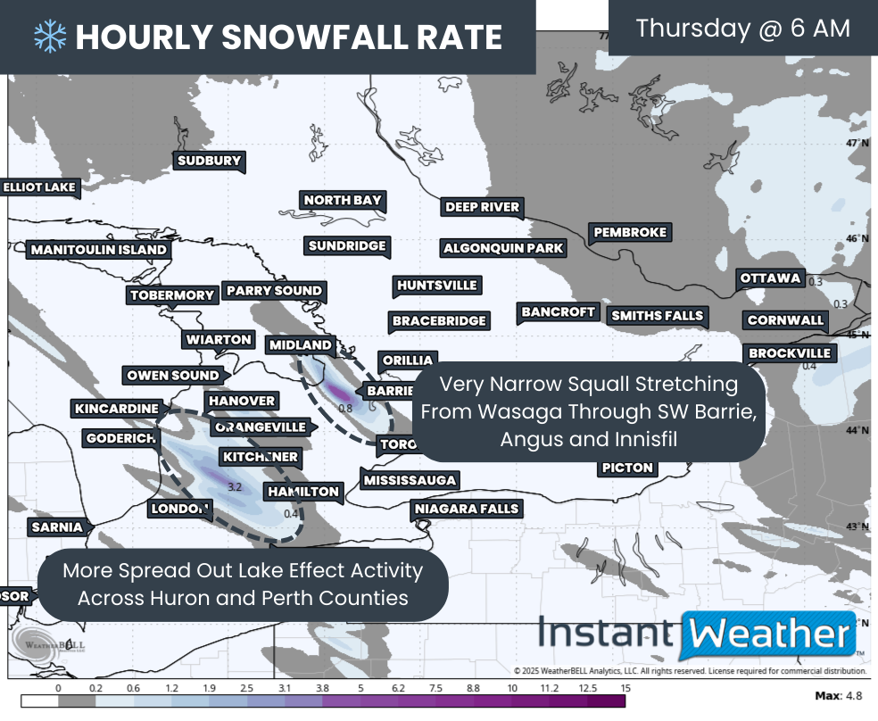
Hourly snowfall rates (cm) - MAP FROM WEATHERBELL
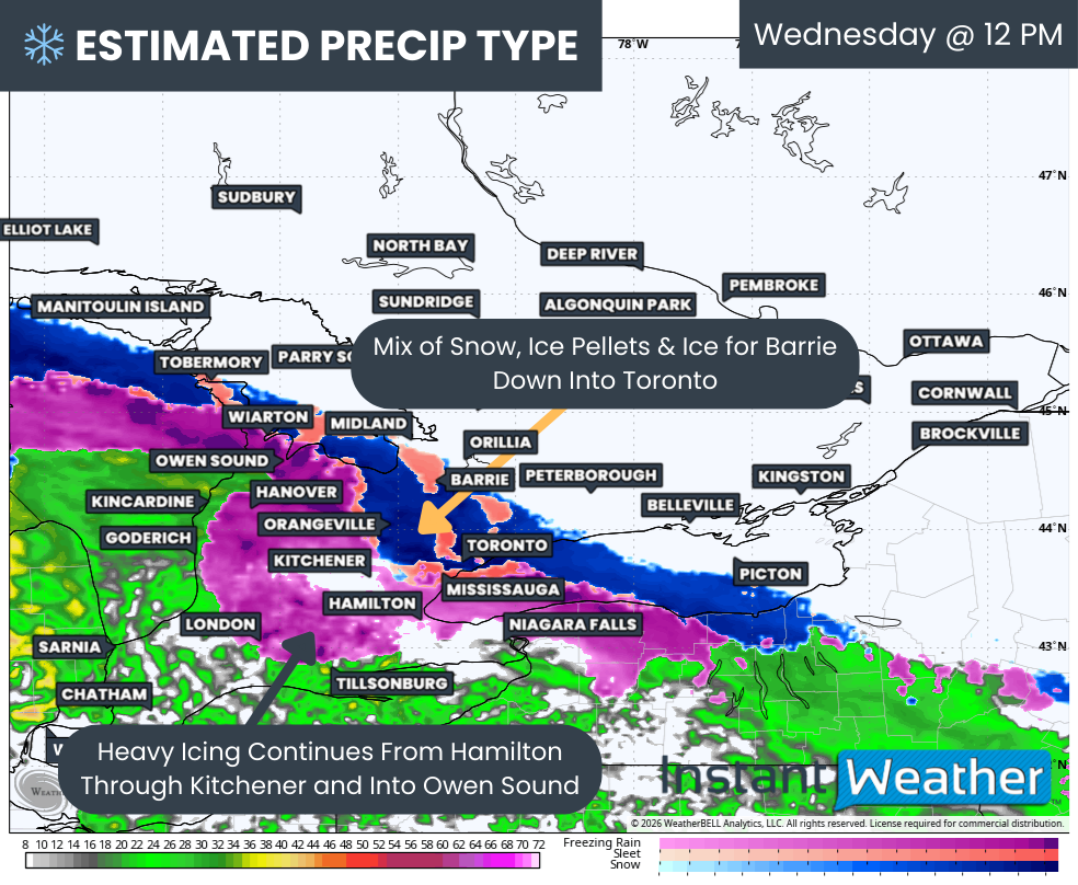
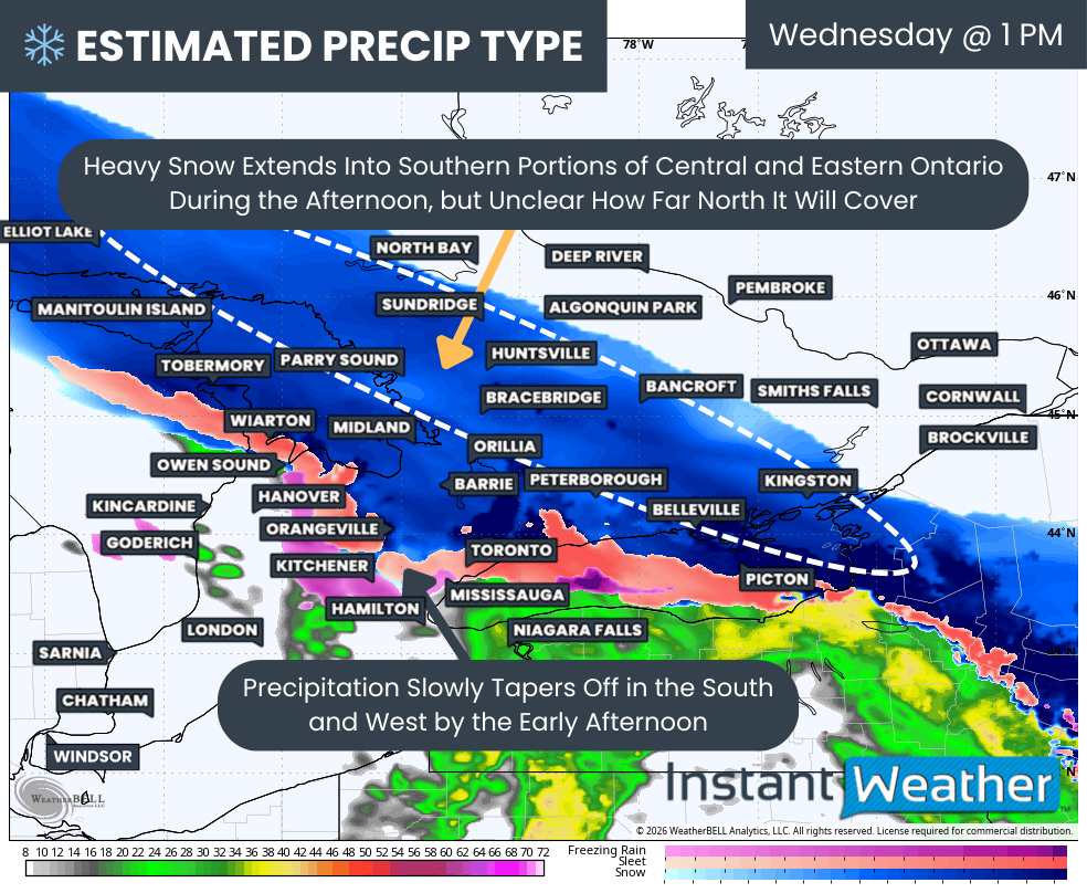
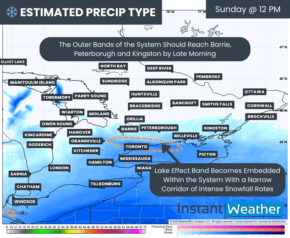
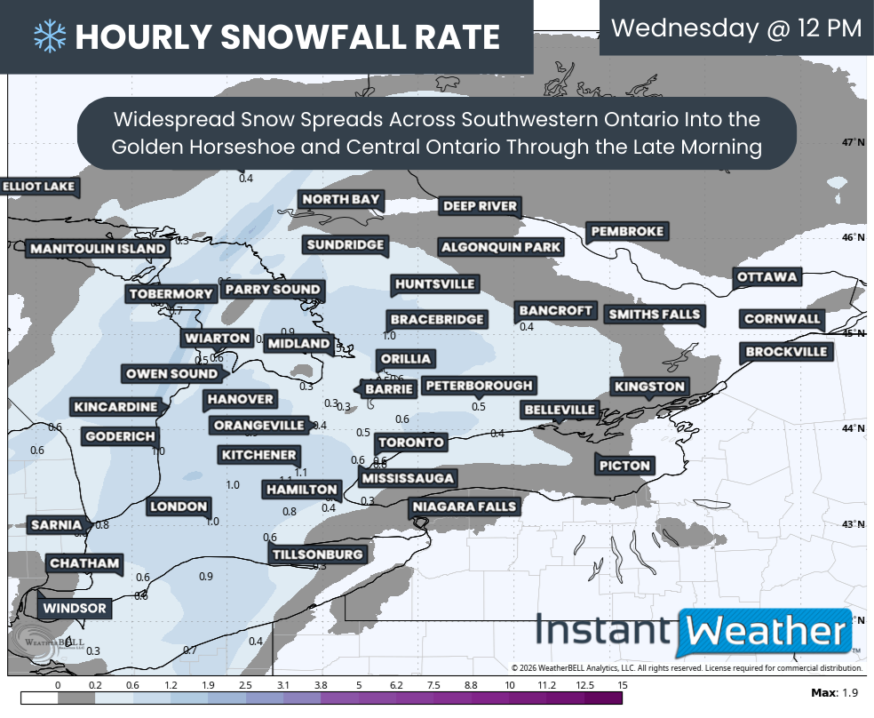
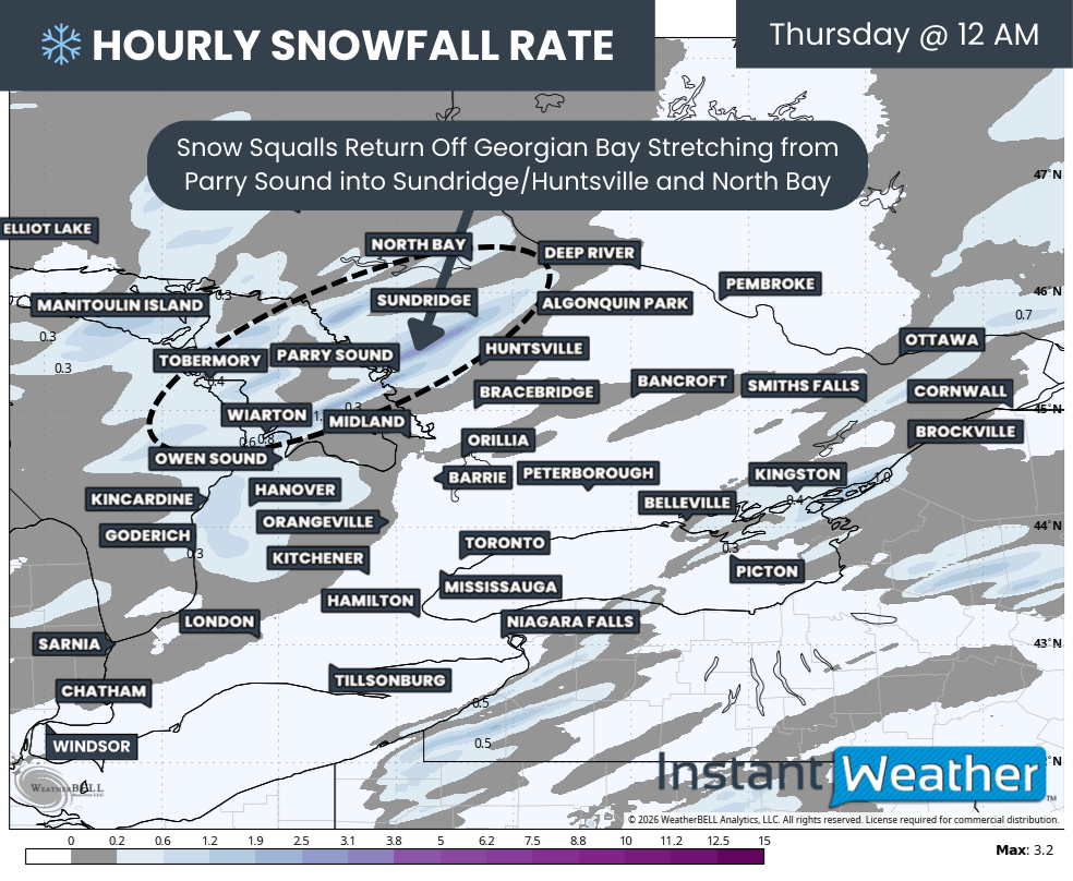
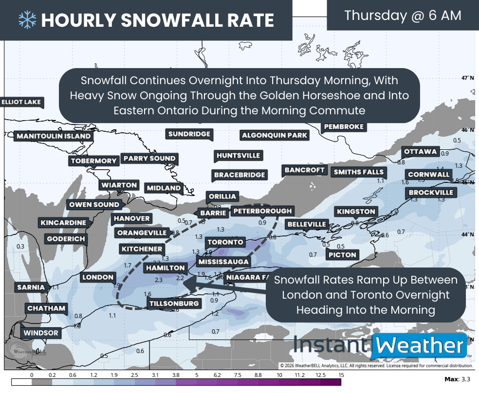
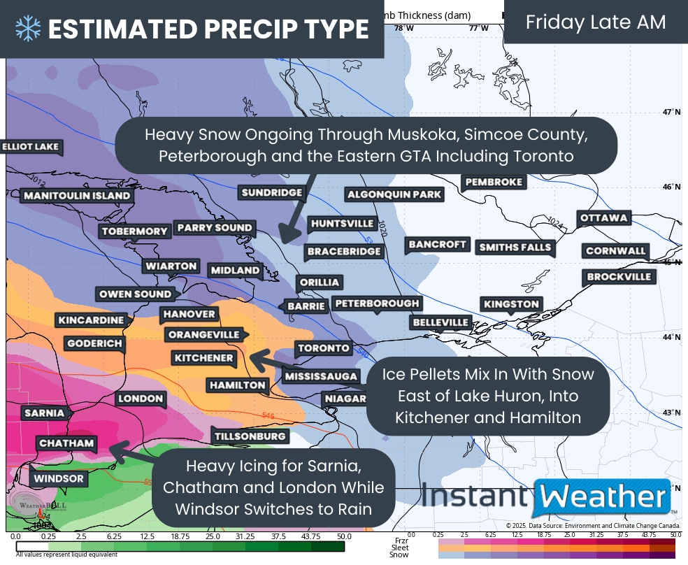
By the pre dawn hours on Tuesday, the snow will become more widespread, extending around the Lake Huron shoreline and into Central and Eastern Ontario.
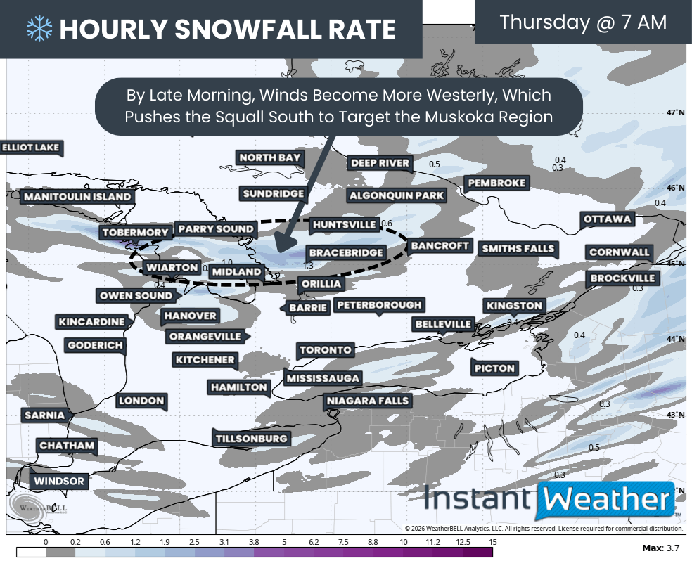
The heaviest pockets of snow appear likely to track from Muskoka through Peterborough and into the Kingston corridor. This could lead to rapid accumulation if temperatures are cold enough to limit melting. Expect poor driving conditions overnight and early Tuesday morning in this area, with sudden whiteout conditions possible.
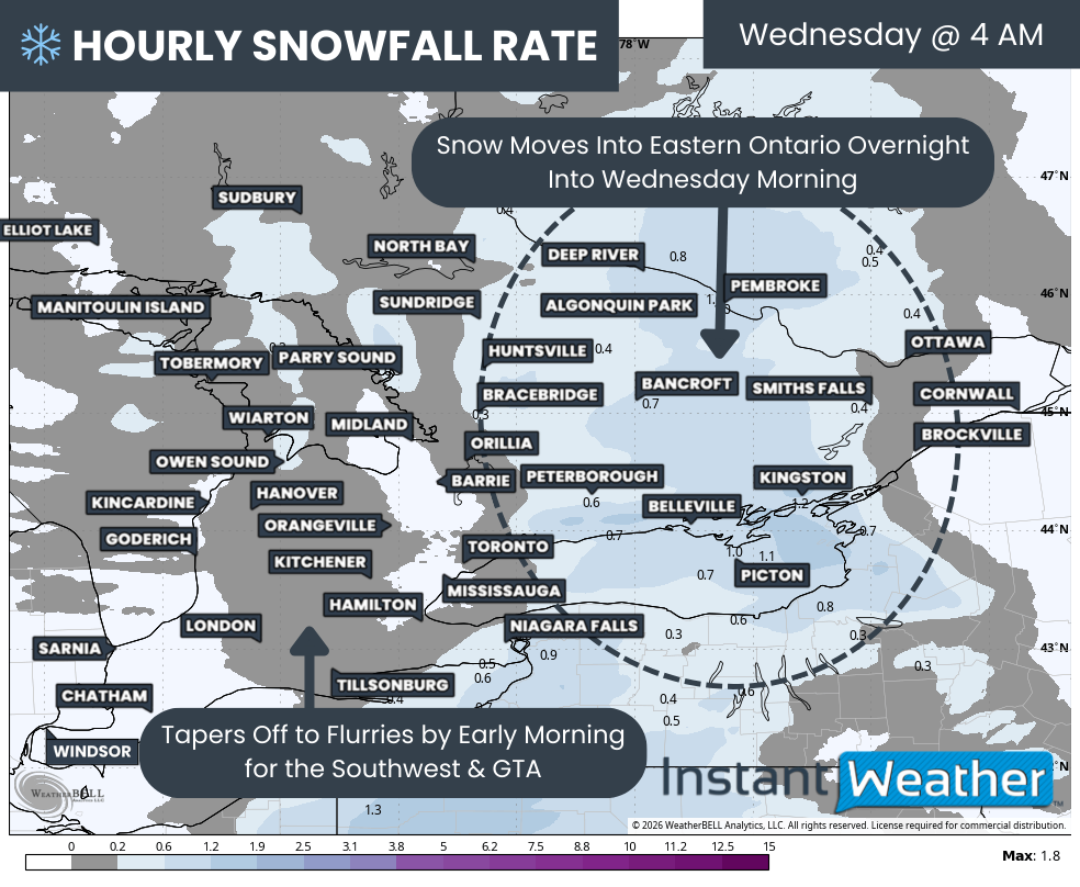
Around Lake Huron, we could see a brief return of lake effect streamers affecting the London, Goderich and Kincardine area through the morning hours. This may also include the southern shoreline of Georgian Bay.
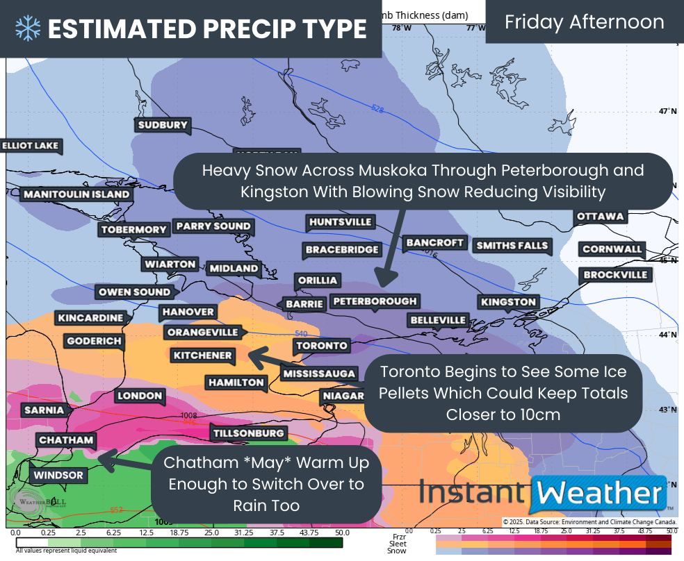
Wind gusts approaching 50 to 70 km/h may lead to blowing and drifting snow in these areas. While overall accumulation is expected to be limited, even a small amount of snow in exposed rural areas can make travel difficult when paired with strong wind gusts.
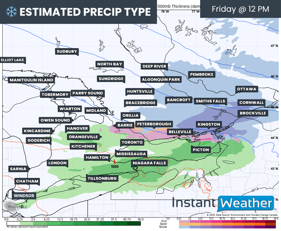
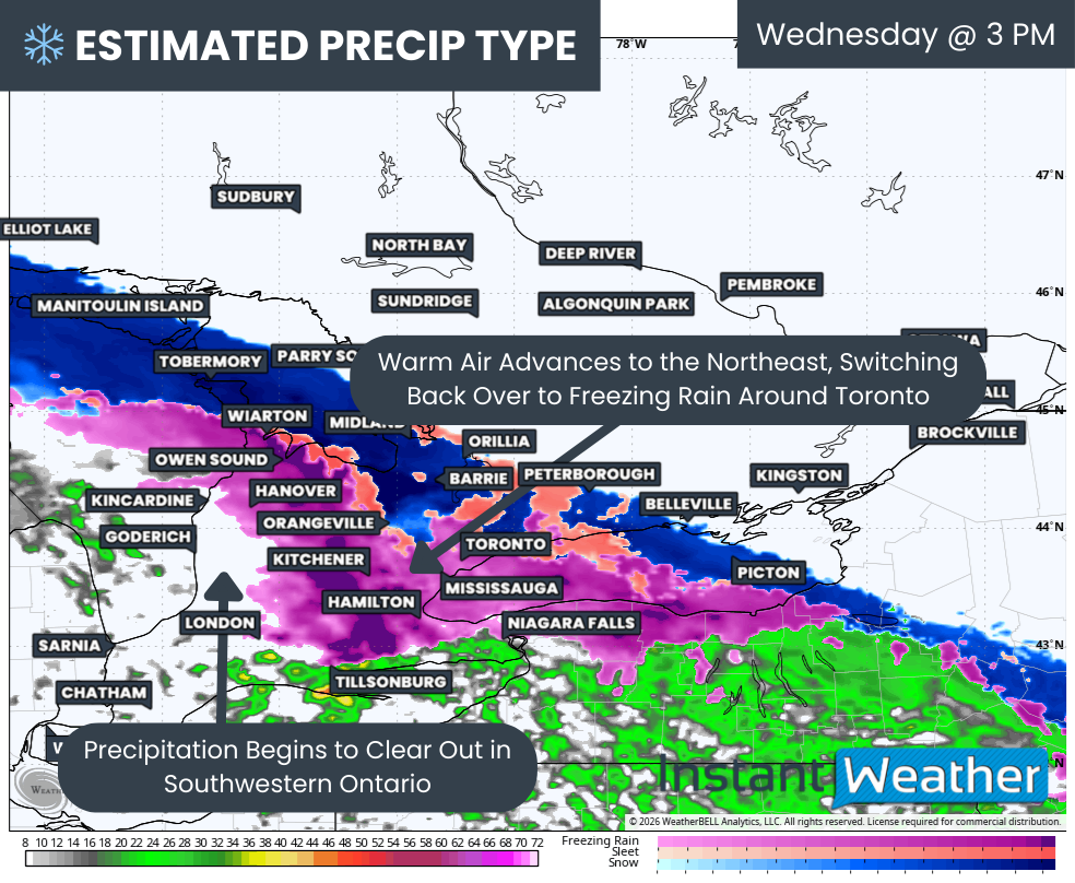
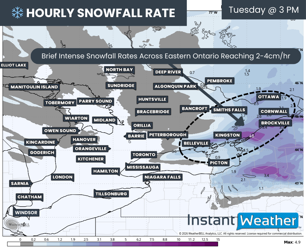
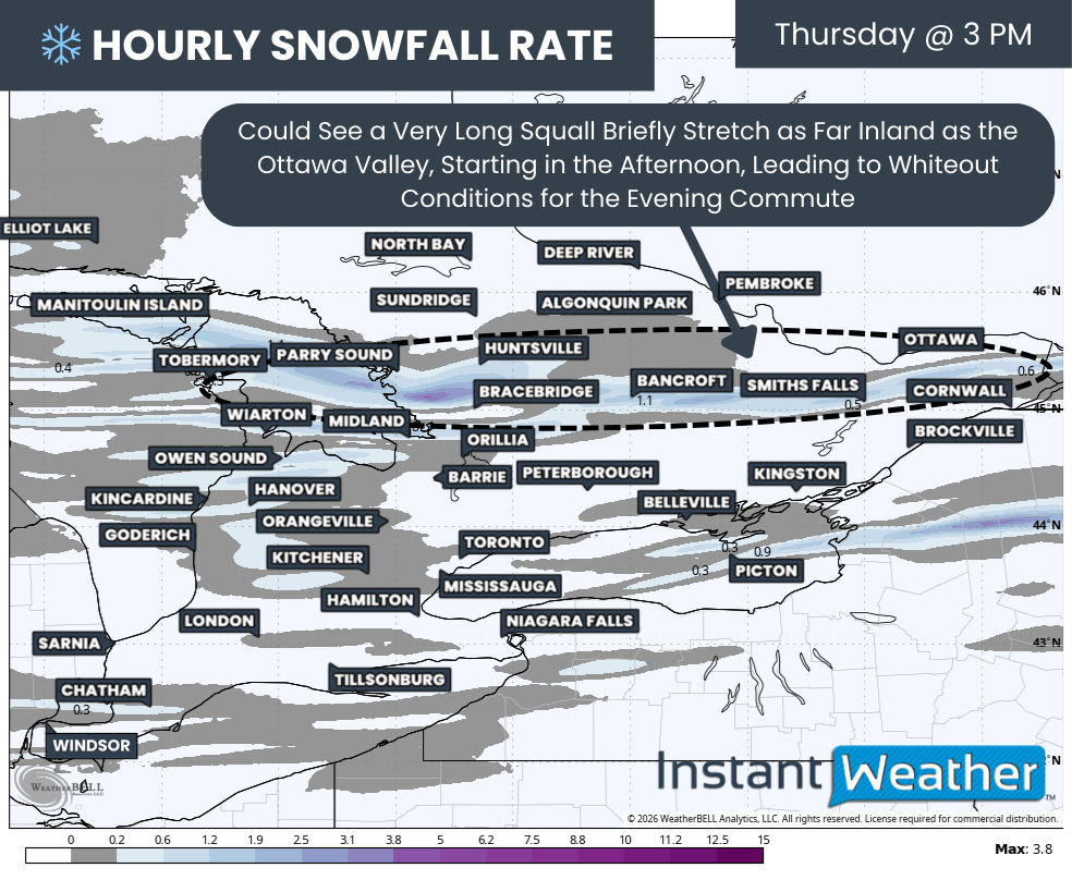
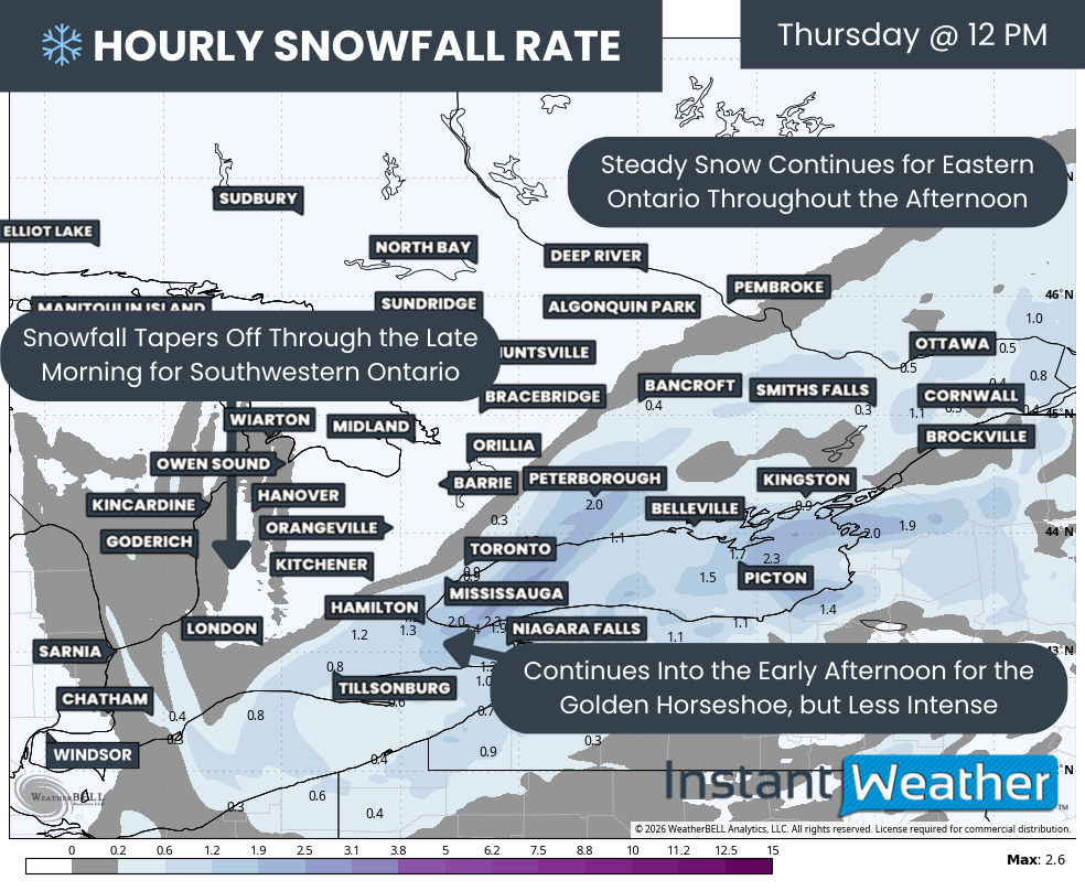
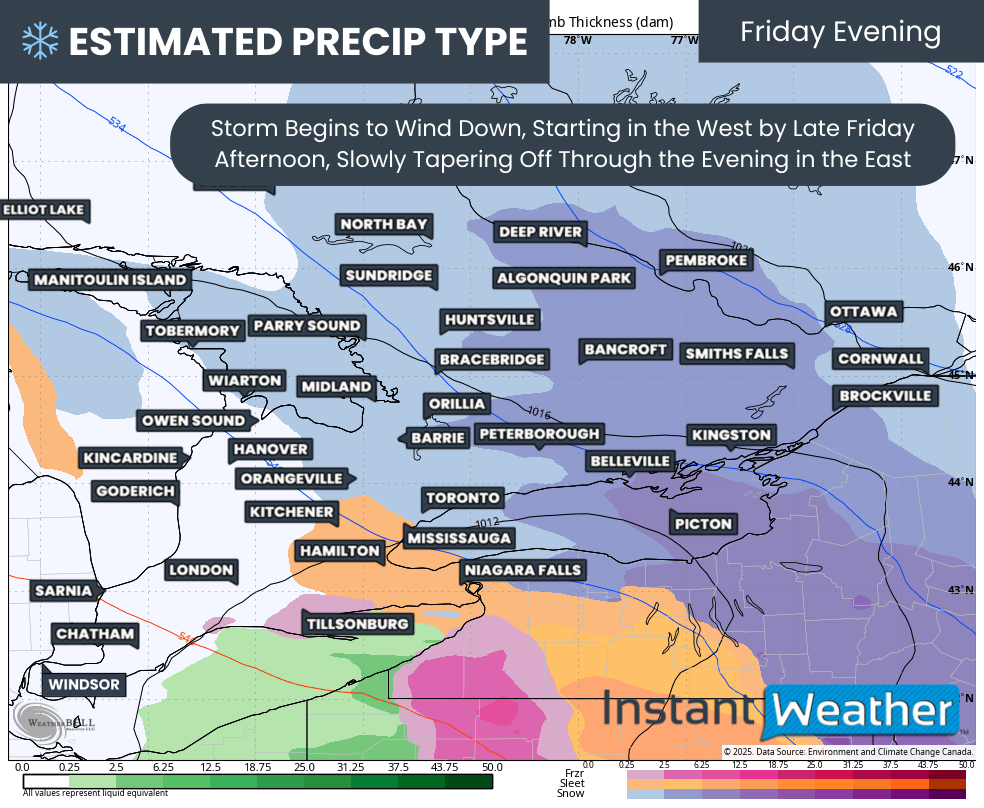
We are expecting all of the snow to taper off by early Tuesday afternoon as the main system moves out of Eastern Ontario. Winds will also begin to lighten, shutting off any lingering lake effect activity from Lake Huron and Georgian Bay.
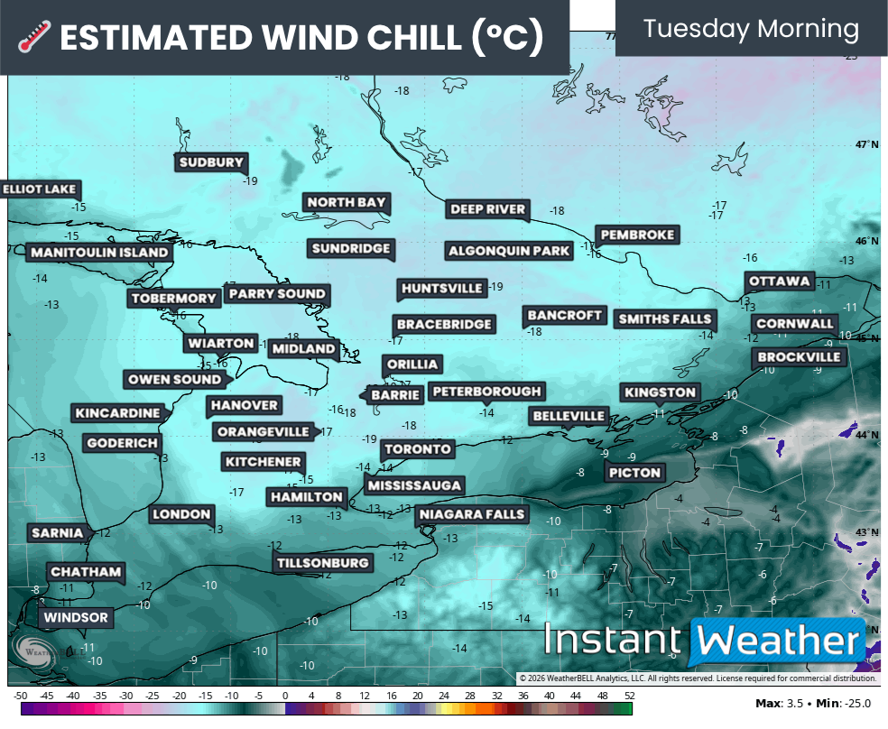
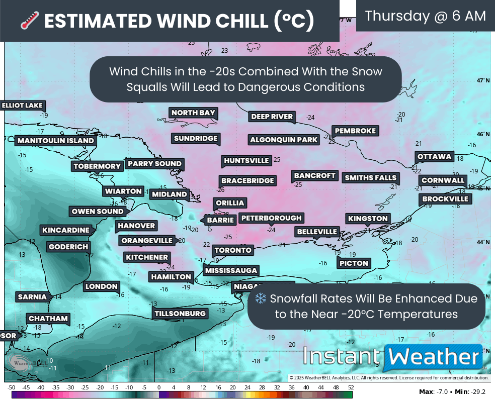
Wind chill - MAP FROM WEATHERBELL
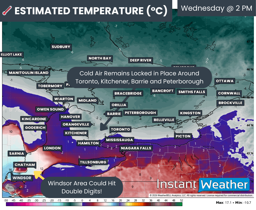
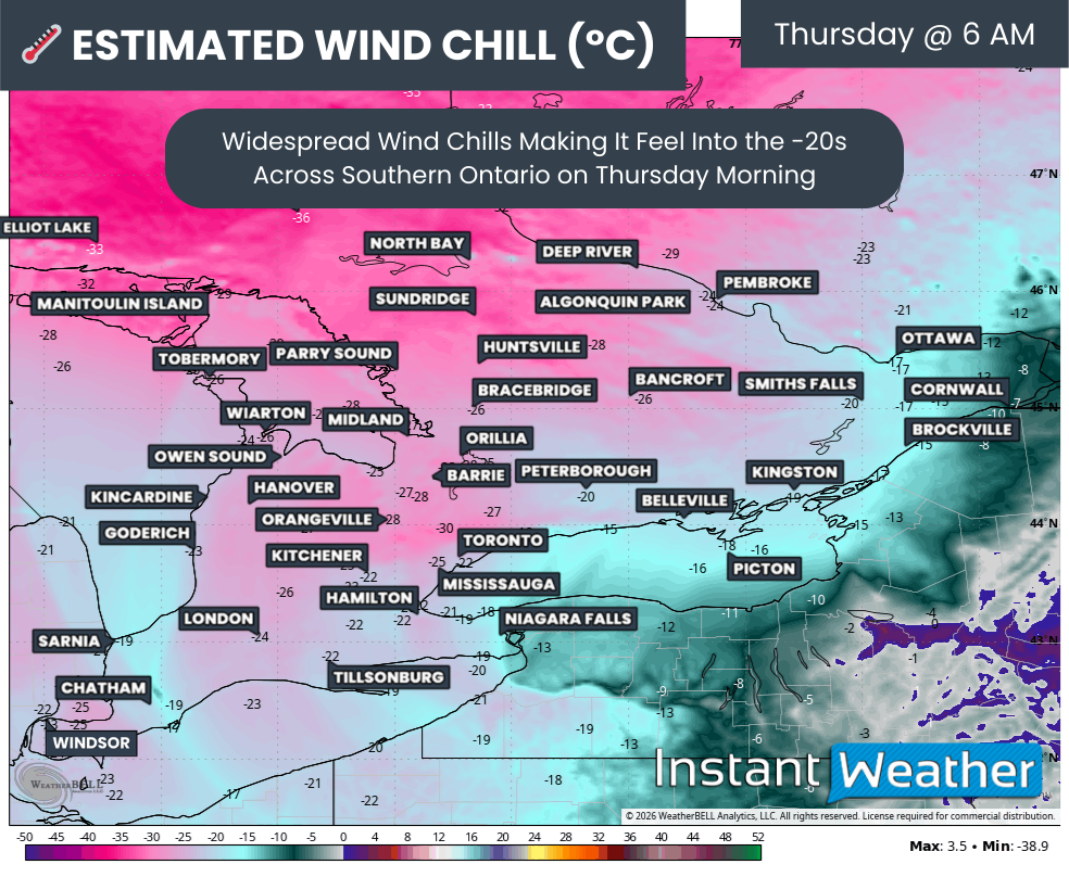
Even if you don’t see accumulating snow, you will still get a taste of Southern Ontario’s third winter over the next few days in the form of bitterly cold temperatures.
It will pale in comparison to the cold we dealt with earlier this year, but it may feel more brutal after many areas hit 20°C just a few days ago. Now, we’re looking at temperatures between -5°C and -10°C to start the day on Tuesday. Factoring in the wind chill, many areas will feel into the negative double digits, with parts of Central and Northeastern Ontario ranging from -15°C to -20°C Tuesday morning.
Thankfully, temperatures are expected to quickly improve by Wednesday and Thursday. Daytime highs will inch back above the freezing mark and could even reach double digits by the end of the week in some areas.

NOTE: YOU CAN CLICK ON THE MAP TO OPEN A ZOOMABLE IMAGE

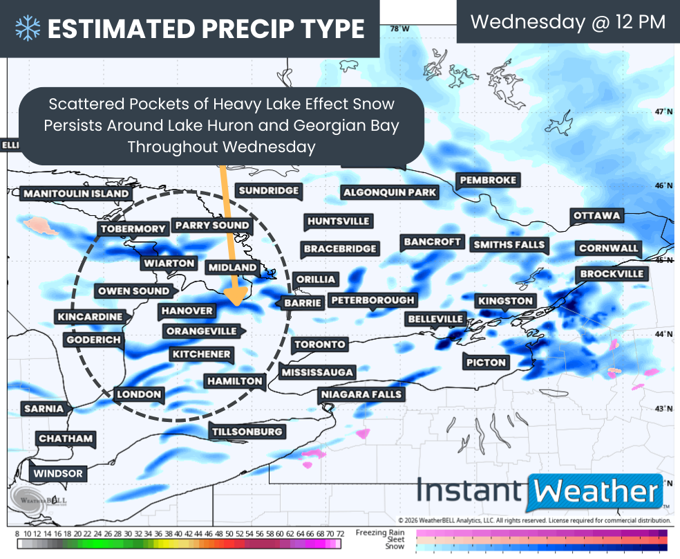
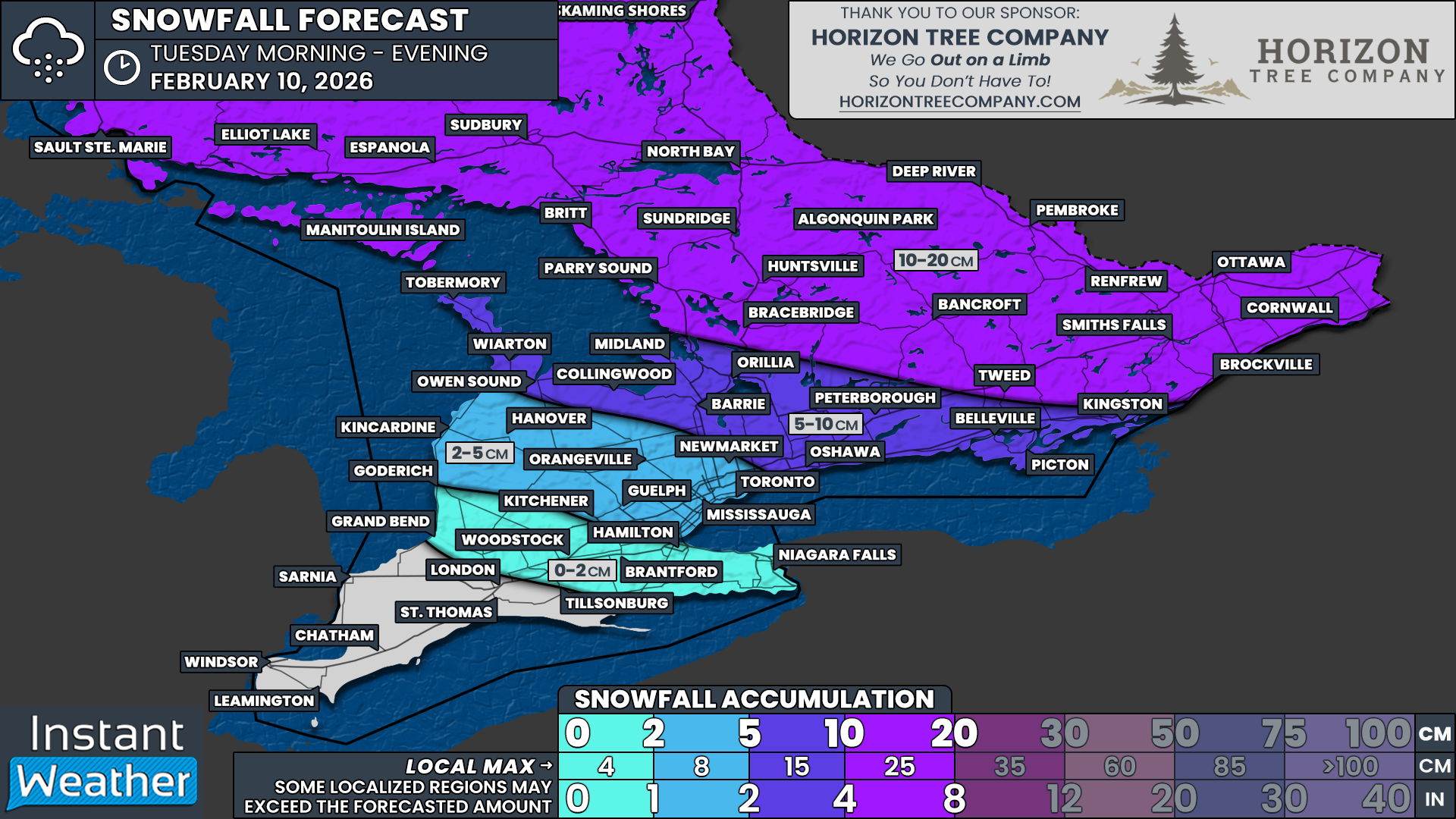
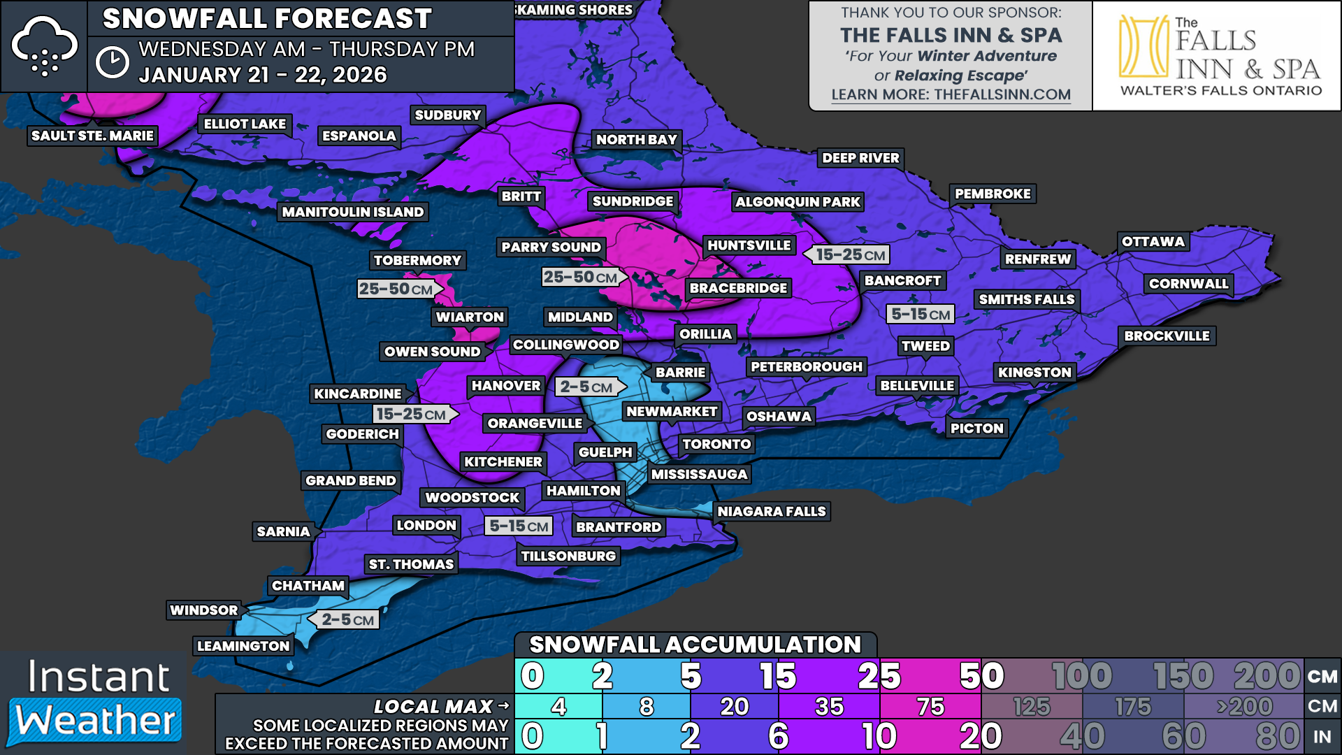
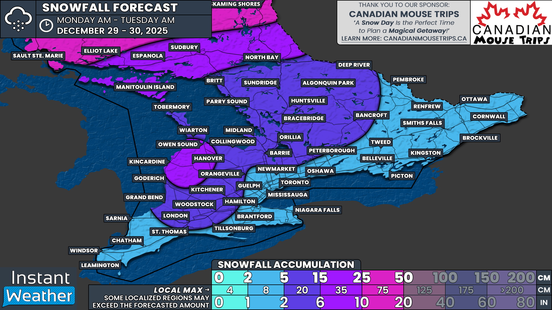
As mentioned, this event will feature significant variation in snowfall totals across the region, making it difficult to pinpoint exact amounts. This is due to both the scattered nature of the snow and temperatures hovering near freezing, along with ground warmth from the recent mild weather. That means not everyone will see accumulating snow, even within the highest forecast zone.
The zone of highest accumulation is expected to include much of Central Ontario extending into Eastern Ontario south of the Ottawa Valley. This includes Kingston, Belleville, Peterborough, Bancroft, Orillia, Bracebridge, Huntsville, Algonquin Park, Parry Sound, Sudbury and Elliot Lake. These areas could see general totals of 5 to 10 cm, with localized pockets potentially exceeding that up to 15 cm. Not everyone within this zone is guaranteed to see 5 cm, as local temperatures will determine how much of the snow is able to stick.
A few centimetres of snow are expected around the Lake Huron and Southern Georgian Bay shoreline, including Grand Bend, Goderich, Kincardine, Owen Sound, Hanover, Collingwood and Barrie. Around 2 to 5 cm is possible here, but due to the nature of lake effect snow, some localized areas could see up to 8 cm, while others may get completely missed.
A trace to a light dusting of snow is expected for Deep Southwestern Ontario into the Golden Horseshoe, along with the Ottawa Valley. Much of this is unlikely to stick to the ground.
No matter how much snow you receive, it will almost certainly be gone within 24 hours thanks to temperatures rising above freezing by Wednesday. That means you likely won’t need to bring those shovels back out of storage.