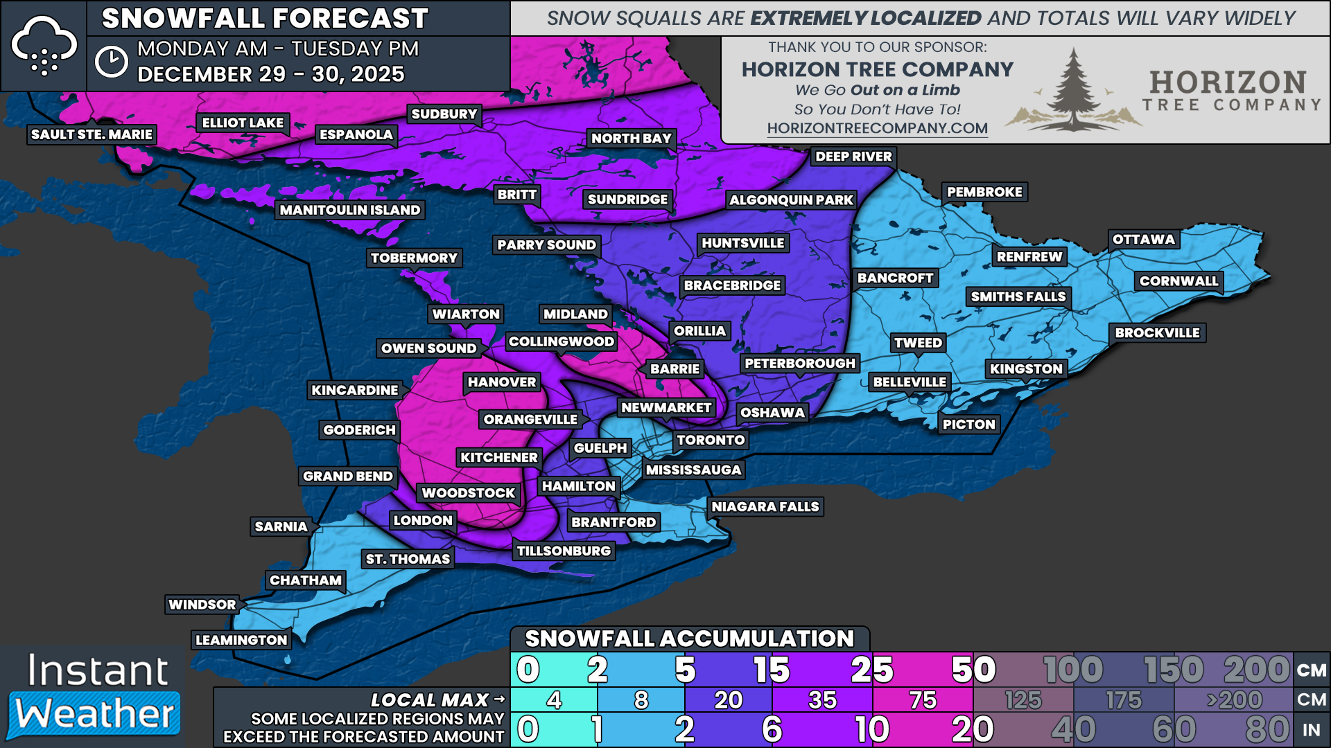
Winter Roars Back Across Southern Ontario Tuesday With Up to 30 cm of Snow and -20°C Wind Chills
/
Interested in sponsoring a forecast? Apply Here
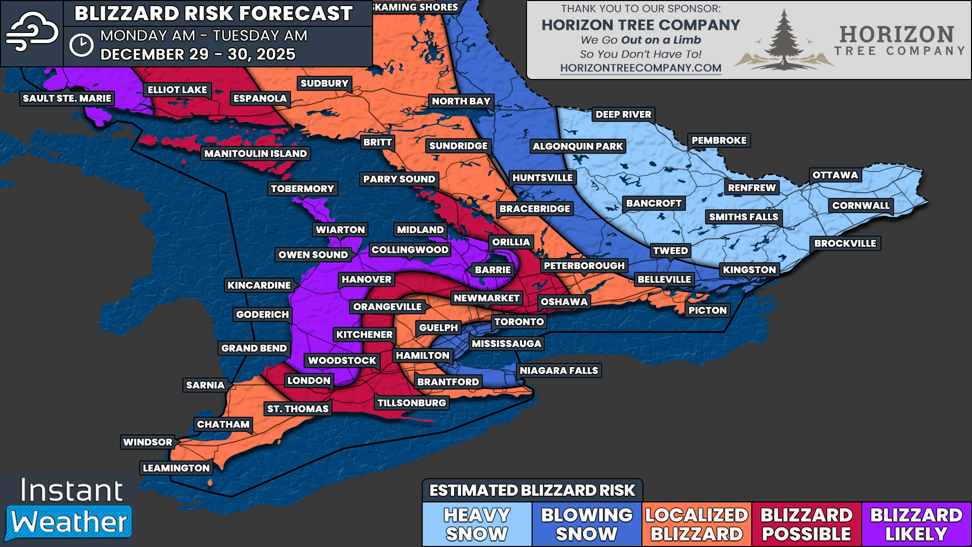
NOTE: YOU CAN CLICK ON THE MAP TO OPEN A ZOOMABLE IMAGE
It sure may have felt like winter was behind us for the first half of March, but the second half of the month will serve as a snowy and chilly reminder of what Mother Nature is still capable of across Ontario.
We certainly saw that over the past 24 hours in Northern Ontario, where some communities were buried under more than 50 cm of snow from a late-season winter storm. And over the next 24 hours, Southern Ontario will join them in sharing some of that snowy misery.
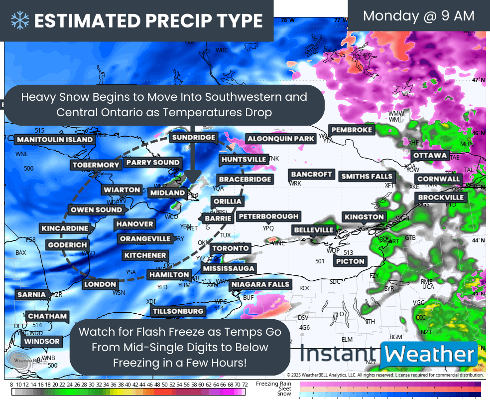
The system that brought the heavy snow to Northern Ontario has now begun to move out over Quebec. As it exits the region, it is set to usher in a blast of cold air late Monday evening into the overnight hours. That includes the return of a familiar word, snow squalls.
Moisture from a separate system tracking along the northeastern United States is expected to push into Eastern Ontario and areas around Lake Ontario starting Monday evening. With temperatures dropping quickly behind the departing system, that precipitation is likely to fall in the form of heavy snow.
That snow could become quite intense at times across Central and Eastern Ontario, with snowfall rates of 3 to 5 cm per hour in the heaviest pockets. While it should taper off by the early morning hours on Tuesday, just a few hours of that intensity could be enough to bring 10 to 20 cm by Tuesday morning in some communities.
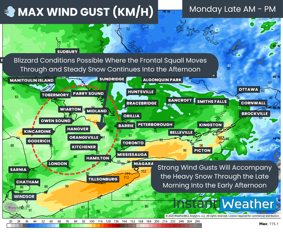
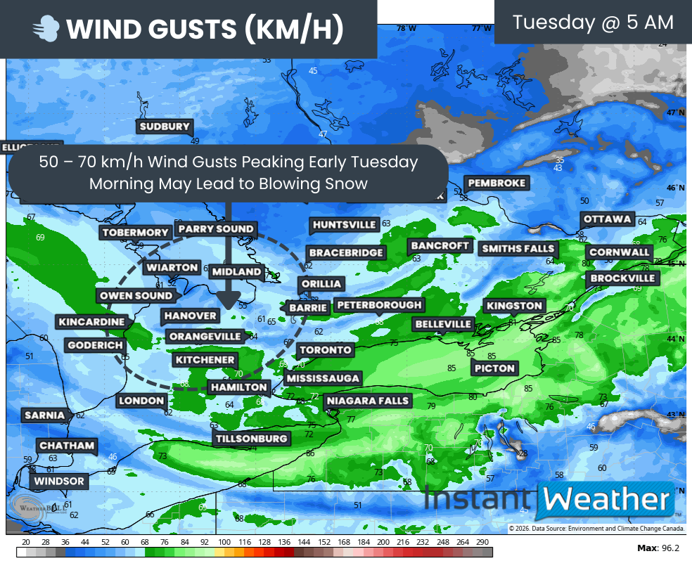
Further west, plunging temperatures will combine with the now partially ice-free waters of Lake Huron and Georgian Bay to bring a brief resurgence of snow squall activity. While it will not last all day, these squalls could bring locally up to 20 to 30 cm of snow before they wrap up by late Tuesday afternoon. Wind gusts peaking Tuesday morning up to 50 to 70 km/h are likely to combine with the snow squall activity to produce blowing snow and potentially disruptive travel in the snowbelt areas.
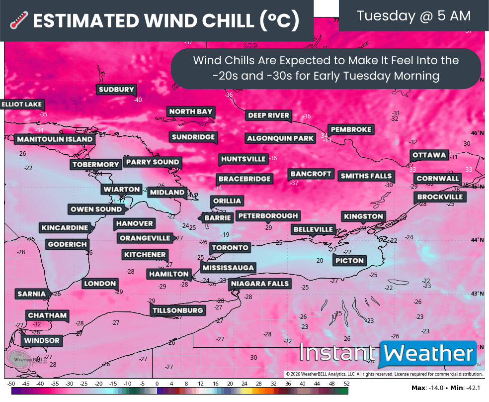
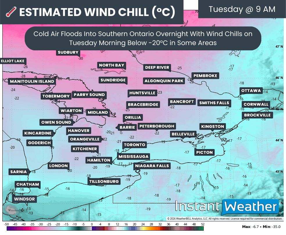
Aside from the snow, Tuesday will start off on a very chilly note with wind chills dropping below -20°C in some areas during the morning hours.
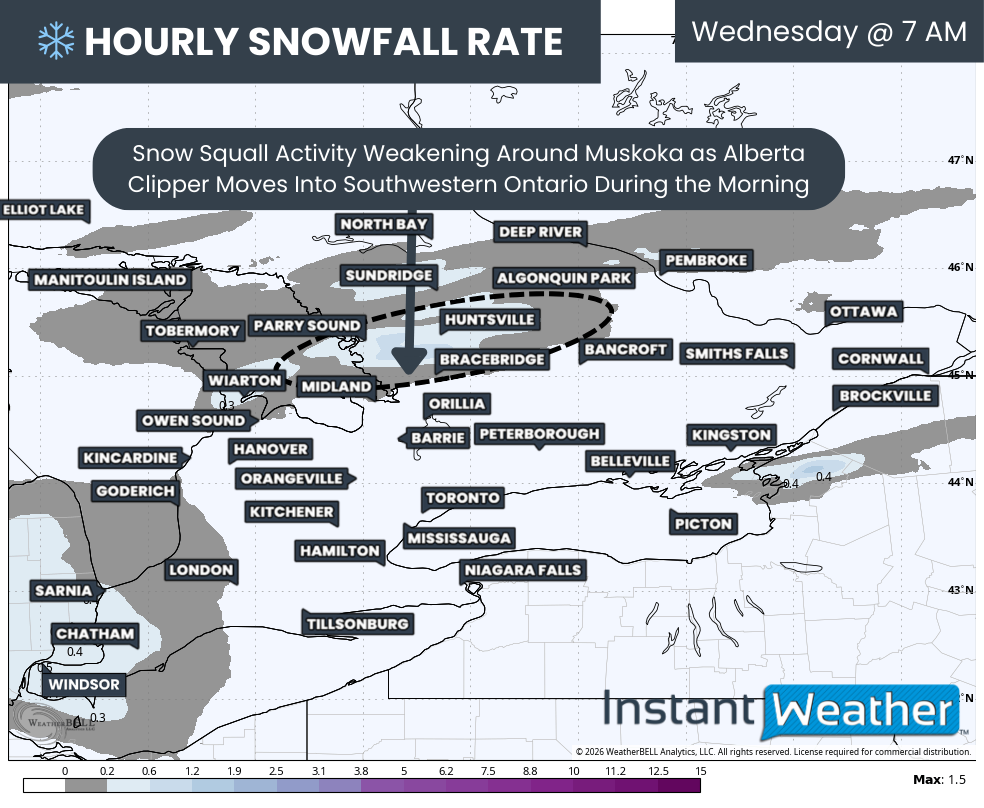
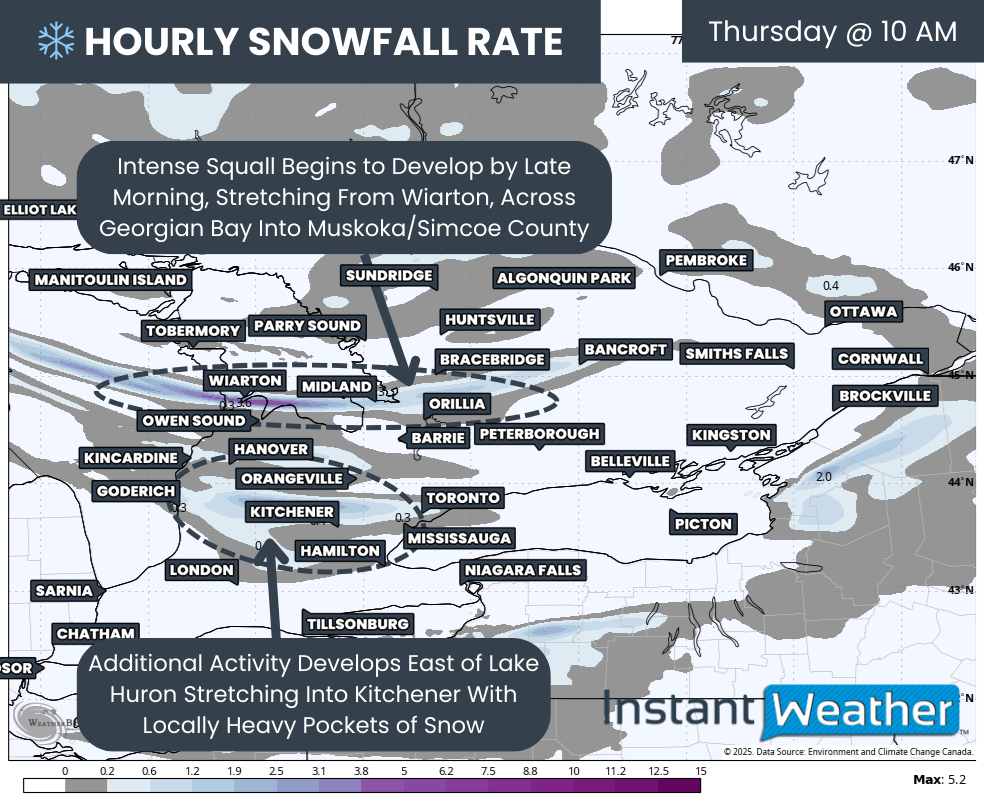
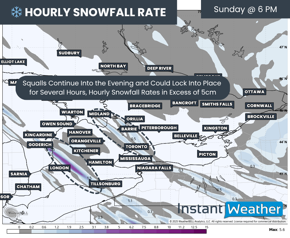
Hourly snowfall rates (cm) - MAP FROM WEATHERBELL
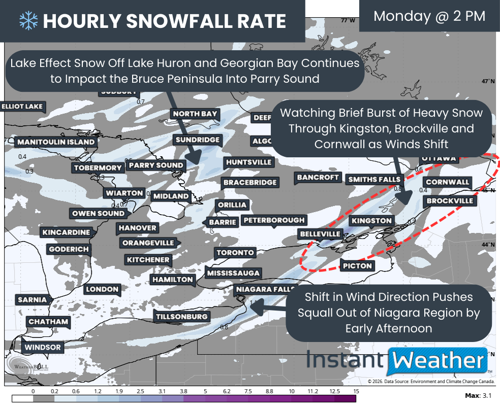
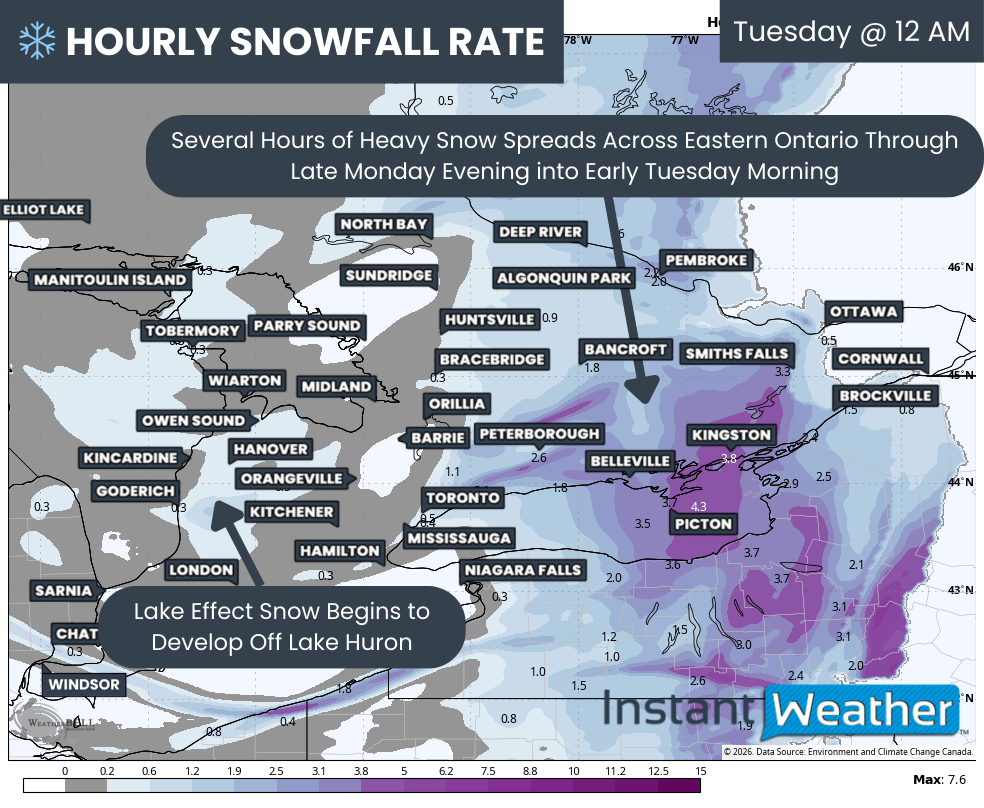
Precipitation has already begun to spread into Eastern Ontario as of early Monday evening and is expected to continue increasing in intensity over the next several hours. The worst conditions are likely to occur around midnight, when snowfall rates could approach 3 to 5 cm per hour, especially between Peterborough and Kingston.
While this will only last for a few hours, that kind of snowfall in such a short timeframe is likely to make travel difficult during the overnight hours as road crews struggle to keep up. The snowfall intensity appears lighter further east around Cornwall and Ottawa, where totals will be more limited.
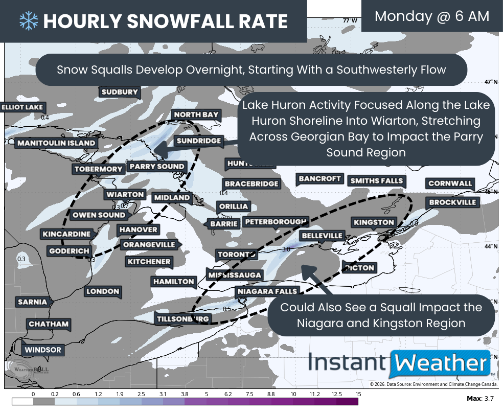
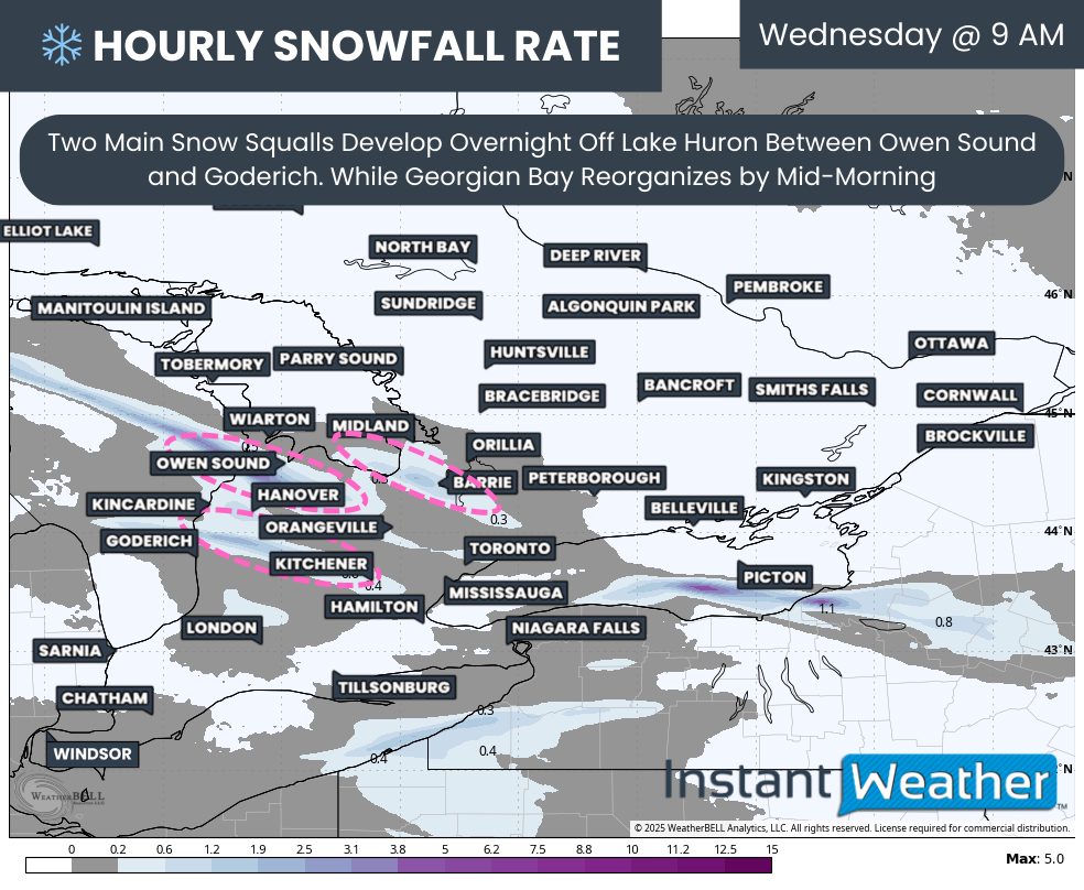
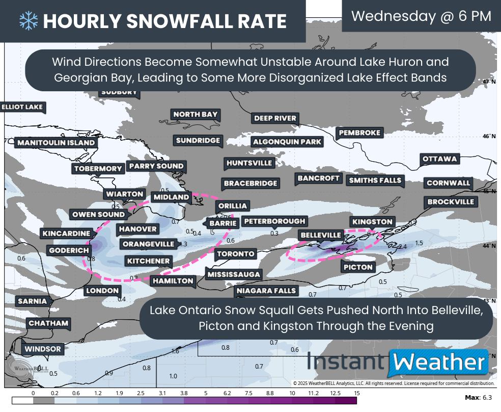
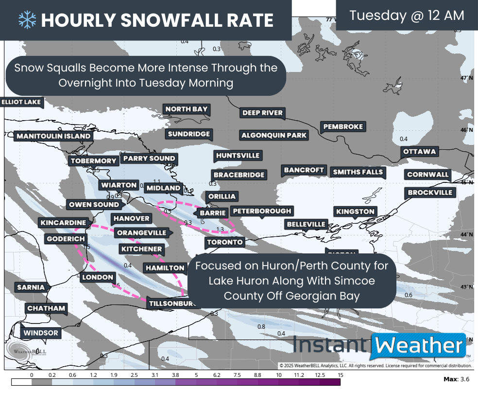
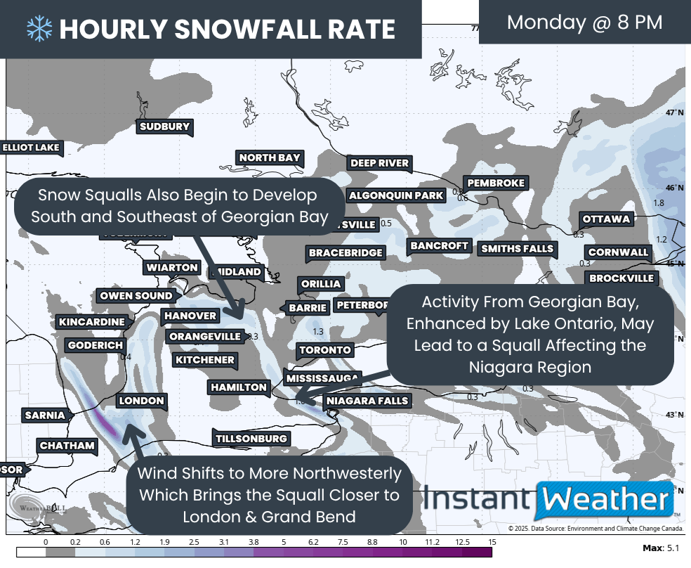
Lake effect activity is also expected to begin organizing, starting with Lake Huron. There is still some uncertainty around the Georgian Bay component. The system affecting Eastern Ontario could track far enough west to influence wind direction off Georgian Bay, which may delay or even limit the onset of snow squalls in that region.
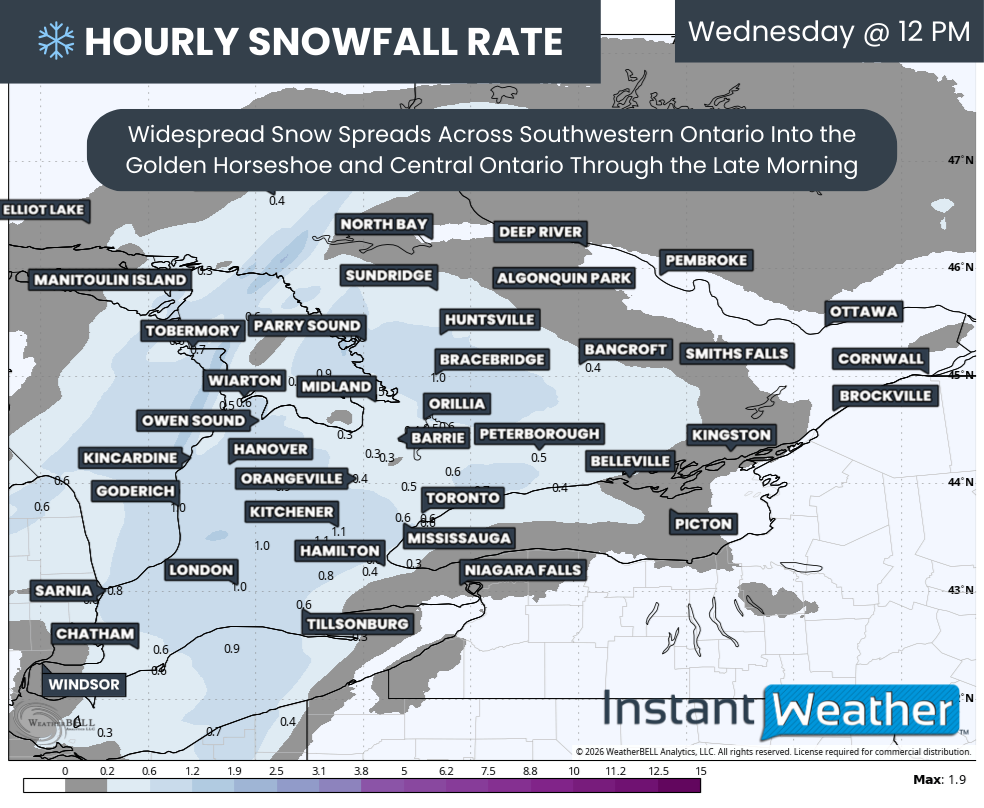
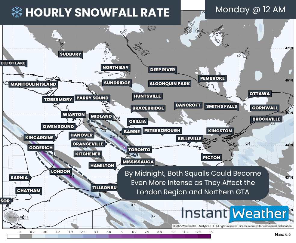
Hourly snowfall rates (cm) - MAP FROM WEATHERBELL
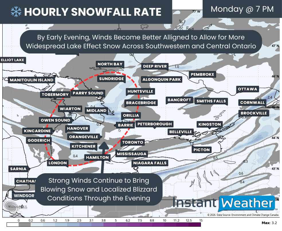
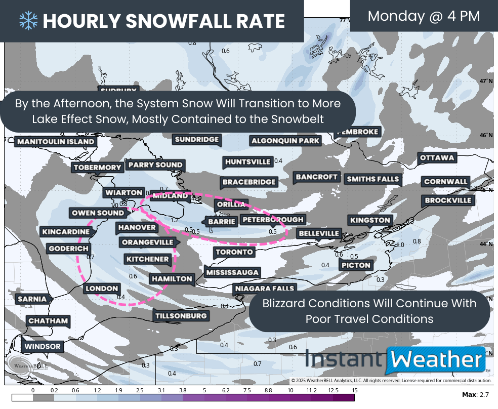
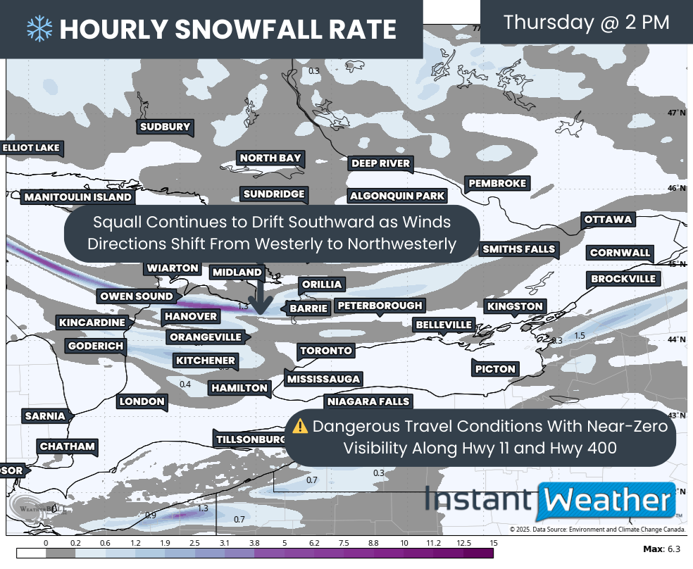
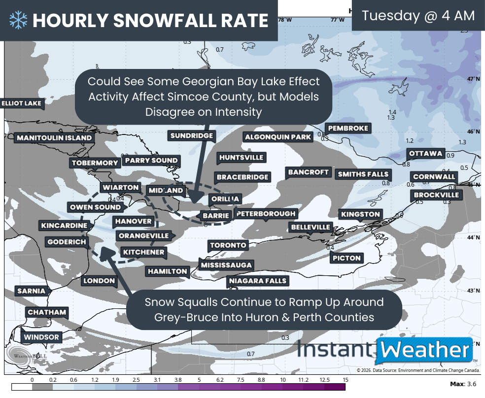
By the early morning hours of Tuesday, Eastern Ontario will see the steady snowfall taper off as it shifts into Quebec.
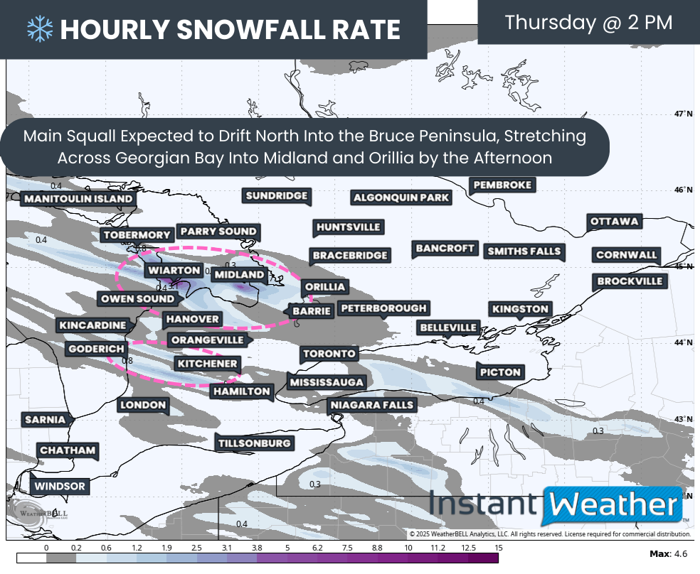
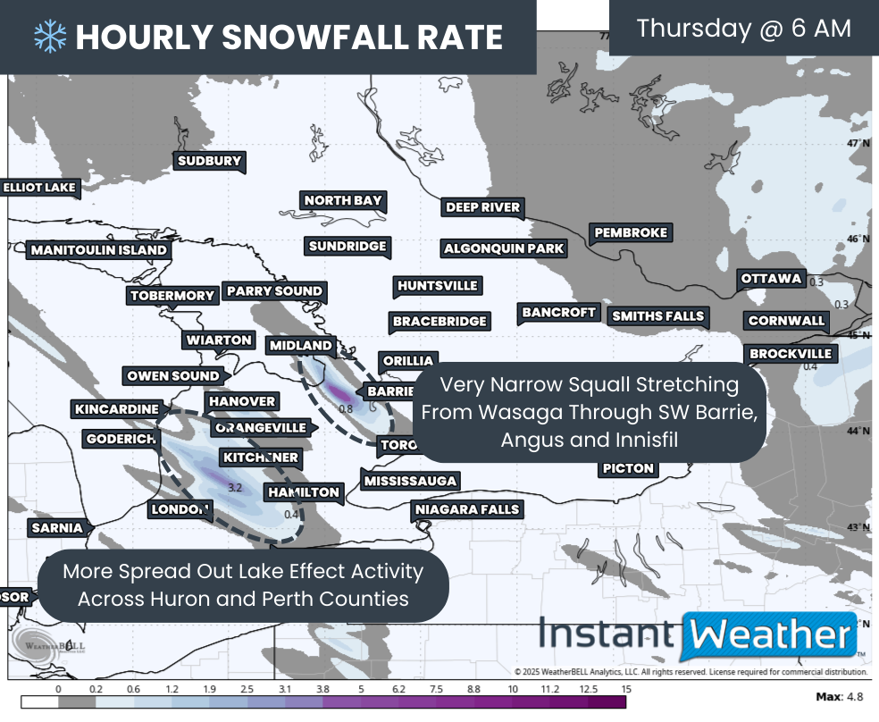
Instead, the focus will turn to strengthening lake effect activity off Lake Huron and Georgian Bay. Again, there is some disagreement on how intense the Georgian Bay squall will become. If it does develop properly, it appears most likely to focus somewhere along the Midland to Orillia corridor.
The Lake Huron activity will initially target Bruce and Grey counties, at times extending into northern Huron and Perth counties, along with portions of Wellington and Dufferin counties.
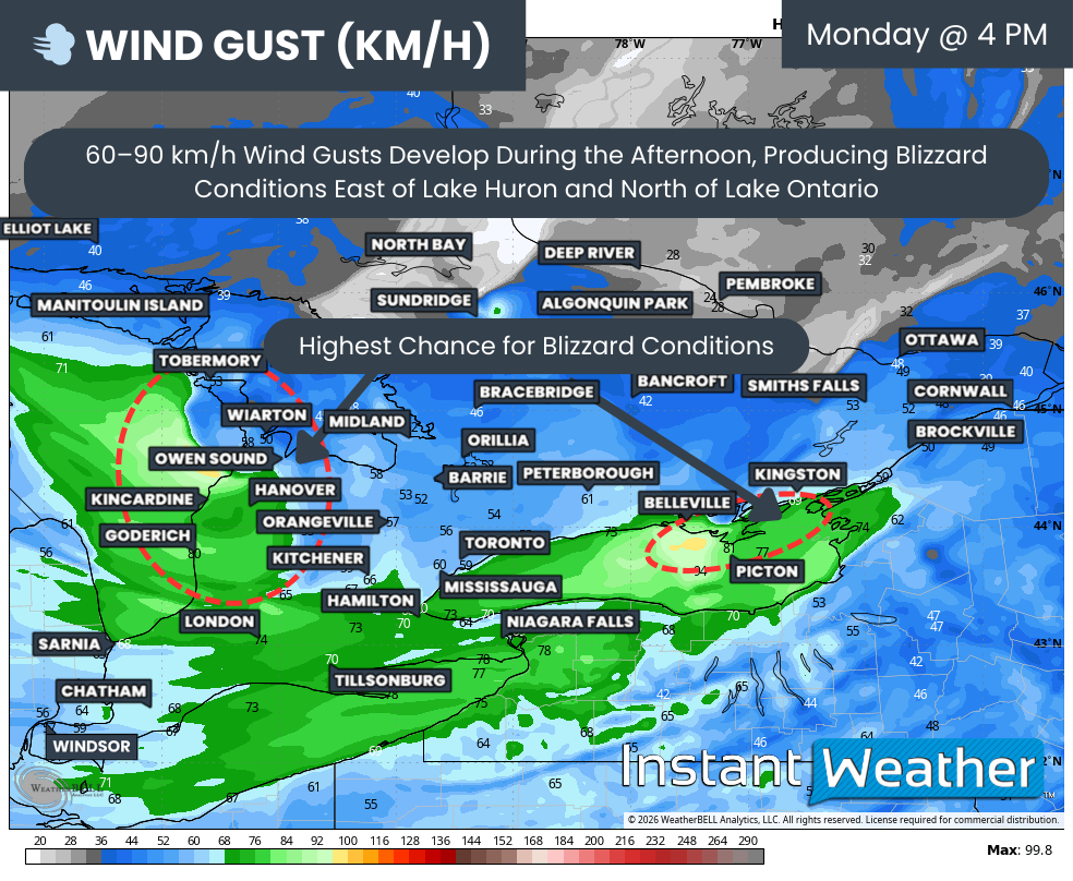
WIND GUSTS - MAP FROM WEATHERBELL
Another major concern is that this lake effect activity will be accompanied by gusts approaching 50 to 70 km/h at times, especially near the shoreline and in flat, exposed areas. That can lead to significant reductions in visibility due to blowing snow and may even briefly meet blizzard criteria in some areas east of Lake Huron.
It is very likely that the usual roads vulnerable to blowing snow across Grey Bruce, Huron and Perth counties may need to be shut down for a period of time on Tuesday. Expect significant delays and consider avoiding travel if possible, especially during the morning and early afternoon.
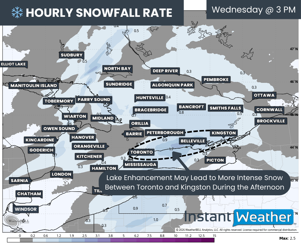
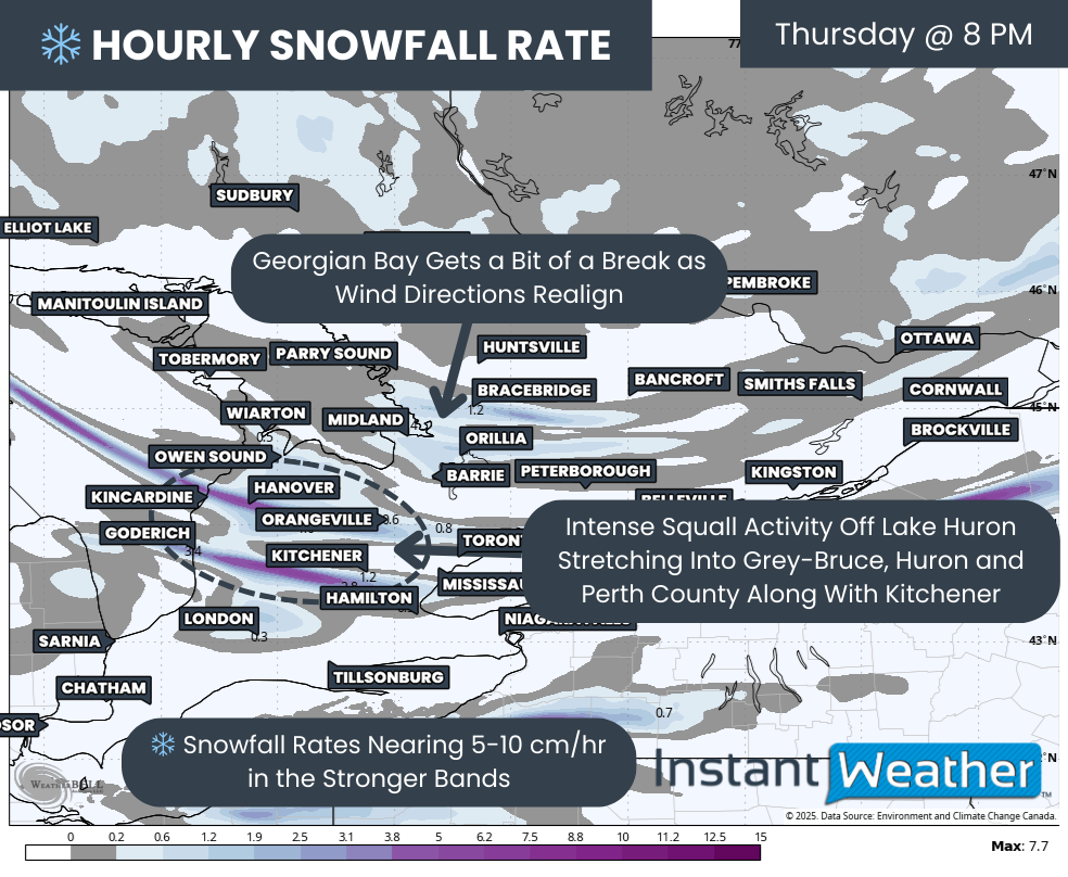
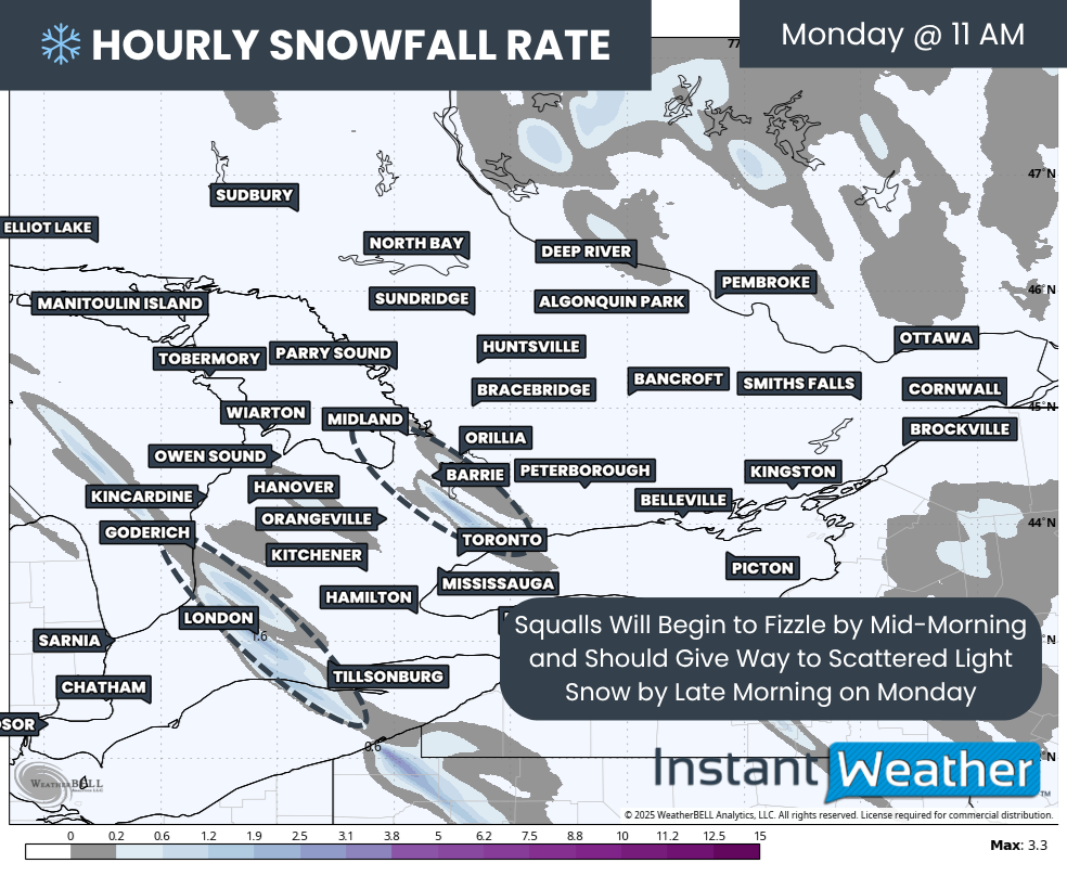
Hourly snowfall rates (cm) - MAP FROM WEATHERBELL
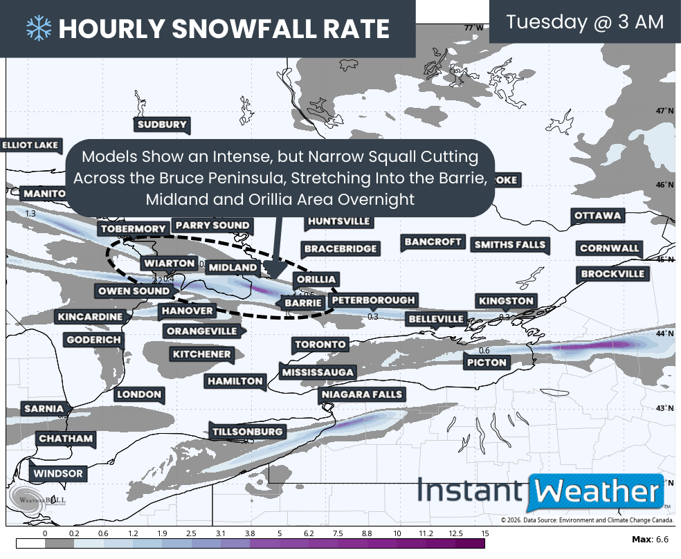
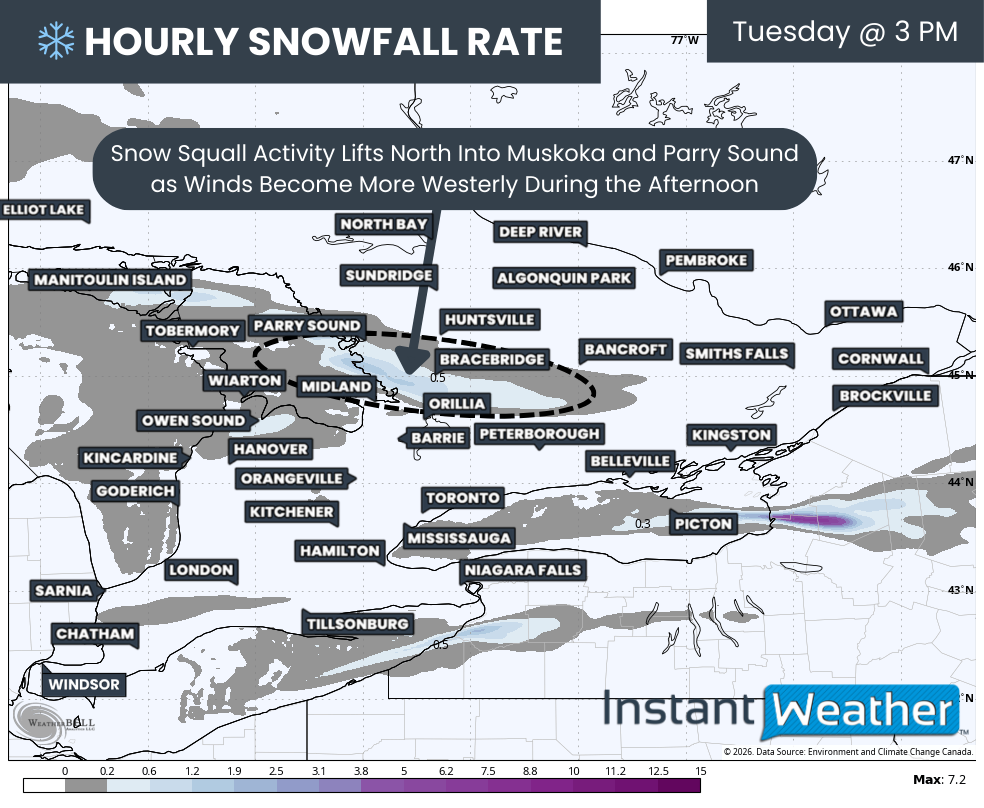
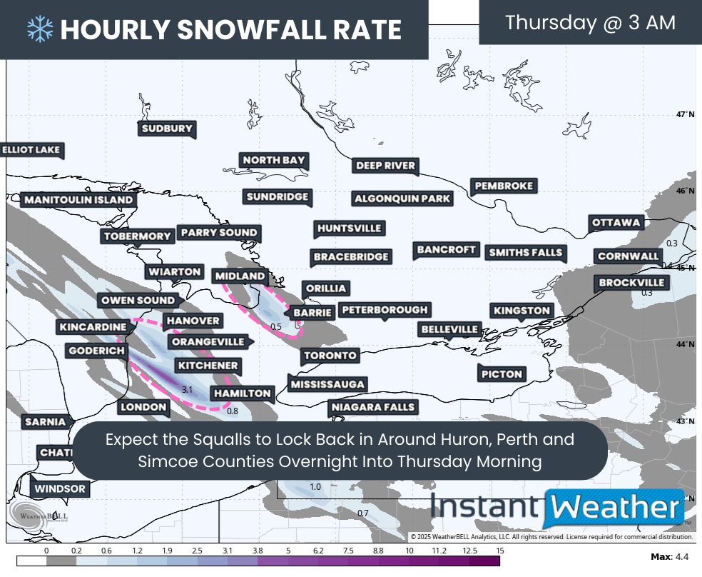
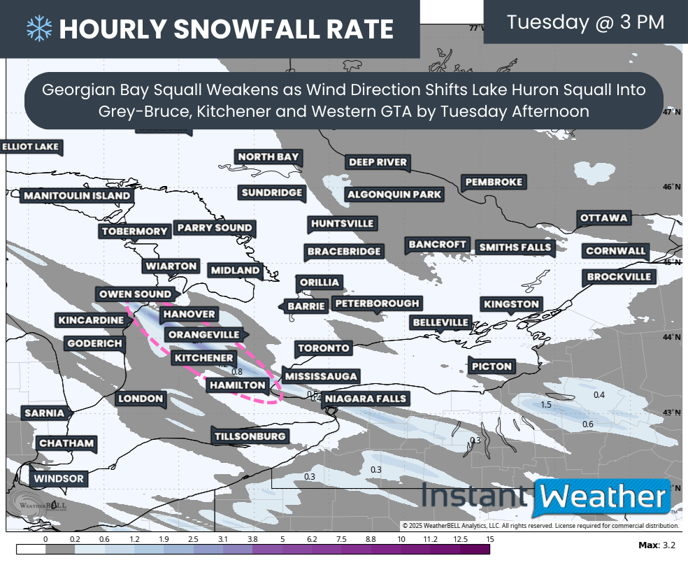
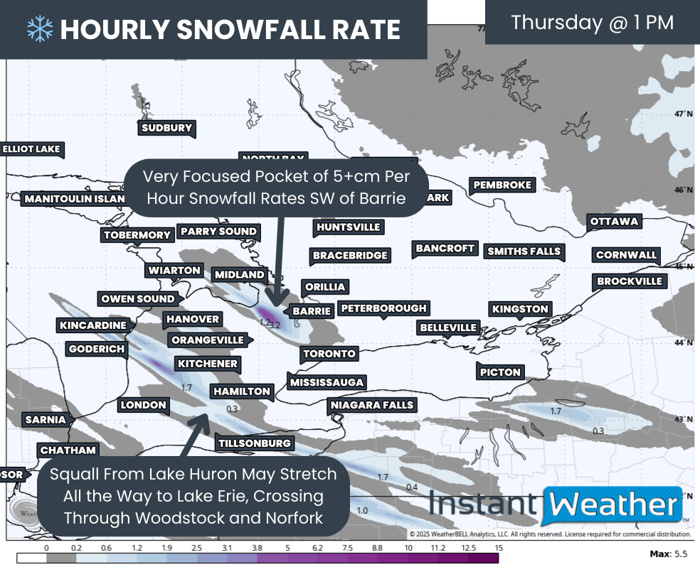
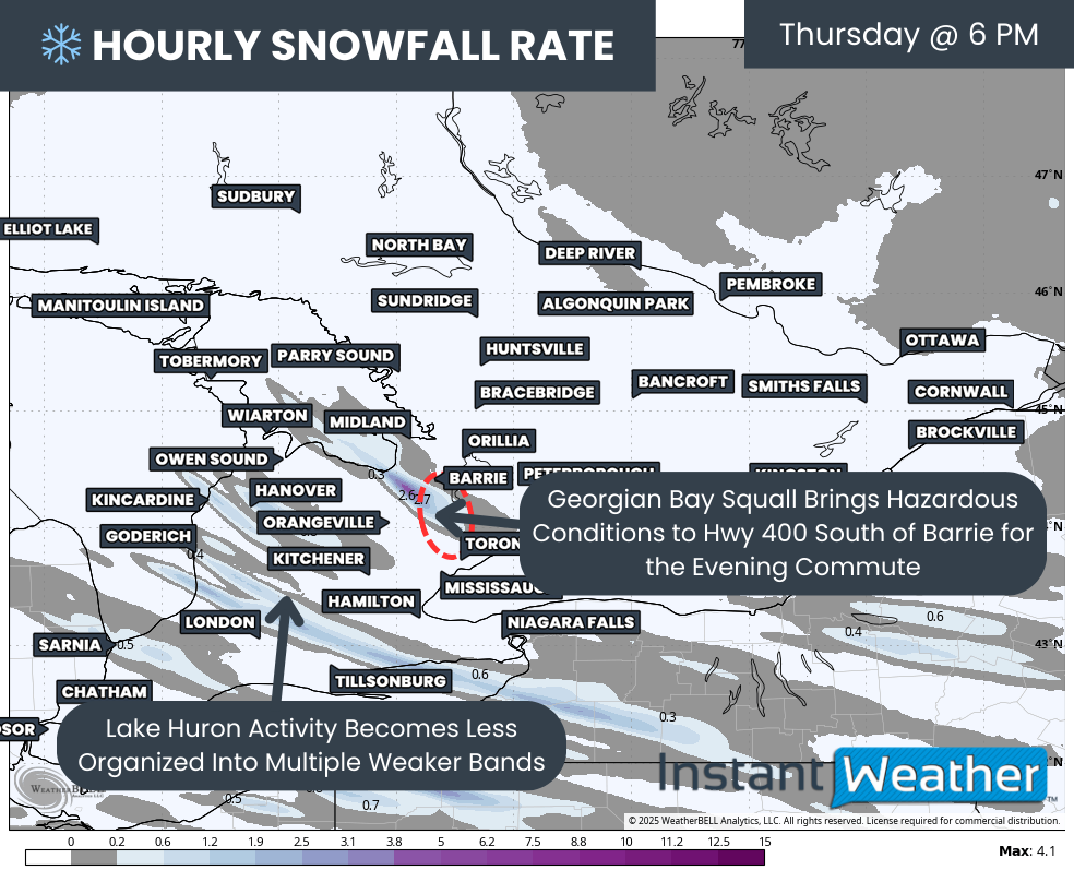
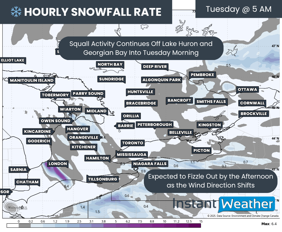
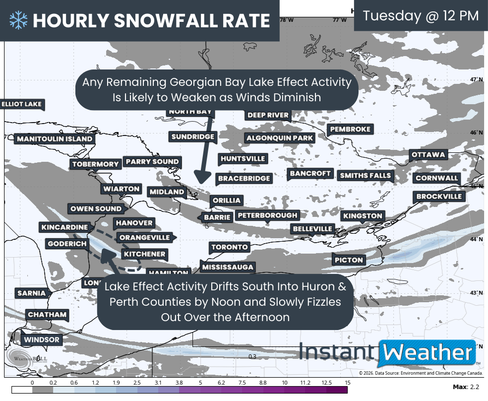
Heading into Tuesday afternoon, the winds fueling the lake effect activity are expected to gradually diminish, starting with Georgian Bay. That will likely allow any activity off Georgian Bay to slowly fizzle out by early afternoon.
For Lake Huron, the activity is likely to drift south of Grey Bruce and focus more on portions of Huron and Perth counties. It may persist for several hours through the afternoon before weakening closer to the dinner hour.
Wind Chill - MAP FROM WEATHERBELL
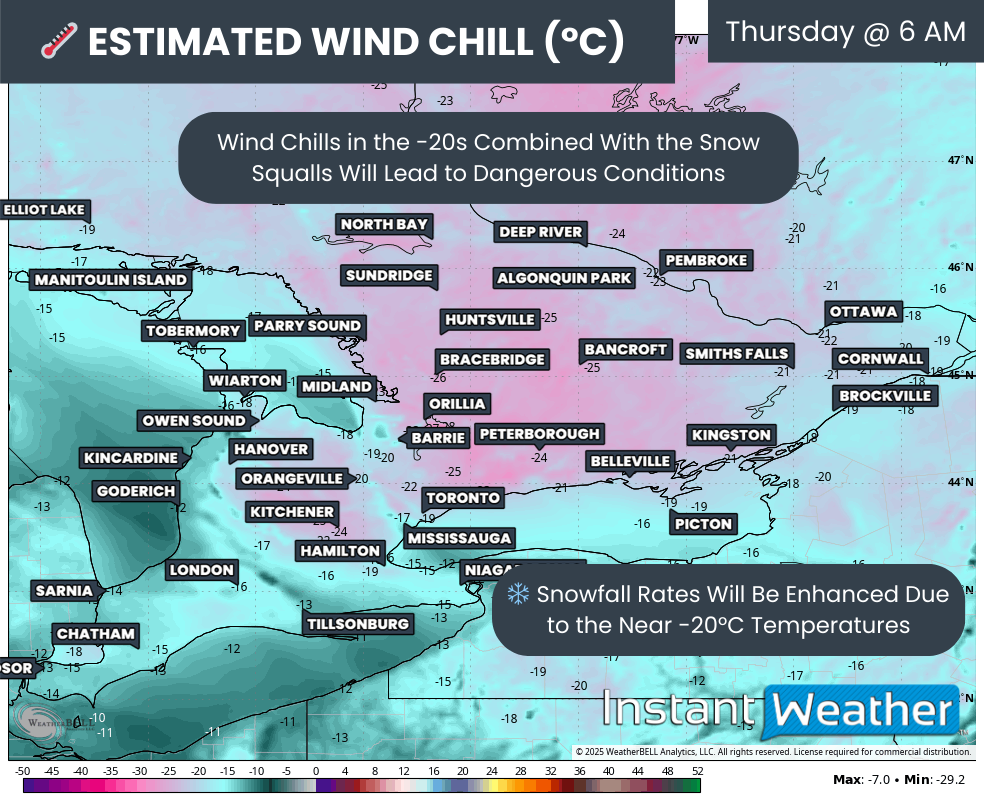
If the snowfall is not enough to set the winter mood, it will certainly feel like it as a surge of Arctic air settles over Southern Ontario overnight into Tuesday.
Many areas are expected to drop below -10°C by Tuesday morning. With the wind chill, it could feel closer to -25°C in some locations, especially east of Lake Huron into Central Ontario and parts of Northeastern Ontario.
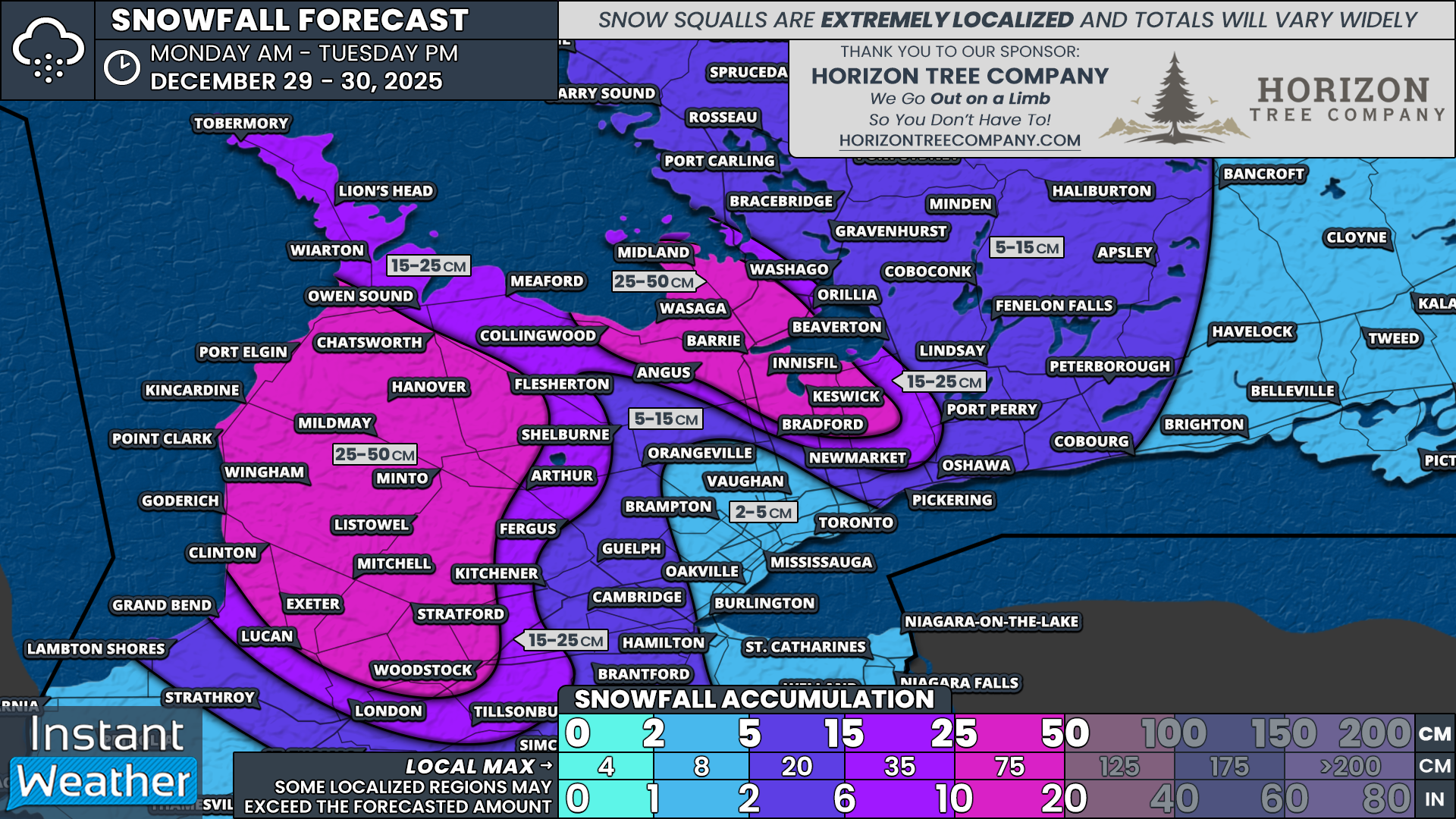
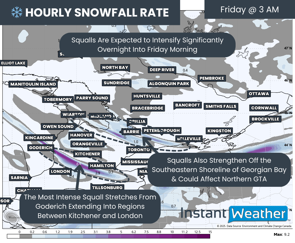
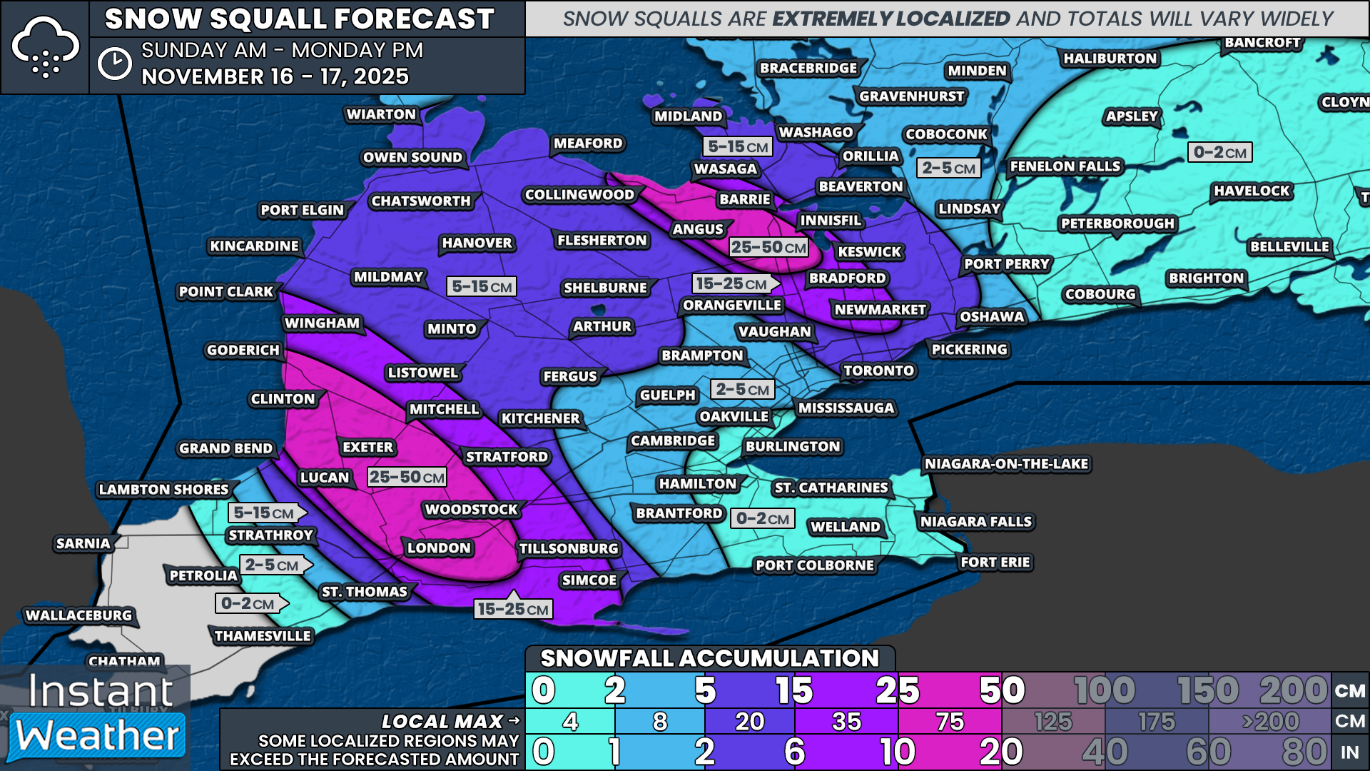
NOTE: YOU CAN CLICK ON THE MAP TO OPEN A ZOOMABLE IMAGE

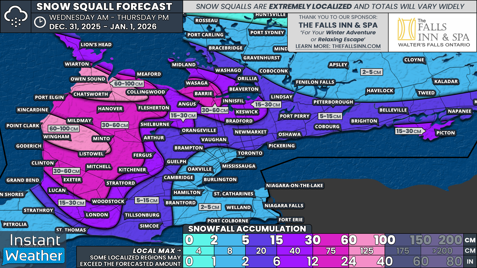
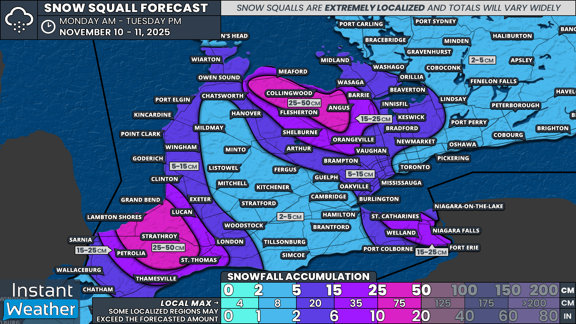
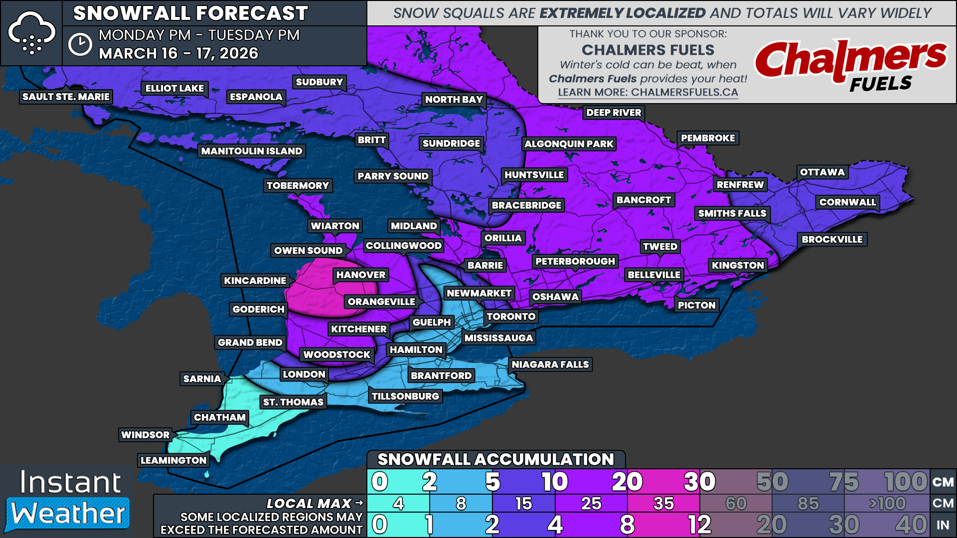
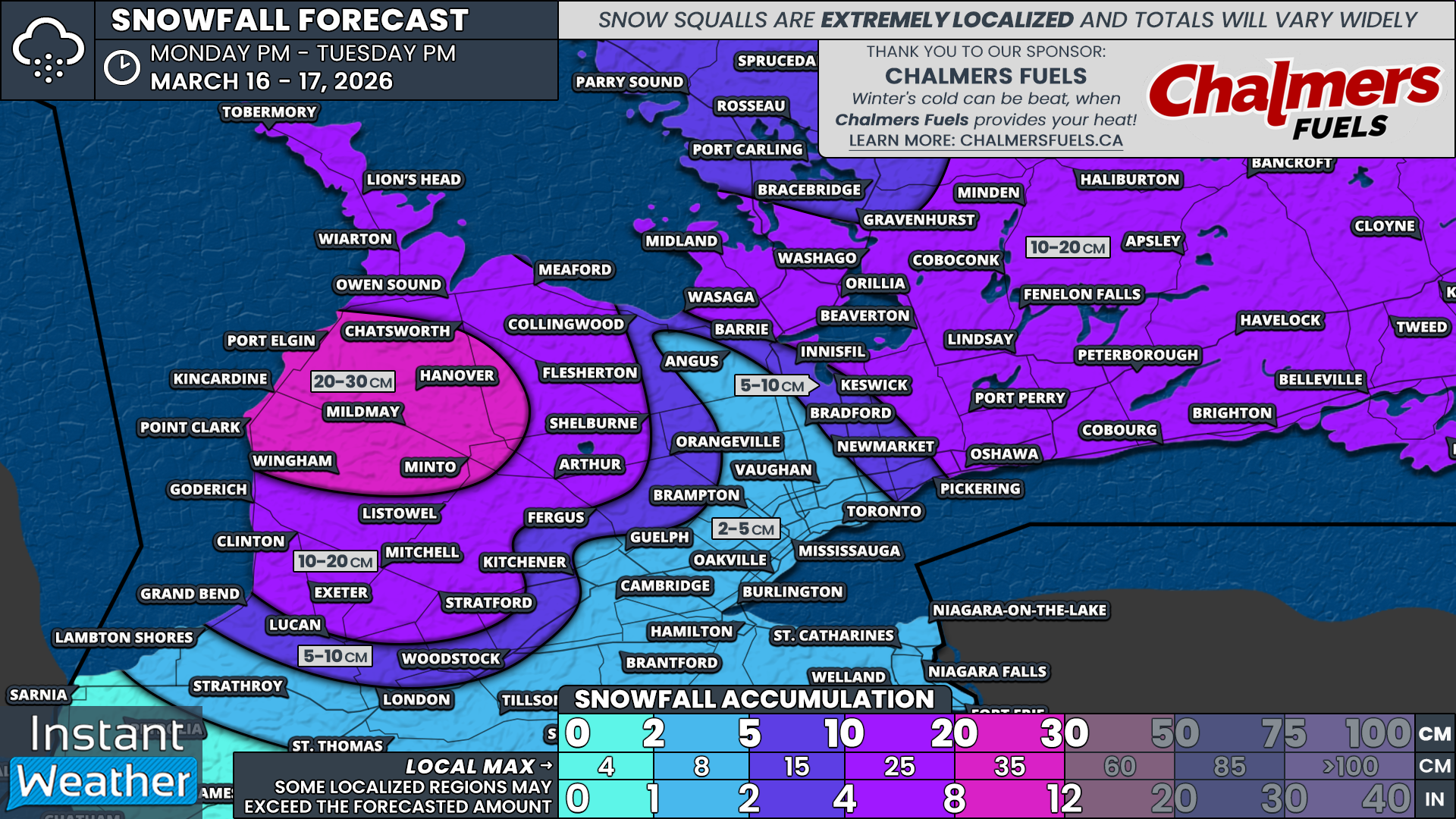
As is usually the case with lake effect snow, it can be very difficult to pinpoint the hardest hit regions. These snow bands can be narrow and highly localized, meaning one community could see significant accumulation while another just down the road sees very little.
With that in mind, the heaviest snowfall totals are most likely somewhere in the Port Elgin, Hanover, Minto, Mildmay, Kincardine, Point Clark and Wingham zones. We are forecasting 20 to 30 cm in this corridor, but there is a chance that localized areas could see as much as 35 to 40 cm if a band locks in place for several hours.
Surrounding areas, including Goderich, Clinton, Exeter, Mitchell, Stratford, Listowel, Arthur, Flesherton, Meaford, Chatsworth, Owen Sound, Wiarton and Lion’s Head could see around 10 to 20 cm. Some of these communities may fall short of that depending on how far inland the lake effect bands extend and how long they persist.
For the Georgian Bay squall, we are forecasting 10 to 20 cm for Midland, Orillia and Washago. Barrie sits right on the line and could go either way. If 10 cm or more falls in Barrie, it would most likely be in the north end, with lesser amounts toward the south. Should the Georgian Bay activity exceed expectations and organize more than current guidance suggests, localized pockets of 25 to 30 cm cannot be completely ruled out. However, it could just as easily struggle to reach 10 cm.
In Eastern Ontario, the system is expected to deliver a general 10 to 15 cm in locations including Peterborough, Belleville, Kingston, Bancroft, Deep River, Renfrew and Pembroke. Some areas, especially north of Lake Ontario between Peterborough and Kingston, may pick up closer to 20 cm where the heaviest snowfall rates set up overnight.
Less than 10 cm is expected for Ottawa, Cornwall and Brockville as these areas are likely to see lighter and less intense snowfall from this system. The same applies to Muskoka and Parry Sound, where 5 to 10 cm is possible.
Lower amounts are expected in the Greater Toronto Area, extending into Hamilton and the Niagara region. Around 2 to 5 cm of snow is expected, mainly during the evening on Monday.
Less than 2 cm is expected for Deep Southwestern Ontario, including Windsor, Chatham and Sarnia, where this system will have very limited impact.