Severe Thunderstorms Possible in Southern Alberta & Southwestern Saskatchewan Thursday, Along with Risk of Funnel Clouds
/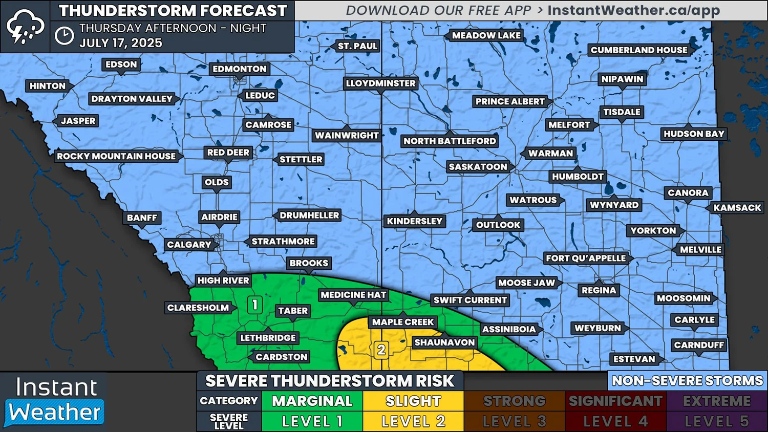
NOTE: YOU CAN CLICK ON THE MAP TO OPEN A ZOOMABLE IMAGE
Despite some cooler temperatures still sticking around, severe thunderstorms are likely today in Southern Alberta and into Southwestern Saskatchewan.
Thunderstorms have already been making their way through parts of Southern Alberta this morning and for the most part, they’ve been fairly weak. As we progress into the afternoon, some of these storms could strengthen to severe levels as they continue tracking east-southeastward. Additional thunderstorm development is also expected to occur closer to the US border through the afternoon, which will also probably become severe. The thunderstorms will track into Southwestern Saskatchewan later in the afternoon and will continue until the late evening hours, at which time they will move south of the border.
The area with the greatest risk of severe weather today will be in deep Southeastern Alberta and Southwestern Saskatchewan, as shown in yellow on the forecast map. In this region, storms could produce strong wind gusts and Timbit-sized hail. These threats also also possible throughout the rest of Southern Alberta and Southwestern Saskatchewan, shown in green, but the risk is slightly lower.

The dashed line outlines the funnel cloud risk from environment Canada
There is also the chance for funnel clouds to form today to the north of where the severe thunderstorms are expected. This will be in the area from Calgary and Olds, eastward through Drumheller and Hanna, and just crossing into Saskatchewan to include the Leader area. If you’re in this region, it’s important to remember that funnel clouds can possibly touch down as weak landspout tornadoes.


