British Columbia Is Going to Be In for a Fantastic Light Show in the Sky!

Issued: December 9th, 2020 @ 9 PM

Updated: December 9th, 2020 @ 9 PM

Forecaster: James Follette

A CME has reached the earth and is producing light shows to some parts of the country. Auroras could potentially reach as far south as Northern US states. For us here in British Columbia, we are going to be one of the provinces that will see them!

Currently, we have a storm off the coast that is bringing some unsettled weather and clouds to parts of the province, but by tomorrow night, clouds increase and we won’t have a chance for a look tomorrow night.

By the weekend, Friday and Saturday night, skies clear on Friday, so expect many parts of the province with the exception of the coast which will be stuck in clouds. Saturday, another storm rolls in! but we see the mainland of our province still fairly clear.

Winter Storm! Snow for Vancouver, As Much as 2 Feet! Over Higher Terrains and Mountains

Issued: November.11,2020 @ 5 PM

Updated: November.11, 2020 @ 5 PM

Forecaster: James Follette

Winter Storm.jpg

Good Afternoon! We have a lot to talk about in today’s forecast! Although for many areas around the province it’s a nice sunny but cold day! We also have some showers that came through Victoria and Vancouver over the last few hours, The RGEM FutureCAST model has done a really good job in forecasting that.

Last night, I was leaning more on the NAM and ECMWF model, but now that I see the showers came about as the RGEM and GEM model forecast.

This doesn’t really change much in the forecast for the lashing winter weather we are about to get!!

A very strong and moisten storm will begin to arrive very late tonight into the day Thursday and then another storm comes in on Friday through Saturday morning.

So there are 2 separate storms and both of them will deliver something different to some parts along with Vancouver.

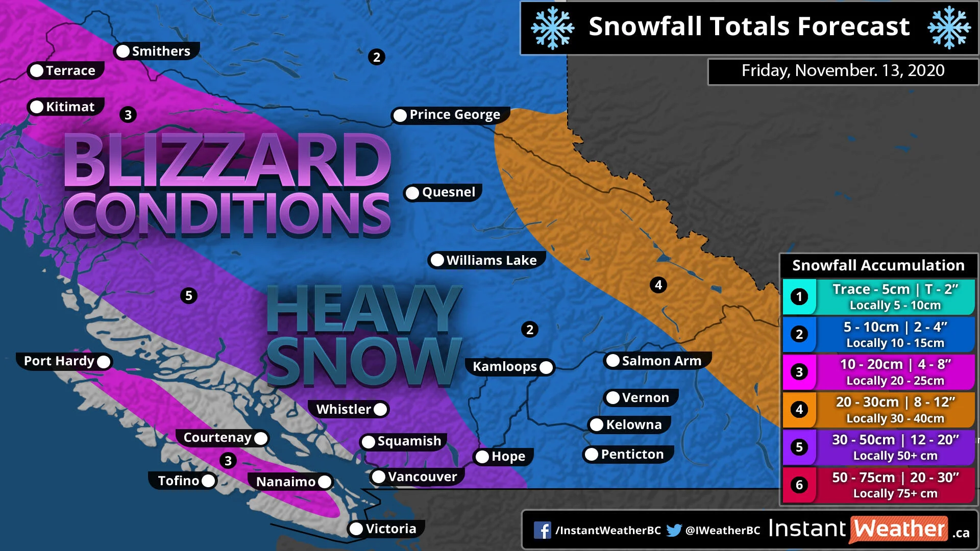
Storm 1: Late tonight into Thursday, Heavy snow at times for Inland Vancouver and Metro, Downtown Vancouver could even see a few slushy inches! But head far inland towards the North district of Vancouver and Port Moody to Coquitlam that is where you could see several inches of snow!

Along with the snow, is the heavy rain that would lash the coastal areas with as much as 50 to 75 mm of rain by the time that Saturday morning rolls around.

Winds will not be too strong as they will mainly stay south, but Gusts to 40-60 km/h is very likely.

Storm 2: Late Thursday night into Saturday morning, Heavy snow will continue to fall in the very high elevations and far inland. But snow will become rain over much of the entire Vancouver area, Snow in the mountains will continue to pile up, seeing as much as 2-3 feet! in lower elevations inland, up to 15-30cm is expected! The Interior could see another 5-15cm.

Rainfall will continue to fall on the coast, and become a bit heavier.

Winds will be stronger in this storm, gusting up to 80 km/h in Vancouver and Victoria and along the coast. Inland can see gusts up to 70 km/h.

So with all this rain, snow & wind, it is very likely we can see power outages.

rgem-all-vancouverski-instant_ptype_3hr-1605117600-1605128400-1605420000-10.gif

Looking at the FutureCAST timing this out over the next 3-4 days. This is the RGEM model and it’s doing a pretty good job so far in today’s forecast!

So Nice today, other than some flurries far inland and a few showers in Victoria and Vancouver. The heavy rain and snow arrive in the early hours of the morning so expect snow for inland Vancouver, a mix to mostly rain in the Metro of Vancouver and along the coast, Victoria will stay all rain for both systems.

The next system is a bit stronger and will sink south of Victoria, this will bring wind-driven rain for much of Vancouver and along the coasts & islands. But snow at times heavy will continue to fall for far inland areas and mountainous terrain.

By Saturday morning we finally begin to clear up a little.

rgem-all-vancouverski-total_snow_kuchera-1605117600-1605121200-1605420000-10.gif

Here is the models’ projection on snowfall over the next 3 days into Saturday, notice the bright pink-purple like colors? that is amounts of over 2-3 feet! This will fall over the higher terrains and mountainous areas. But Vancouver Inland… 5 to 15 cm over the North District of Vancouver, a few inches for the Metro and as head far north of Vancouver District, up to 30cm can fall! Vancouver Island Inland areas could see as much as 25 to 30cm of snow, coastal areas near the water will see much less with amounts of up to 5cm.

for the rest of the province, here is what you can expect in possible snowfall.

rgem-all-albertabc-total_snow_kuchera-5420000.png

Interior can see as much as 15cm, possibly more can not be ruled out! Further north more to the east, you will see far less snow, as the system will ne further away from you, Amounts of a few cm’s.

BC Snowfall Map.jpg

Here is what you can expect in my snowfall forecast!

Vancouver Island: 10-20cm with locally up to 25cm in the inland areas.

Inland Vancouver, Whistler, and Squamish to Hope you will see the highest amounts! depending on where you are, the higher up you are in the elevations the more snow you will get and those areas will see up to 50cm and lower elevations could see just 25cm.

For the Interior and much of mainland BC, look for about 5 to 10cm, however, could be some local amounts of up to 15cm.

Then we get to the Rockies into AB border, expect upwards of 30cm with local amounts near 40cm.

rgem-all-vancouverski-total_precip_mm-5420000.png

With the 2 combined storms, there is going to be a lot of precipitation water! now this includes all types of precipitation including snow! The areas that will see rain, such as along the coasts and in Vancouver, Vancouver Island Coastal areas. a good 50 to 75 mm of rain will likely fall by Saturday morning.

rgem-all-albertabc-total_precip_mm-5420000.png

For rest of BC, look at a good 10-30 mm of water in snow form! and with super cold temperatures far north and over mountains and high elevations that will produce a very high snow ratio and that is why the amounts are higher in those areas. The colder it is, the more snow will fall!

BC Rain Map.jpg

Here is my thoughts on the rainfall amounts through Saturday, A wide swath of a good 30-50mm with locally up to 70mm! And honestly, with the models being in a good agreement on showing 50 or more, I may tick that up in tonight’s forecast from 30-50 to 50-75mm. Either way, expect a flooding rain! You are wanting to make sure to unclog your storm drains so that the water call flow down into the sewer and not get clogged and create street flooding.

BC Remembrance Day Forecast.jpg

So for today, expect a chance of flurries or rain showers as that has been the case this afternoon from Squamish to Vancouver and for the South-East parts of the province.

BC Thursday Map.jpg

Then we get into Thursday!, There is that Low pressure just near Vancouver Island. A good soaking rain much of the coast, Very heavy snow inland and it will also be breezy at times with gusts up to 40 or 50 km/h. and from Prince George to the Okanagan looking at some Flurries.

Friday BC Storm.jpg

Then we have storm #2 for Friday! Low pressure over Vancouver island will sink south and curve up the coast. A nasty snow storm for Vancouver Island, and many parts of the coast, with exception of near Vancouver will you will be all rain!

Parts of the Interior from Kamloops to Hope, can look at a steady snowfall with blowing snow and potential blizzard conditions at times.

Strong winds on the coasts will gusts upwards of 60-80 km/h and that will create some blizzard conditions.

24 hour regional forecast.jpg

For the rest of today, expect sun and clouds for much of everyone, except some flurries in Kelowna and even some showers in Vancouver and Victoria late this afternoon and evening. Storm arrives in Vancouver to Victoria later overnight with a mix bag in Vancouver and rain in Victoria. Highs of 4-7 degrees, and lows tonight dipping down to -5 in Kamloops to as warm as +3 in Victoria.

BC Today forecast.jpg

Here in the city, expect gorgeous sunshine today, however again there is that shower chance in the afternoon hours. highs on the chilly side! only 3-6 degrees. South-West winds on the light side at only 5-10 km/h.

BC 24 hour forecast.jpg

Today, Sunny & cold with a chance of showers late in the day, high of 6. a slight chance of rain-snow mix overnight tonight with lows dipping down near the freezing mark at 1 degrees.

Vancouver 7 day.jpg

Here is your 7-day forecast, We are nice today, slightly breezy and cool with possible showers on the coast. high of 7. Colder tomorrow with a winter storm on our steps, snow inland, rain/mix on the coast. cold! highs only around 5 degrees!

Storm# 2 arrives on Friday, this time it is all rain and gusty winds to 80 km/h. That rain byway will be very heavy at times and some flooding is likely. milder at 7! lows of 4.

We continue to warm up on Saturday with lots of clouds but the precipitation stays far to the North sand South of us to not give us a bother. Sunday is also dry and slightly cool at 7. So your weekend is dry and cool but not a stormy one like Thursday & Friday so the weekend will be a great time to get out.

And getting out on the weekend will be a great idea because look what is coming for the start of the new week! YUP! another storm, this one though is all rain, lot’s of it! more flooding problems, strong winds. But the best part is that it is not a very cold rain, in fact, the temperatures will rise into the low 10’s!

I’ll have a better update on the 2 storms, and your latest updated forecast! coming up later tonight!

Have a safe Remembrance day, Remember to wash your hands, keep 6ft apart, and wear a mask! The more people that do this, the more quickly we can go back to normal!

Be safe, Be well, Buh-Bye!

You Will Have Plenty of Snow to Make Snow Cones!!!

Issued: November 9th, 2020 @ 10:30 PM

Updated: November 9th, 2020 @ 10: 30 PM

Forecaster: James Follette

BC Snow Map.jpg

The barometer is diving, the northerly winds are blowing, and the flakes are flying as of early this evening. Snow from the Fraser Valley to Osoyoos continues to pile up this evening and the snow will continue to fall well into the morning hours of tomorrow.

As much as 20+cm of snow can fall over much of the Interior and Fraser Valley from Prince George all the way down to Kelowna. There could also be amounts of up to 20-25 cm over Whistler. For the rest of the mainland, It looks like a good 6-12cm, however local amounts of up to 16cm is not out of the question.

For the coasts, Vancouver Island and the Metro of Vancouver, it looks like just a few slushy inches or up to 4cm, however further north in higher elevations of Vancouver could see local amounts nearing 6-10cm.

Vancouver Island can see as much as 10cm locally.

rgem-all-albertabc-instant_ptype_3hr-1604966400-1604977200-1605268800-10.gif

The white stuff is all thanks to a frontal low pressure and a low pressure over Northern Alberta, these two lows are sending cold arctic air down to the far south.

The weather will improve by Tomorrow afternoon, with scattered flurries still being a possibility, but the main snow will be done with.

High pressure takes over the province on Wednesday, but it will be located to the North West of us which means the winds will be coming from that area where it’s cold. So while it will be a beautiful day, there will also be some very chilly temperatures.

Another low pressure off the coast will impact coastal parts of the province Wednesday night into Thursday with more rain and snow & likely some gusty winds.

But a much bigger storm will arrive on Friday, with very low pressure, a pressure center of 968mb, So if you have a Barometer at home, the 968mb is way down near the bottom in the STORMY section.

Coastal parts of the province can expect a very long stretch of unsettled weather, heavy rain, snow & 100 km/h winds are likely on Friday.

There will be more on Friday’s system over the coming days.

The Monster Mash!! Thundery cold rain & Hurricane force winds to massive blizzard conditions in the Mountains

Issued: October 13, 2020 @ 4:30 AM

Valid: October 13, 2020 @ 5 AM

Forecaster: James Follette

Severe II.jpg

Gooooooood Tuesday morning British Columbians!! Hope you all had a great and happy Thanksgiving and it not to full for more turkey sandwiches ;)

We have a lot of weather to talk about today, we’ll start with our Severe Weather Alert!

We’ll go first to the radar, where we are tracking some heavy rain & thunderstorms over the Vancouver Island area.

simuawips (3).png

We are tracking several thunderstorms and moderate to heavy rain to start the early Tuesday morning. A lot of the storms are heading to the North and North East towards Vancouver and Victoria. The rain will pick up through the day today and then begin to taper off by the evening hours with scattered showers still coming down.

simuawips (4).png

As we zoom out of the ready for a closer look at rest of Vancouver areas, Lot’s of rain to our South and East, both of those directions is where our winds will be coming from and where the moisture will come from, So plan on a mostly all day washout.

simuawips.png

Taking a look at the latest current Satellite Infrared Imagery with Front & MSLP progs programmed in,

We have a very large low-pressure system just off the coast near Haidi Gwaii that will track towards Port Hardy later today as the system strengthens even more, and as it does so it will increase the winds later this afternoon. Winds will become at it’s worst later this afternoon into tonight.

Meanwhile, elsewhere there is lots of nice weather as high pressure in the big boss!

With the Tops Super HD Satellite Imagery, you can picture out where the storm is, a huge wall of cold cloud tops, which means high cloud tops and the colder it is the more intense the system, and the colder it gets the more it intensifies. Currently, we have cloud tops as cold as near -60*C.

As well, the circulation of the low, and where the center is, with the swirl of clouds. You can get a better look however by looking at the Water Vapour Satellite Imagery. This tells us how much moisture is in the clouds. The darker the color, the higher the moisture, the good chance you will see some precipitation falling or even some very heavy moisture.

With systems like these, drier air wraps around the low to the South and East, and this is just like the other cases. Lot’s of moisture wraps around from the SE then a dry air on the back side. Where there is dry air, expect some breaks in the rain and clouds.

simuawips (1).png

We have a warm front that will pass through first bringing us rain, and storms, then behind it we have a cold front, that will swing through later today and tonight to ramp up the winds. Then we’ll have a few good days as High pressure off in the open to our west will slide in here starting on Thursday.

xx_blitze-en-193-0_2020_10_13_17448_1140 (1).png
xx_blitz-en-193-0_1621_202010131044845000072955.png
xx_blitz-en-193-0_1621_202010131117603000080922.png

We are tracking several thunderstorms from the south coming up towards Port Hardy. Here is one that is a strong slammer just on the Naniamo River.

xx_blitz-en-193-0_1621_202010131123479000059216.png

Another Strong slammer from between Howell Island and Austin Island

xx_blitz-en-193-0_1621_202010131124555000088715.png

Another strong slammer towards Brewster Lake and the Brewster Lake Recreation site.

xx_blitz-en-193-0_1621_202010131139833000020900.png

And we have this Wild house shaker thunderstorm that is producing cloud to ground lightning, heavy rainfall, and strong winds with intense thunder and frequent lightning. could even see some small hail with these storms. This storm is over the Shushartie River.

hrrr-conus-vancouverski-instant_ptype_3hr-1602565200-1602576000-1602630000-10.gif

Here is a look at our FutureCAST taking us out over next 18 hours, Rain already starting and moved into Vancouver Island, this will continue to spread further North inland, while Snow, Ice Pellets and Freezing rain will occur for a few hours over the higher terrain over Vancouver Island, and some heavy snowfall turning into a massive blizzard for the Mountainous Terrain. Many of the mountains will see as much as 2 to 3 feet of snow!!! meanwhile closer down to lower levels, up to a half foot can be expected in the very high terrain areas, and areas of lower terrain such as in Vancouver Island and along the coast near the water. only a few cm’s is expected.

hrrr-conus-vancouverski-gust_kmh-1602565200-1602576000-1602630000-10.gif

Along with Rain, Snow, Mix, Ice & Thunderstorms are the very strong winds! Winds will gust as high as 115-125 km/h for some parts of the South coast later today and tonight while most other areas will still see damaging winds of near 100 km/h. and Inland areas will also see strong winds Gusting 40-80 km/h.

Widespread power outages are very likely today, tonight & tomorrow for much of the South coast, and lower Vancouver, meanwhile further Inland where Gusts of 80+ km/h Gusts are possible, potential outages there are also expected.

BC Thunderstorm forecast.jpg

Thunderstorms expected over much of all of Vancouver areas and the entire South Coast.

BC Morning Rainfall Intensity.jpg

Rain this morning, will be Moderate to even heavy at times. Lighter rainfall over Terrace to Kitimat.

BC Afternoon Rainfall Intensity.jpg

Rain becomes more lighter, by Afternoon but the winds will pick up. meanwhile snow will continue to fall heavily over higher terrain and the mountains.

BC Evening Rainfall Intensity.jpg

Similar conditions in the Evening hours. So how much rainfall can we expect by time it is all over?

BC Rainfall totals.jpg

Large area of 20-30 mm is expected, however there are local spots that will likely reach 40+ mm. areas South of Naniamo and around Hope and Penticton. Could see rainfall amounts of near 50 mm, and a bit more near Hope. For remainder of the province far inland, 5-10 mm for Prince George to Williams Lake and down to Kamloops, Vernon and Kelowna. Further South of those areas, only up to 20 mm is expected.

BC Snowfall Totals.jpg

Here is the latest snow map, these DO INCLUDE amounts for High terrain and mountainous areas.

Huge swatch of 30-50cm with many areas in the mainland mountains getting close to or over 60 cm. Same with Hope, Penticton, Kelowna, Vernon & Salmon Arm high terrains, and the TransCanada highway over the mountains. Prince George to Quesnel, up to 20cm of snow is expected, near 12cm over terrain in Kamloops. Parts of Vancouver coast could see some 6-12cm of snow, before a change over to all rain.

Vancouver Island, up to 20cm over the high terrains and near 6cm in lower elevations before a changeover. a small dusting to 2cm for the South of Nanaimo.

BC Wind Forecast.jpg

Lastly, here is a look at the winds! very strong along the coast where it will gusts over 100 to even 110+ km/h. this also includes Kelowna to Penticton. further Inland, expect 80 to as high as 95 km/h Gusts and much of the province from Kamloops all the way north, expect Gusts to 60 km/h.

Another update later this afternoon!

More Record Heat Continues For The weekend, Then A BIG Change!

Updated: October 3rd,2020 @ 2:30 AM

Valid: October 3rd, 2020 @ 4:00 AM

Forecaster: James Follette

BC Heat Map Saturday.jpg

It was another record breaking day for Temperatures as the continued late summer warmth persists to end the first week of October, Looks to go into the first weekend of October before finally giving up and going to near or below normal temperatures.

Here is a look at some records that were broken on Friday, October 2nd.

Merritt…….. Old record: 18.3 degrees C from 2016, New record: 25.1 degrees C. Average is 17 degrees C

Hope……….. Old record: 22.6 degrees C from 2004, New record: 25.1 degrees C. Average is 16 degrees C

Squamish… Old record: 24.1 degrees C from 1993, New record: 25.2 degrees C. Average is 14 degrees C

Bella Coola. Old record: 23.6 degrees C from 1988, New record: 23.9 degrees C. Average is 14 degrees C

Clinton……… Old record: 23.0 degrees C from 2003, New record: 23.7 degrees C. Average is 14 degrees C

Bella Bella… Old record: 16.8 degrees C from 2016, New record: 21.8 degrees C. Average is 14 degrees C

Prince Rupert Old record: 17.9 degrees C from 2017, New record: 20.2 degrees C. Average is 13 degrees C

Sandspit……. Old record: 15.7 degrees C from 2002, New record: 16.7 degrees C. Average is 13 degrees C

These are just a sample of many records broken on Friday, several towns as warm as 10 to 15 degrees above average. The hot spot in the province Friday was Princeton at 26 degrees C, sadly not a record as the record for Friday was a sizzling 29 degrees from 1975.

xx_obs-en-193-0_2020_10_03_06_00_1621_2.png

These are the max high temperatures from Yesterday (Friday), a small swath of temperatures in the 25 to 30 degree range which is in red, but check out the orange, A very large swath of 20 to 25 degree temperatures which is not uncommon for early October but is at same time, not usual. Those warm temperatures even spread fairly far north of the province where records were also broken.

gfs-deterministic-wcan-z500_barbs-1601704800-1601704800-1602536400-10.gif

The Large ridge pumping up the very warm conditions will begin to start flattening out as early as Later today and will persist through the weekend, This will allow for some more unsettled weather and much cooler air to flow down. However the big change where we see some unsettled and very chilly air is not until we get into the latter part of next week towards Thanksgiving weekend and into Thanksgiving.

Even if it will be cooler, Temperatures look to still be almost 5 degrees above normal over the next 2 weeks with day time highs in the 15 to 20 range. Where as by near Thanksgiving, the Average high is between 10 and 15 degrees.

If you’re those kind of people who love this heat, wanting to keep enjoying it and still go to the beach or pool and get a tan, Then you still have the weekend to do so before it becomes a bit cool for the water and tanning.

Hazy & Smokey Skies to Continue Through The Weekend

Updated: October. 3rd, 2020 @ 12:30 AM

Valid: October 3rd, 2020 @ 2:30 AM

Forecaster: James Follette

AQI BC Saturday.jpg

It was once again another hazy and Smokey day over much of Southern and Central portions of British Columbia as high pressure continues to dominate the province and will continue to do so as the large ridge will continue to build and head further North. This will allow for not only warmer & more humid conditions, but also for an increase in smoke & Haze to flow further over the province from the SW wind allowing smoke from the three States currently burning; Oregon, Washington, & California to cross the border.

The smoke and haze will not be as nearly as bad as the huge blanket of toxic smoke over the province in early Septembe but there will be some unhealthy air conditions over a good portion of Southern and Central BC. The AQI ( Air Quality Index) will be around Low to Moderate for many areas with only one area making it to level 6, which is the high-end of Moderate. Everypne else will be Low to Moderate, between 2 and 4.

RGEM 10-km British Columbia 6-h Precipitation Type.gif

While it will be a fairly warm and very dry weekend, there is a system that looks to bring some unsettled weather in the form of showers and much cooler temperatures over parts of Vancouver Island from Nanaimo to Campbell Island. This will reduce, if not, clear all the haze and smoke by Sunday.

Unfortunately, the dry weather will look to stretch into much of the week for Vancouver and Central & Interior desert areas. There could also be a few showers Sunday late day for extreme northern parts.

There is a pattern change coming after the weekend that will bring much cooler temperatures to the province as a series of Low pressures will flatten the jet stream, allowing for cooler Canadian air from the North to flow down. There is also some suggestions from the models that many parts of the province could see some first snow of the season by later on in the new week.

For those with medical and breathing problemssuch as Asthma and Respiratory problems should take some extra caution if going out by limiting the time out in the haze & smoke. Please wear a mask and reduce outdoor exercise.

Also, you should try and stay indoors and have the Air Conditioner on. If you know anyone that is prone to complications from smoke and is in poor health, please check on them frequently and help keep them safe. If experiencing heavy coughing, asthmatic like problems, throat irritation, etc., please go to the ER.

The smoke and haze should exit the whole province by Monday or Tuesday as the more unsettled and cooler air moves in.