Larry To Make Landfall Late Friday on the Avalon Peninsula as a Category 1 Hurricane

Hurricane Larry is expected to finally make landfall this evening over the western Avalon Peninsula as a Category 1 storm. Hurricane warnings are in effect for the entire Avalon Peninsula while Tropical Storm warnings are in effect from the Bonavista Peninsula, through Clarenville and south to Connaigre and the Burin Peninsula. The greatest threats from this storm are high winds, large waves, coastal flooding, and periods of heavy rainfall with up to 50mm falling.

Winds will begin to increase as Larry approaches with peak winds expected in the overnight hours. The strongest wind gusts will be along the coastal areas of the Avalon, especially in Cape Race and along the southern shore. Gusts of up to 150km/h are possible there and the winds will decrease further north and inland, with gusts of up to 130km/h possible for the St John’s Metro area and Conception Bay South through to Carbonear. Wind gusts of 100-110km/h will occur from Bonavista and south through the Burin Peninsula and winds will decrease moving westward. Any loose objects should be secured or brought inside ahead of the storm. By Saturday afternoon, winds should begin to diminish as Larry tracks offshore to the north and weakens to post-tropical storm in the cooler waters.

Along with the winds, waves and storm surge are a major threat from this storm, especially south facing shores from McCallum to Cape Race as well as in Placentia Bay. High tide this evening in conjunction with the storm surge will result in significantly higher water levels. Waves heights of 10-14 metres will also be present and could cause damage along the coast and flooding in coastal communities.

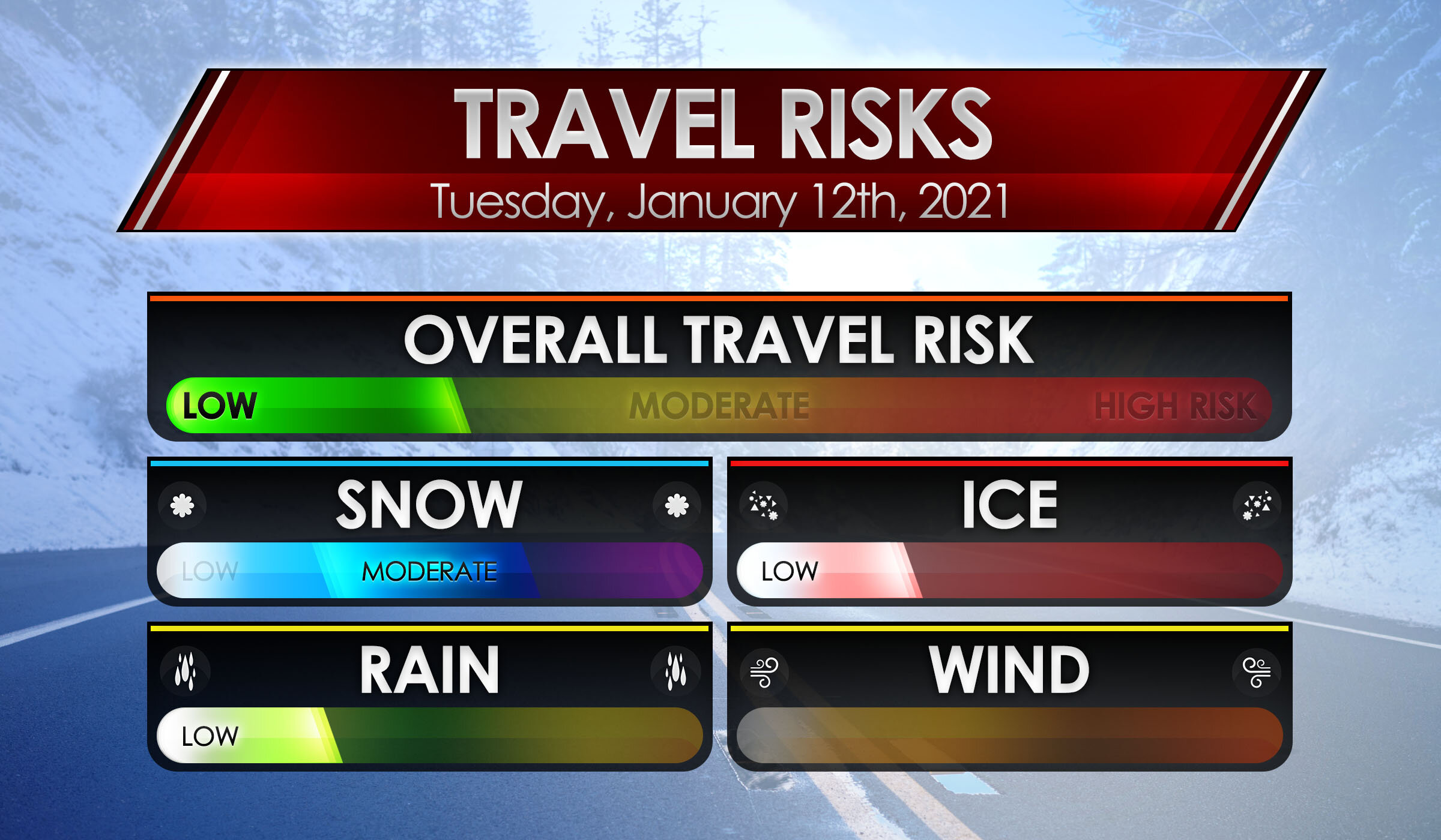
It is likely that some communities may lose power due to this storm and it is not too late to put together an emergency kit. Some important things to have on hand include:

  • Water

  • Non-perishable foods

  • First Aid kit

  • Battery powered flashlight and extra batteries

  • Candles and matches/lighter

  • Prescription medications and equipment

  • Pet food and supplies

  • Extra gas for generators

Please remember that if you use a generator, DO NOT operate inside your home, garage, or shed.

Stay safe and we will be posting updates this evening as the storm approaches.

Instant Weather NS Rise 'n Shine Updates: January 12, 2021

Issued: January 12th, 2021 @ 5 AM

Updated: January 12th, 2021 @ 8AM

Forecaster: James Follette

Good Soup Tuesday morning y'all!

xx_obs-en-114-0_2021_01_12_08_00_1626_1.png

Wow, compared to yesterday morning, It is balmy out there! especially on the south coast where we are now currently at around 3 to 5 degrees.

There is still some colder air in the northern parts of the province but not so bad as yesterday!

Today will be a bit milder! We do have a lot of clouds in the forecast for today and the next several days.

xx_obs-en-114-0_2021_01_12_08_00_1626_77.png

Winds are light this morning and will remain light through the day today and into the middle to later part of the week! Baccaro Point currently a breezy spot with a sustained wind of 22 km/h.

Your Hour by hour, Out the door day planner & the School bus stop forecast, is next at 6 O'clock! along with the not to shabby 5-day Regional forecast and 7 days Halifax forecast!

download (6).png
download (7).png

We also do have some snow out there this morning that have started not too long ago towards the TCH 101 From Digby County all the way towards Kentville, Wolfville, and Hantsport. So if out there this morning, take some extra time and drive slow!

Elsewhere on the roads this morning the 102, 103 is looking mighty fine!

Good Tuesday Morning, local time now 6:30 AM! on this rather cloudy morning, a bit snowy start to the morning on the western portions of the coast. Much milder today also!

Traffic & weather updates on the hour til 9 AM!

Good morning, James here for Instant Weather NS Rise 'n Shine, every morning from 5am to 9am!

Taking a look at the radar first! We do have some snow in the west from East of Digby County all the way towards Annapolis and Kings county. so much of the 101 is slick if heading or coming from there between Digby and Kings. Snow should taper off in a little bit, but we do keep the chance of flurries in the forecast for those areas, along with much of Halifax and north! A little more on the forecast coming up in the next hour.

download (6).png
download (7).png

Hour by Hour forecast, looking at cloudy skies this morning, some breaks in the clouds as we head towards noon, and then as we get into the evening hours, we'll see some of that shower and flurry chance before it clears up and gets much colder later this evening.

HOUR-BY-HOUR FORECAST.jpg

Day planner forecast, Look at a rather cloudy day, a chance of flurries later on in the afternoon. A milder day! Because of the clouds, the cool NW wind, and the chance of flurries. going to give this a C- grade today! Better than a D or F!

Day planner forecast.jpg
School Bell Forecast Jan8thAM.jpg

Out to the bus stop! looking at a much milder morning! compared to -10's yesterday morning. However more cloud cover! Temperatures around 2 degrees on the plus side as you head to the bus stop!

Coming up in the next half hour at 7am, we'll have the latest weather conditions and Traffic updates and at 8am, the latest on your detailed weather forecast!

7 AM! Time to look at the Traffic and latest weather conditions! We’ll start with traffic first! and we do have some snowy weather out there this morning along with the western parts of the province. Main areas of slow travel and snow-covered roads will be along with Cumberland County, Colchester & Hants county this morning.

So if you’re in those regions this morning, may want to give yourselves some extra time and reduce your speed this morning as you head off to school or work.

download (9).png

Elsewhere the roads are bare or wet! and dry conditions.

download (11).png

Taking a look at the road conditions now with the Nova Scotia webcams. We’ll start with the areas seeing the snow this morning.

Amherst_1.jpg

Taking a look at Amherst HWY 104 N right now, no traffic but it’s not a pretty drive! mostly snow covered roads, and low visibility under some falling snow.

Springhill_1.jpg

Springhill HWY 104 N, light traffic, some very heavy snow falling and roads are snow covered, so please use extra care on the roads this morning if in Springhill and surrounding areas!

Westchester_1.jpg

Westchester HWY 4 N now, light traffic and cloudy skies with some snow. wet and slushy road conditions so be sure to reduce your speed and take some extra time on the roads this morning.

Pugwash_1.jpg

Heading to Pugwash HWY 6 E we have snow falling, and wet and slushy roads but no traffic! If heading out this way, be sure to take extra care on the roads and give your self some extra time!

Seal Island_1.jpg

Looking at the Seal Island Bridge looking West, seeing no traffic, dry roads and dry conditions!

Seal Island_2.jpg

Looking at Seal Island Bridge looking East, no traffic, dry roads and dry conditions!

Bridgewater_1.jpg

Bridgewater HWY 103 S now, little to no traffic, bare roads and dry conditions.

East Bay_1.jpg

East Bay HWY 4 N, light traffic, bare roads, a bit slick and dry conditions.

Avonport_1.jpg

Avonport HWY 101 E looking at little to no traffic, slick roads and dry conditions

Pubnico_1.jpg

Pubnico HWY 103 E, looking at dry roads, dry conditions and little to no traffic!

Milford_1.jpg

Milford HWY 102 W we are looking at little traffic, dry conditions and bare roads.

Yarmouth_1.jpg

Yarmouth HWY 101 N, light traffic and bare roads and dry conditions!

Meteghan_1.jpg

And lastly, looking at Meteghan HWY 101 N, little to no traffic, dry conditions and bare roads!

Travel Risk.jpg

We have some travel risks to mention out there this morning with that snow in the western areas. Moderate travel risk for snow, Low travel risk for ice and rain. No wind issues! Overall the Travel risk is low, just be sure if heading on the 101 from Digby to Annapolis and then the 104 towards Amherst, you will need to slow down and take some extra time and care on the roads, this is where the weather Travel risks are needed. Elsewhere it’s dry and bare! and no Travel risk!

Travel Delay Panel.jpg

Heading for the airport this morning! Expect no delays! and all flights are on time!

The current local time is now 8 AM, when we come back at 9 AM we will have the full detailed weather forecast! And remember! to keep refreshing this page and keep checking it for live updates!

Nova Scotia to miss out on the Northern Lights show!

Issued: December 10th, 2020 @ 12 AM

Updated: December 10th, 2020 @ 12 AM

Forecaster: James Follette

A CME from the sun has reached the earth and it is possible that northern lights will be seen as far south as Oregon during the next couple of days.

But the question is, will the weather cooperate to make viewing possible? Well sadly the answer is no, We have unsettled weather over next 4 days that will bring nothing but clouds and precipitation.

A potential geomagnetic storm is predicted for tonight and Thursday.

Tonight, a small low pressure will bring scattered showers and flurries and plenty of clouds for the entire province, so tonight is not a great night to see the lights.

Tomorrow Night, There will still be lot’s of cloud cover, but less chance of precipitation. Good news is that there will be some areas in the province that will have clear breaks!

These counties include:

  • Cumberland

  • Colchester

  • Hants

  • Halifax East

  • Guysborough

  • Victoria

These counties will see the chance for a view of auroras on Thursday night.

For Friday Night & Saturday night, mostly cloudy skies will take over for the whole province again.

So best view for the mentioned counties is tomorrow night.

Mother Nature Has Lost Her Temper

Issued: Monday. November 23rd, 2020 @ 7:30 AM

Updated: Monday. November 23rd, 2020 @ 12:00 PM

Forecaster: James Follette

Winter Storm.jpg

Good late morning! You will want to enjoy this gorgeous beautiful weather today because, as we get into tonight, tomorrow, and early parts of Wednesday, we are going to be bombarded with Rain, Snow, & Damaging winds.

We’ve got a Blizzard that will be occurring in Labrador with Snowfall warnings, Blizzard warnings, High Wind warnings, Wreck house wind warning, Winter storm warning, and special weather statements in effect!

A look at what to expect!

NFLD 5.30 Map.jpg

We’ll start the timing here at 5:30 PM this evening! Flurries begin to enter the Channel-Port Aux Basques, while rest of province will see increasing clouds.

NFLD 8.30 Map.jpg

By 8:30 PM this evening, we’ll see Flurries begin to develop and spread Eastward from Stephenville, Deer Lake, Corner Brook, and into Grand Falls Windsor.

NFLD 11.30 Map.jpg

As we get into the late evening hours near midnight, we’ll see a switch to rain from the Channel-Port Aux Basques to Corner Brook, Deer Lake, and North. Further North into St. Anthony, look for some ice mix and snow flurries.

NFLD 2.30 AM Tues Map.jpg

Now entering overnight hours into Tuesday morning, Rain begins to spread far west in the south from Channel-Port-Aux-Basques to Deer Lake, Corner Brook, and parts of the Northern Peninsula. A wintry mix can be expected further North on the northern most part of the province, which includes St. Anthony.

NFLD 5.30 AM Tues Map.jpg

Waking up tomorrow morning on the Island, expect widespread rainfall from Channel-Port-Aux-Basques to Clarenville and Marystown. The Avalon will remain dry for the first few hours of the start of the day.

NFLD 8.30 AM Tues Map.jpg

By 8:30 AM Tuesday, Rain would now have engulphed the entire Island. Light Rain from the Avalon Peninsula to Clarenville, Gander, Grand Falls-Windsor, Corner Brook and Deer Lake and up north into St. Anthony. As the Low nears and intensifies, we’ll see heavy rainfall enter Southern sections from Stephenville, Channel-Port-Aux-Basques through the Burin Peninsula in Marystown and south-western sections of the Avalon Peninsula such as Placentia.

NFLD 11.30 AM Tues Map.jpg

By time it is near Dinner time, and you have your chili put on or your fish that you caught, there will be heavy rain over much of the entire province. Exception will be Gander and Northern parts of the Island through St. Anthony.

NFLD 2.30 PM Tues Map.jpg

As we enter Tuesday Afternoon, Heavy rain will now change to snow for Western sections from Deer Lake to the Channel-Port-Aux-Basques, a dry break East of there. heavy rain tapers to light rain for Northern Peninsula and Burin Peninsula. however we will continue to see heavy rainfall continue into the Avalon Peninsula.

NFLD 5.30 PM Tues Map.jpg

By Supper hour, much of the system has exited, some left over remaining showers for Northern Avalon Peninsula, including St. John’s, and Northern most part of the province up towards St. Anthony. Snow will continue into the western parts of the island. from the Channel-Port-Aux-Basques to Deer Lake and a bit further up. Corner Brook is included in this.

By 8:30 pm in the evening, we can expect snow over Western sections to continue, areas of Grand Falls-Windsor eastward, will see clearing conditions. But that snow in the west will stick around through much of early Wednesday morning, which is why we do have the higher snowfall numbers in that area.

Monday Storm Timeline

NFLD Monday Storm Timeline.jpg

Nothing much to be expected today with the exception of rain beginning in Corner Brook & Port-Aux-Basques.

NFLD Tuesday Storm Timeline.jpg

Now Tomorrow is an all different story together! Depending on where you are, you could have a quick storm or a slow and punishing storm.

Rain will begin in the Avalon Peninsula by early Tuesday morning on the capes around 4 or 5 am but not in the capital city of St. John’s until 8 am. Northern Peninsula will see rain begin near 7 or 8 am. West coast is where all the action is! Rain continuing to fall through tonight all the way into 11 am in Corner Brook where it will then change to snow then heavy snow later in the evening. Rain continues and changes to snow in the Channel-Port-Aux - Basque at 11 am and continues through the night hours of Wednesday.

St. Anthony will start off as some Mixed precipitation and Ice pellets ( Sleet) then change to rain by 4 am and snow as of 7 pm tomorrow evening.

NFLD Wednesday Storm Timeline.jpg

By Wednesday morning while much of the island is cleared off, Snow will still continue to fall over western sections. through at least 5 to 8 AM. For, Corner Brook, Port-Aux-Basques & St. Anthony.

Rainfall Amounts

NFLD Total Rain Map.jpg

Rainfall will be heaviest over Southern sections, Burin Peninsula and the Avalon Peninsula.

  • Avalon Peninsula can expect upwards of 30 mm with local amounts up to 40 mm.

  • Burin Peninsula can expect a little less rainfall, with amounts of 5 to 10 mm however up to 20 mm in local areas are likely.

  • Northern and Central from Gander to Grandfalls-Windsor, amounts of 5 to 10 mm, local amount of up to 20 mm

  • South West Coast. the highest rainfall with 50 to as much as 70 mm of rainfall. Elsewhere 30 to 50 mils can be expected.

The Snow! Blizzard & Blowing snow

NFLD Total Snow Map.jpg

Along with Rain is the heavy snow to the west!! A big chunk of the Island will only see a dusting to 2 cm, but winds will persist and strong enough to create blowing snow. Channel-Port-Aux-Basques and northward, as much as 12 cm, with local amounts up to 15 cm. Stephenville, Corner Brook, Deer Lake, as much as 20 cm of snow can fall by Wednesday morning.

Strong winds will give Blizzard like conditions for much of the Western portions of the Island.

For Labrador… Blizzard warnings are in place for what will be an epic monster snowstorm. Winds of 90-120 km/h and snowfall amounts of 2-4ft! drifts could be as high as 5-7ft! Travel is expected to be nearly impassable, widespread power outages are expected and plenty of wind damage as well for much of Labrador.

The Powerful winds! Tropical Storm to Hurricane Force!

NFLD Wind Gust Map.jpg
  • The biggest story with this storm is the winds! many wind warnings are in place!

  • Avalon Peninsula can see winds exceeding 110 km/h and as high as 120-130 km/h. exception will be the northwest parts of the Avalon Peninsula where winds gusting to 105 km/h is expected.

  • Burin Peninsula can expect 90 to 115 km/h Gusts, East of Marystown winds will likely exceed 110 km/h.

  • Central portions of the province can expect wind gust to be 90-105 km/h

  • Northern portions of the province can expect 80-95 km/h wind gust from Gander to GrandFalls-Windsor.

  • Farthest Northern section of the Province towards St.Anthony, wind gust of 90-105 km/h is expected including in St.Anthony, West of St. Anthony wind gusts are very likely to exceed 110 km/h.

  • Western Portions, wind gust will be very strong! with Gusts as high as 120-130 km/h towards Port-Aux-Basques. and 100-115 km/h from stephenville, Corner Brook and towards Deer Lake.

Your Windshield Wipers Will Be On High as Cat and Dog Rainfall Arrive , Screaming Wind & A Few Slushy Inches

Issued: November 23, 2020 at 12:40 AM

Updated: November 23, 2020 at 6:50 AM

11 PM Late Evening Update

Forecaster: James Follette

Heavy Rain I.jpg

Good Evening! Another Storm system is on its way towards Atlantic Canada for the start of the new work week with Heavy soaking rains, Strong to Damaging Winds & yes, even some snow! with the potential for blowing snow and blizzard-like conditions.

Monday, November 23rd.

NS Mon 11 AM Map.jpg

Rain will begin to spread into the Southern portions of the province early tomorrow morning from 7am in Yarmouth to 11am in Halifax and surrounding areas, This rain will be the first outer bands so it will be a light rainfall.

NS Mon 5.30 PM Map.jpg

As we fast forward into the early evening hours, at around 5-5:30pm The rain will become more moderate over Eastern areas from Liverpool to Halifax, still fairly light through Digby & Yarmouth. Rain spreads into Northern Nova Scotia, almost entering Cape Breton.

NS Mon 8.30 PM Map.jpg

By Late evening hours tomorrow, we will begin to see that heavier rain moves into the Southern portions from Yarmouth to Halifax by 8 pm and Light rainfall spread elsewhere in the province, a more moderate rainfall as you may notice by the amount of rain falling on the map from Halifax to Antigonish and New Glasgow, that is Moderate rainfall occurring.

NS Mon 11 PM Map.jpg

Now at 11pm nearing Midnight, we see the Heavy rainfall continue in the South and spread North of the province, only Cape Breton seeing some Moderate rainfall.

Tuesday, November 24th

NS Tues 2AM Map.jpg

As we enter the early morning hours of Tuesday, The 2 systems will move a bit more quickly to taper off the showers and rain for Yarmouth and much of Shelburne, parts of Digby county as well. but light rain or showers will persist for Liverpool to Kentville and a more soaking rain for Halifax to New Glasgow and as far North as Sydney.

NS Tues 5AM Map.jpg

As many will wake up near 5 and 6am on Tuesday, the entire Southern portions will be dry and done with the rain and the rest of the system in fact! Few sprinkles in Halifax may linger and showers will persist into Truro and New Glasgow & Amherst with heavy rainfall persisting in Antigonish and Sydney.

NS Tues 8 AM Map.jpg

As we get later into the morning hours, by 8 am the system begins to accelerate and much of the province would be out of the woods for any more rainfall, in fact, much of Nova Scotia with the exception of Cape Breton should have a fairly beautiful day Tuesday, despite the cold breezy winds that will stick around. Cape Breton will be seeing continued rainfall here at 8 am.

Monday Storm Timeline

NS Monday Storm Timeline.jpg

Let’s now take a look at our storm timeline! We’ll start with the Southern portions first!

So in the Tri-Counties and South Shores, look for your rain to start very shortly this morning in the next few hours, between 7 and 8 am will be the first drops! and continue on to midnight.

For Mainland areas, New Glasgow, Halifax, Dartmouth, Greenwood & Kentville first drops falling near 10 or 11 am.

For Northern sections. Cheticamp and Sydney, your rain will not start until later this evening at around 8 pm. Cheticamp may see a brief period of flurries or light snow at 2 pm this afternoon from an onshore flow.

Tuesday Storm timeline

NS Tues Storm Timeline.jpg

As we forward into Tuesday now! Rain will begin to end in the overnight hours by 2 or 3 am Tomorrow morning for much of everyone with exceptions to Greenwood and Kentville where your rain may linger into 5 AM.

The cold air will rush in here like racing horses at the track fighting each other for a win. This will send rain turning into the snow for Mainland and Northern sections. Halifax, Dartmouth you can see a brief period of snow from 8 am into 11 am tomorrow morning. Kentville can see quick brief snow at 8 am tomorrow morning.

Rain ends for Sydney at 10 am tomorrow morning, so for much of the province, by the time we get to mid-morning tomorrow, the storm is done with. In a way, it is, however, look at Cheticamp where the precipitation just keeps going for another 24 hours and changes to snow by 9 am and just persists into midnight. That is the back end flow of that storm taking advantage of that bitterly cold air above and just keep the snow and snow squalls persisting much of Tuesday.

Wednesday Storm Timeline

NS Wed Storm Timeline.jpg

Now we are into Wednesday, Only place getting precipitation is Cheticamp and surrounding areas. Snow persists all way into early morning and ending by 6 am. So looking at a long period of snow from 9 am Tues to 6 am Wed. This will be the reason of the high snowfall amounts for this area.

Rainfall Amounts through Tuesday

NS Total Rain Map.jpg

Now looking at the Rainfall amounts we can expect through out Tuesday. Much of province looking to see 20-30 mm with local areas likely to receive 40 mm, Greenwood, Kentville, New Glasgow, Sydney you will all see a bit less rainfall with amounts of 10-20 mm with local amounts up to 30 mm. Then finally for Western Cape Breton.. going to be hardest hit area with up to 50 mm of rain and potential local amounts up to 70mm, and perhaps even a bit higher than that! this is before the change over to snow!

Ugh! Snowfall Amounts!

NS Snowfall Map.jpg

If there is any good news in this forecast, is that not everyone will see snow! Some Flurries are expected through parts of Digby and Kentville and then a widespread path of snowfall from Amherst to Antigonish and Sydney and these areas will see amounts of only up to 2cm! maybe some local amounts up to 4cm.

But the heaviest snow is Western Cape Breton! where the snow will fall for a very long period of time, into Wednesday morning. amounts of up to 6cm, some local amounts up to 10 cm.

The snow is not the bad part… it’s the wind! We are looking at very strong to damaging winds in Cape Breton along with Les Suetes! This combined with a long period of snow, at times heavy will create blizzard-like conditions!

The big bad wolf's breath… Blowing very hard! May cause some damage!

NS Wind Gust Map.jpg

Finally last but not least! the winds! Winds will Gust pretty strong across the province, but Northern parts will see the really big winds where you can see some power outages and damage to roofs, shingles, windows, property, Christmas Decor.

Much of province will see a good gusty wind of 70 to 80 km/h this includes from Yarmouth all way up to Halifax and near Antigonish.

Amherst, New Glasgow, Antigonish… you make it up to level 4! ;) congrats! that means you get to see winds from 80 to 95 km/h.

Majority of Cape Breton with the exception of Western Cape Breton… Level 5, is where you get to see the beginning of some slight wind damage. Gusts of 90 to 105 km/h.

And Western Cape Breton, this is the jackpot! Level 6 on our Wind Guage chart! Wind Gusts exceeding 100 to 115 km/h! This is where you will see nasty blizzard conditions, Blowing snow, windswept rain, large waves, power outages, and property wind damage.

We will have more on this system throughout the morning so keep checking back with us on IW Nova Scotia on Twitter and Facebook, and of course on our app! Just download the IW app, and you can check out our amazing radar! and hour by hour forecast and your long-range and any alerts or updates issued!

More coming up later this morning on this gloomy Monday, But try and love and shine bright!

Be safe! Wear your mask! Keep your distance! & wash your hands!

Love and light from us here at IW Nova Scotia.

Clearing Begins! But So Does the Big Chill and Snowflakes! *Monday Storm Coverage*

Issued: November. 16th, 2020 @ 11: 30 AM

Updated: November. 16th, 2020 @ 3:30 PM

Forecaster: Student Meteorologist James Follett

Good Afternoon! It is 3:30 PM, and we have some new updates to talk about!

Storm Surge Warning and Special Weather Statements have now ENDED.

High wind warnings remain in effect for CB.

download (1).png

Looking at Radar right now, We have some heavy rain occurring over Northern Nova Scotia and more clearing to the South. We also have showers and downpours over New Brunswick and Maine, These will likely fade out somewhat, but don’t be surprised if some pop-up showers arrive near the Bay of Fundy.

Looking at current Wind Gusts,

https://meteologix.com/ca/observations/nova-scotia/gusts-10min/20201116-1900z.html

xx_obs-en-114-0_2020_11_16_19_00_1626_174.png

Here is a look at the latest Wind Gusts, Wind Gust of 80 km/h right now in Sydney. still have Gusts of Tropical Storm force which is over 64 km/h, as high as 70 km/h. Winds Gusting to the south still over 40-50 km/h.

nam-218-all-labrador-instant_ptype_3hr-1605528000-1605808800-1605830400-10.gif

Looking at the FutureCAST right now. NAM model shows fast clearing through the day with the rain ending this evening or overnight in CB, However, showers are possible.

Behind the storm is a very cold arctic mass and when that taps into the leftover moisture, the cold air above, and the warm waters below. we are looking at the potential for flurries and squalls Tomorrow Night and Wednesday. Sunshine and cold air continue the rest of the week.

As of 3:30 PM there are currently 11 active power outages that are affecting 29 customers. Down from 204 four hours ago.

That will do it for this Special Weather Update

Can catch other fast-breaking updates on our Facebook page, just go to Instant Weather NS. Or to our IW app for the latest radar and forecast!

Hope to catch you back here at 4 pm and you can catch the evening updates at 6,7,9,10 & 11!

Be safe, Be well, Buh-Bye!

Winter Storm! Snow for Vancouver, As Much as 2 Feet! Over Higher Terrains and Mountains

Issued: November.11,2020 @ 5 PM

Updated: November.11, 2020 @ 5 PM

Forecaster: James Follette

Winter Storm.jpg

Good Afternoon! We have a lot to talk about in today’s forecast! Although for many areas around the province it’s a nice sunny but cold day! We also have some showers that came through Victoria and Vancouver over the last few hours, The RGEM FutureCAST model has done a really good job in forecasting that.

Last night, I was leaning more on the NAM and ECMWF model, but now that I see the showers came about as the RGEM and GEM model forecast.

This doesn’t really change much in the forecast for the lashing winter weather we are about to get!!

A very strong and moisten storm will begin to arrive very late tonight into the day Thursday and then another storm comes in on Friday through Saturday morning.

So there are 2 separate storms and both of them will deliver something different to some parts along with Vancouver.

Storm 1: Late tonight into Thursday, Heavy snow at times for Inland Vancouver and Metro, Downtown Vancouver could even see a few slushy inches! But head far inland towards the North district of Vancouver and Port Moody to Coquitlam that is where you could see several inches of snow!

Along with the snow, is the heavy rain that would lash the coastal areas with as much as 50 to 75 mm of rain by the time that Saturday morning rolls around.

Winds will not be too strong as they will mainly stay south, but Gusts to 40-60 km/h is very likely.

Storm 2: Late Thursday night into Saturday morning, Heavy snow will continue to fall in the very high elevations and far inland. But snow will become rain over much of the entire Vancouver area, Snow in the mountains will continue to pile up, seeing as much as 2-3 feet! in lower elevations inland, up to 15-30cm is expected! The Interior could see another 5-15cm.

Rainfall will continue to fall on the coast, and become a bit heavier.

Winds will be stronger in this storm, gusting up to 80 km/h in Vancouver and Victoria and along the coast. Inland can see gusts up to 70 km/h.

So with all this rain, snow & wind, it is very likely we can see power outages.

rgem-all-vancouverski-instant_ptype_3hr-1605117600-1605128400-1605420000-10.gif

Looking at the FutureCAST timing this out over the next 3-4 days. This is the RGEM model and it’s doing a pretty good job so far in today’s forecast!

So Nice today, other than some flurries far inland and a few showers in Victoria and Vancouver. The heavy rain and snow arrive in the early hours of the morning so expect snow for inland Vancouver, a mix to mostly rain in the Metro of Vancouver and along the coast, Victoria will stay all rain for both systems.

The next system is a bit stronger and will sink south of Victoria, this will bring wind-driven rain for much of Vancouver and along the coasts & islands. But snow at times heavy will continue to fall for far inland areas and mountainous terrain.

By Saturday morning we finally begin to clear up a little.

rgem-all-vancouverski-total_snow_kuchera-1605117600-1605121200-1605420000-10.gif

Here is the models’ projection on snowfall over the next 3 days into Saturday, notice the bright pink-purple like colors? that is amounts of over 2-3 feet! This will fall over the higher terrains and mountainous areas. But Vancouver Inland… 5 to 15 cm over the North District of Vancouver, a few inches for the Metro and as head far north of Vancouver District, up to 30cm can fall! Vancouver Island Inland areas could see as much as 25 to 30cm of snow, coastal areas near the water will see much less with amounts of up to 5cm.

for the rest of the province, here is what you can expect in possible snowfall.

rgem-all-albertabc-total_snow_kuchera-5420000.png

Interior can see as much as 15cm, possibly more can not be ruled out! Further north more to the east, you will see far less snow, as the system will ne further away from you, Amounts of a few cm’s.

BC Snowfall Map.jpg

Here is what you can expect in my snowfall forecast!

Vancouver Island: 10-20cm with locally up to 25cm in the inland areas.

Inland Vancouver, Whistler, and Squamish to Hope you will see the highest amounts! depending on where you are, the higher up you are in the elevations the more snow you will get and those areas will see up to 50cm and lower elevations could see just 25cm.

For the Interior and much of mainland BC, look for about 5 to 10cm, however, could be some local amounts of up to 15cm.

Then we get to the Rockies into AB border, expect upwards of 30cm with local amounts near 40cm.

rgem-all-vancouverski-total_precip_mm-5420000.png

With the 2 combined storms, there is going to be a lot of precipitation water! now this includes all types of precipitation including snow! The areas that will see rain, such as along the coasts and in Vancouver, Vancouver Island Coastal areas. a good 50 to 75 mm of rain will likely fall by Saturday morning.

rgem-all-albertabc-total_precip_mm-5420000.png

For rest of BC, look at a good 10-30 mm of water in snow form! and with super cold temperatures far north and over mountains and high elevations that will produce a very high snow ratio and that is why the amounts are higher in those areas. The colder it is, the more snow will fall!

BC Rain Map.jpg

Here is my thoughts on the rainfall amounts through Saturday, A wide swath of a good 30-50mm with locally up to 70mm! And honestly, with the models being in a good agreement on showing 50 or more, I may tick that up in tonight’s forecast from 30-50 to 50-75mm. Either way, expect a flooding rain! You are wanting to make sure to unclog your storm drains so that the water call flow down into the sewer and not get clogged and create street flooding.

BC Remembrance Day Forecast.jpg

So for today, expect a chance of flurries or rain showers as that has been the case this afternoon from Squamish to Vancouver and for the South-East parts of the province.

BC Thursday Map.jpg

Then we get into Thursday!, There is that Low pressure just near Vancouver Island. A good soaking rain much of the coast, Very heavy snow inland and it will also be breezy at times with gusts up to 40 or 50 km/h. and from Prince George to the Okanagan looking at some Flurries.

Friday BC Storm.jpg

Then we have storm #2 for Friday! Low pressure over Vancouver island will sink south and curve up the coast. A nasty snow storm for Vancouver Island, and many parts of the coast, with exception of near Vancouver will you will be all rain!

Parts of the Interior from Kamloops to Hope, can look at a steady snowfall with blowing snow and potential blizzard conditions at times.

Strong winds on the coasts will gusts upwards of 60-80 km/h and that will create some blizzard conditions.

24 hour regional forecast.jpg

For the rest of today, expect sun and clouds for much of everyone, except some flurries in Kelowna and even some showers in Vancouver and Victoria late this afternoon and evening. Storm arrives in Vancouver to Victoria later overnight with a mix bag in Vancouver and rain in Victoria. Highs of 4-7 degrees, and lows tonight dipping down to -5 in Kamloops to as warm as +3 in Victoria.

BC Today forecast.jpg

Here in the city, expect gorgeous sunshine today, however again there is that shower chance in the afternoon hours. highs on the chilly side! only 3-6 degrees. South-West winds on the light side at only 5-10 km/h.

BC 24 hour forecast.jpg

Today, Sunny & cold with a chance of showers late in the day, high of 6. a slight chance of rain-snow mix overnight tonight with lows dipping down near the freezing mark at 1 degrees.

Vancouver 7 day.jpg

Here is your 7-day forecast, We are nice today, slightly breezy and cool with possible showers on the coast. high of 7. Colder tomorrow with a winter storm on our steps, snow inland, rain/mix on the coast. cold! highs only around 5 degrees!

Storm# 2 arrives on Friday, this time it is all rain and gusty winds to 80 km/h. That rain byway will be very heavy at times and some flooding is likely. milder at 7! lows of 4.

We continue to warm up on Saturday with lots of clouds but the precipitation stays far to the North sand South of us to not give us a bother. Sunday is also dry and slightly cool at 7. So your weekend is dry and cool but not a stormy one like Thursday & Friday so the weekend will be a great time to get out.

And getting out on the weekend will be a great idea because look what is coming for the start of the new week! YUP! another storm, this one though is all rain, lot’s of it! more flooding problems, strong winds. But the best part is that it is not a very cold rain, in fact, the temperatures will rise into the low 10’s!

I’ll have a better update on the 2 storms, and your latest updated forecast! coming up later tonight!

Have a safe Remembrance day, Remember to wash your hands, keep 6ft apart, and wear a mask! The more people that do this, the more quickly we can go back to normal!

Be safe, Be well, Buh-Bye!

You Will Have Plenty of Snow to Make Snow Cones!!!

Issued: November 9th, 2020 @ 10:30 PM

Updated: November 9th, 2020 @ 10: 30 PM

Forecaster: James Follette

BC Snow Map.jpg

The barometer is diving, the northerly winds are blowing, and the flakes are flying as of early this evening. Snow from the Fraser Valley to Osoyoos continues to pile up this evening and the snow will continue to fall well into the morning hours of tomorrow.

As much as 20+cm of snow can fall over much of the Interior and Fraser Valley from Prince George all the way down to Kelowna. There could also be amounts of up to 20-25 cm over Whistler. For the rest of the mainland, It looks like a good 6-12cm, however local amounts of up to 16cm is not out of the question.

For the coasts, Vancouver Island and the Metro of Vancouver, it looks like just a few slushy inches or up to 4cm, however further north in higher elevations of Vancouver could see local amounts nearing 6-10cm.

Vancouver Island can see as much as 10cm locally.

rgem-all-albertabc-instant_ptype_3hr-1604966400-1604977200-1605268800-10.gif

The white stuff is all thanks to a frontal low pressure and a low pressure over Northern Alberta, these two lows are sending cold arctic air down to the far south.

The weather will improve by Tomorrow afternoon, with scattered flurries still being a possibility, but the main snow will be done with.

High pressure takes over the province on Wednesday, but it will be located to the North West of us which means the winds will be coming from that area where it’s cold. So while it will be a beautiful day, there will also be some very chilly temperatures.

Another low pressure off the coast will impact coastal parts of the province Wednesday night into Thursday with more rain and snow & likely some gusty winds.

But a much bigger storm will arrive on Friday, with very low pressure, a pressure center of 968mb, So if you have a Barometer at home, the 968mb is way down near the bottom in the STORMY section.

Coastal parts of the province can expect a very long stretch of unsettled weather, heavy rain, snow & 100 km/h winds are likely on Friday.

There will be more on Friday’s system over the coming days.

Stays dry for many through Wednesday, CB Showers Monday. shorts weather continues!

Issued: November. 7th, 2020 @ 11 PM

Updated: November. 7th, 2020 @ 3:19 AM

Forecaster: James Follette

Tuesday Temps.jpg

As forecast, It was a very warm and fairly sunny day across the province with many towns reaching above 20 degrees and breaking records!

The following towns have hit 20 degrees as of latest update at 2 AM, Sunday November 8th, 2020.

~ Western Head……….. 22.0

~ Shelburne……………….20.5 ( 21)

~ Shearwater……………..20.1

It was also very warm in many parts that have not hit 20, but was close to it!

~ Kejimkujik……………….. 19C

~ Halifax Airport………… 18C

~ Debert…………………….. 18C

~ Kentville……………………18C

~ Greenwood………………18C

Along with the heat came some breaking records once again!

~ Halifax Shearwater area broke a record gone back all the way to the olden day of 1913 where it was a very nice 19.4 degrees, today’s high of 20.1 breaks that record.

~ Kejimkujik National Park area also broke a record that has gone back since 1988 just breaking it by only .3 degrees! the old record in ‘88 was 18.5, today’s high was 18.8.

~ Shelburne smashes a record! from 2011 at 14.3 degrees with a balmy high today of 20.5 degrees

~ Halifax Airport breaks a record going back only to 2015, just 5 years ago where the record was set at 16 degrees, today’s high of 18.1 degrees smashes that record.

Temperatures across the province continue to hang on to the late spring and early summer warmth even though we know the calendar says November.

Highs for this time of year typically are around the 6 to 9 degrees range, with lows in the 0-3 degrees range. But so far lately temperatures have been running a good 10-15 degrees above normal with average lows being the day time highs and much higher.

There is very little relief in sight for these warm temperatures to pack up and leave, Tomorrow ( Sunday) will be much cooler for much of the province with the exception of Southern shores and the Tri-Counties where once again they will stay near 15 degrees.

The heat will increase on Monday but will peak on Tuesday & Wednesday with highs in many areas soaring into the low and mid 20’s, Along with the heat will be a touch of humidity which will help in increasing the dewpoints and raising the Humidex values soaring to near 30-degree levels.

The cause of the soaring heat and humidity is thanks to a very large ridge of high pressure that will be bringing in warm southerly tropical winds.

The heat looks to slowly cool down as enter the mid to late week, however highs still will be far above average with highs in the 10’s.

Monday Showers for the Island!

Monday Rain 7 AM.jpg

A small weak trough will be coming through on Monday morning and early afternoon to bring some spotty showers and sprinkles. Not a wash out! Don’t need to cancel plans, it’s just some sprinkles.

Because of the large ridge of high pressure, the clouds and sprinkles will stay well above much of the province and only effect Cape Breton.

Monday Rain Noon.jpg

The Sprinkles are expected to end by early afternoon.

very little rain accumulation is expected.

rgem-all-labrador-instant_ptype_3hr-1604793600-1604804400-1605096000-10.gif

Looking at the FutureCAST with one of the short term forecasts, here’s the RGEM model showing a very dry pattern for us here in the province with the exception of the island Cape Breton, where some sprinkles can be expected for the first half of Monday. Otherwise, plan on a very dry week! along with continued warmth!

BC Saturday Morning Forecast: More Heat, Haze & Sunshine. Showery Sunday and A Cooling Trend!

Updated: Saturday, October 3rd, 2020 @ 4:25 AM

Valid: Saturday, October 3rd, 2020 @ 5 AM

Forecaster: James Follette

Slide1.jpg

Good Early Morning! This is a updated Version of the BC Evening forecast on Friday, October 2nd, 2020.

Taking a look at the Almanac for today ( Friday) in Vancouver, We have made it to a very nice and warm 20 degrees, The average is only 15, So we were once again above normal by as much as 5 degrees. Record was not broken here in the city, which is at 23 degrees and 0 degrees for record low, we hit 9 this morning only 1 degree above the average low of 8. Sunrise was at 7:14 AM and sun set was at 6:49 PM. We had no rain today, nor we had rain so far this month. Record is 0.50” today and average monthly rainfall is near 5”.

xx_obs-en-193-0_2020_10_03_06_00_1621_2.png

Max highs today, very warm with many broken records smashed. Princeton the hot spot at 26 degrees, a lot of towns and cities making it above 25 degrees and a very large area of temperatures well over 20 degrees. Normal highs this time of year is now between 13 and 17 degrees C. We are at the time of year where 20’s is becoming very rare.

xx_sat-en-193-0_2020_10_03_11_10_1621_486.png

Taking a look at the current Satellite Cloud Tops Alert Super HD. we have that ridge keeping much of the province clear, with the ridge keeping the clouds far to the north. We do have some Haze out there from the wild fires down south in the states, This Haze will persist through the weekend.

xx_obs-en-193-0_2020_10_03_11_00_1621_1.png

Here is a live look at temperatures on this early Saturday morning, First weekend morning of October.

Cold spot is Chilanko Forks at only 2 degrees! It is 4 in Merritt in the Interior. Most areas though are in the 5 to 10 range over the mainland of the province and 10 to 15 on the coast and islands.

xx_obs-en-193-0_2020_10_03_11_00_1621_111.png

Looking at the conditions at this early morning, many areas right now seeing thick fog out there, Where we also have thick fog advisories in effect. You can take a look at those on the IW weather app, but also on Instantweather.com and on the IW BC Facebook page. We have Haze still reported in Vancouver International Airport, Light rain continuous over Sandspit in Haidi Gwaii.

Slide3.jpg

Here is what you need to know to plan your day for this Saturday! Fog patches and Haze at 6am, we’ll slightly warm up to 15 by 9 AM with Haze, That Haze sticks around all through the day and night. we’ll climb to 18 at noon, and climax to 20 at 3pm, However inland areas likely get up to 23/24 degrees. Temperatures tumble to 17 by supper hour and really crash to 12 by midnight.

Slide2.jpg

Here is your weather grade for today! Sunny, Hazy and Warm still! Looking at low 20’s and low 10’s for lows this morning. 8am, we’re at 13 and Haze, 18 by noon and Hazy skies and by 4pm we’re at 20 with Haze, expect a sea breeze to develop this late afternoon which will drop temperatures fast into the late afternoon and evening. where we’re at 13 by 8pm under some clear skies and haze. SW winds off the water at 5-10 km/h so, a light breeze. High humidity! so it may feel a bit sticky out there, areas in the Metro that get to 20 will feel like 26 with humidex today, and those getting up to like 23/24 such as Abbottsford and surrounding inland areas, will feel like the low 30’s with humidex today.

Because of the high humidity, A sea breeze, The Smokey and Hazy skies. I am giving it a B- grade today.

RGEM 10-km British Columbia 6-h Precipitation Type.gif

Looking at the FutureCAST taking us out over next few days, Large ridge of High pressure will continue to dominate the province, however a coastal storm will break off a few pieces and bring a slight chance of showers tomorrow for the Interior. Windy and wet weather will continue into Monday for Haidi Gwaii and Central parts of the province. Otherwise, we looking at fairly very dry and mild to warm conditions for the Interior, Vancouver and Vancouver Island over next several days.

gfs-deterministic-wcan-precip_72hr_inch-2277200.png

Looking at rainfall totals going through next Friday, parts of the NW coast, Haidi Gwaii looking to get up to 2-4” of rain or 50 to 100 mm of rain by Friday evening. For Northern British Columbia, parts of the Interior and Vancouver Island. .10th of an inch to a half inch of rain is expected, or 5 to 15 mm by Friday Evening.

Slide4.jpg

The Warm and dry weather has not been great for the Pollen/Allergy counts where they continue to be High to Extreme for Trees, Grass and weed, Mold counts are down though to near Moderate.

As rain and cooler air moves in during the week, pollen counts will fall to low and moderate levels.

Slide5.jpg

If you’re not a fan of the above average warmth, then maybe you will love this 7-day Temperature trend as temperatures drop swiftly by Sunday, highs of 16, 17 on Monday and climbing to 18 Tuesday and 20 on Wednesday, So we do warm up again briefly, but fall back into the 17-18 range. Now even though these temperatures may be cooler, They’re still above average by a few degrees. Once we get into the 7-10 day period, that is when we could see a much cooler pattern where temperatures go below average.

Vancouver weekend forecast.jpg

Here is the weekend forecast, hit 20 yesterday under haze, similar conditions today! A tad more humid and still hazy. More clouds than sun and still Hazy tomorrow, cooler! but still above average at 17 degrees.

Regional Forecast Inland.jpg

Taking a look at the 5-day Regional forecasts, first starting with the Desert, Okanagan, Interior and Kootenays area.

Starting with Kamloops, Hazy skies again today and looking to break record temperatures with highs once again around 24-25 range, much cooler on Sunday with a few showers, Highs near normal! at 18, Clouds and sun on Monday & Tuesday and remains cool at 17-18 degrees and drizzle and clouds on Wednesday and 21.

For Kelowna, Hazy and hot once again today with records being broken, Highs at 26. Cooler with a chance of storms on Sunday, Highs around 20. Cooler and dry next week with highs of 17-19 degrees.

For Grand Forks, Sunny and warm once again next 5 days with highs in the low 20’s, near 24 today.

Cranbrook, Looking at a sizzler today with highs near 27, Records likely to be broken. Cooler and remains sunny all week with highs Sunday into mid next week 20 to 24 degrees.

Now taking a look at the Coasts, Capes & Islands.

Regional Forecast Coasts.jpg

Victoria, Hazy skies through the weekend and continued sunshine into mid next week. Highs of 19 to 21 degrees.

Naniamo, Hazy and warm today at 24. Rain at times on Sunday and cooler with a high of 19, sun and clouds Monday, And 19 then sunny and 22 degrees Tuesday & Wednesday.

Campbell Island, Sun & Clouds today and 18. Showery weather Tomorrow into Tuesday and much cooler! Highs of 17 Tomorrow, Only 11 on Monday and 14 on Tuesday, Warmer on Wednesday with a high of 18 and some clouds.

and Lastly for Sandspit in Haidi Gwaii, Showery weather with periods of wind through the week with a break on Tuesday. Highs of 12 to 14 degrees.

Vancouver 7 day forecast.jpg

And finally your Local Vancouver 7-Day forecast. Haze and 20 today, Another warm one! as well more humid so it will feel more like 26 degrees. Sun & Clouds on Sunday and 16, Sunny skies to start the week and highs of 17-20, We Increase clouds on Thursday and 17 and end the week with a slight chance of showers Friday. High of 18!