Marginal Risk for Thunderstorms in Southern Saskatchewan and Manitoba Beginning Sunday Evening
/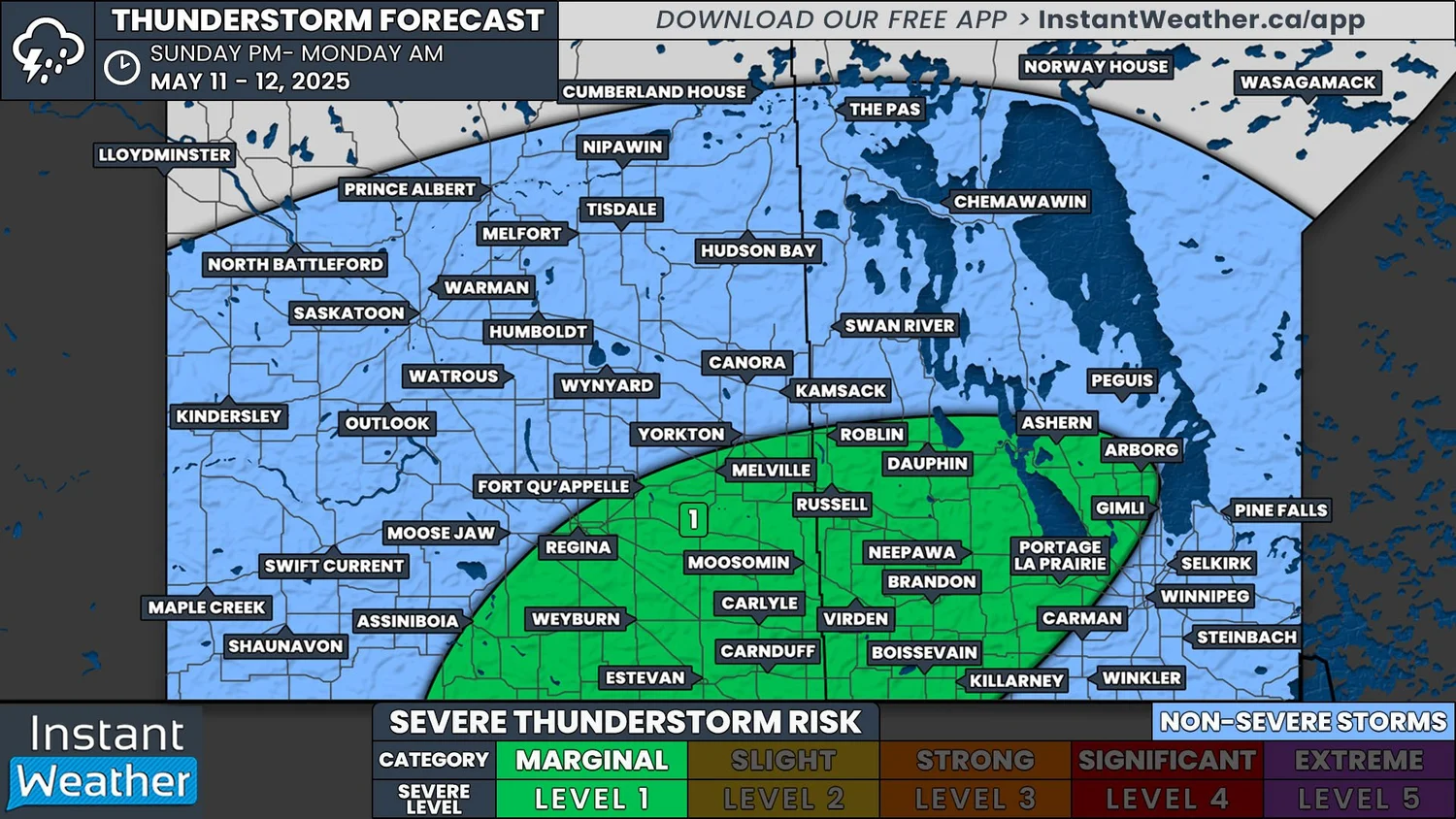
NOTE: YOU CAN CLICK ON THE MAP TO OPEN A ZOOMABLE IMAGE
With the arrival of the first heat wave of the year to Southern Saskatchewan and Manitoba this weekend, we’re also looking at our first real threat of severe thunderstorms for the season.
Isolated storms are expected to develop along the American border in both Saskatchewan and Manitoba this evening, starting around 5-7pm. The storms will travel northeastward into both provinces throughout the evening and into the overnight hours.
Models are suggesting that the environment could be favourable for the development of supercells, but further analysis puts the development of severe storms in question and storms could remain sub-severe. One particular area of interest for possible severe storm development will be in Southeastern Saskatchewan and through the Westman and Interlake Regions.
If severe storms end up developing this evening, the overall threats are expected to be limited. These storms could produce small hail and strong wind gusts, while the possibility of a tornado is unlikely.


