Strong Winds and Timbit Sized Hail Possible with Widespread Risk of Severe Thunderstorms in Southern Alberta & Saskatchewan Tuesday
/
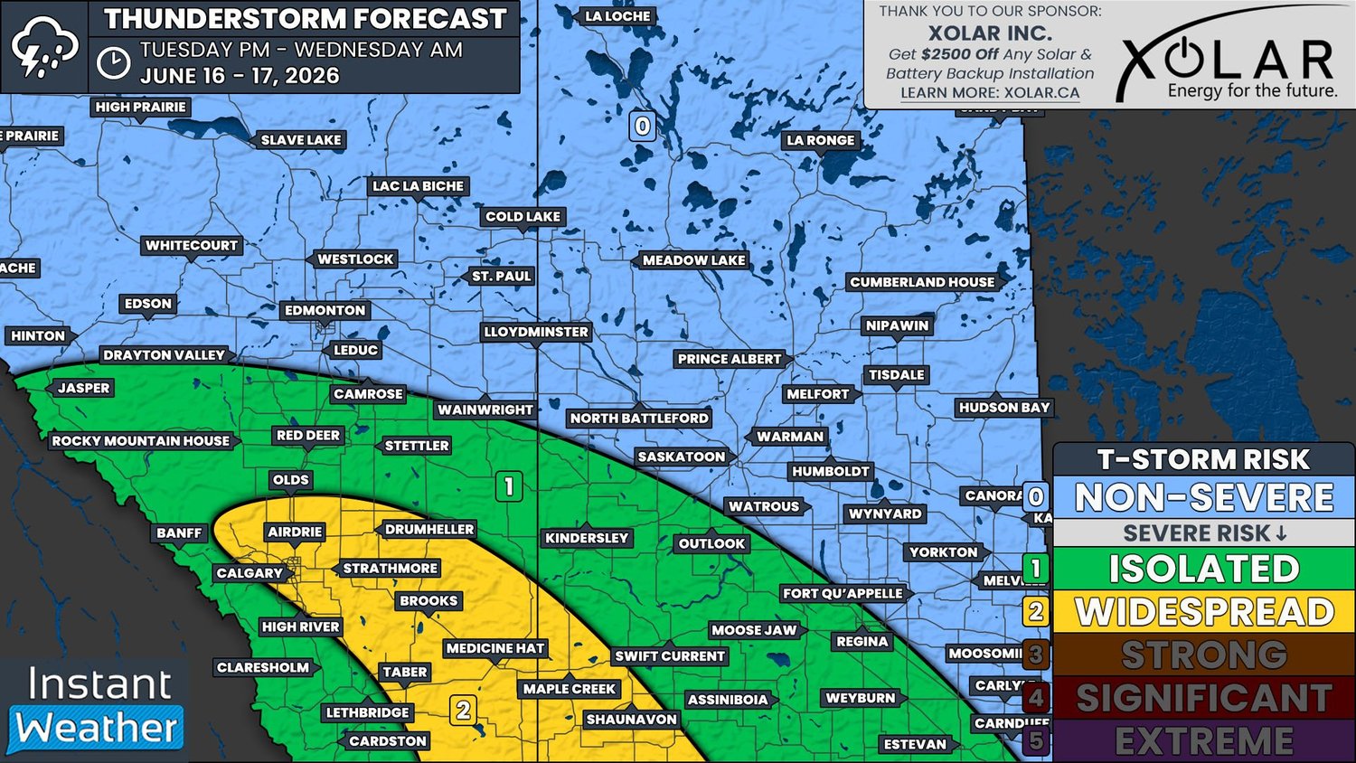
NOTE: YOU CAN CLICK ON THE MAP TO OPEN A ZOOMABLE IMAGE
It’s looking like it’ll be an active day for some parts of Alberta and Saskatchewan today. A low pressure system from Southern British Columbia will track southeastward through Southern Alberta and Saskatchewan today, which will trigger the development of thunderstorms across the region.
Temperatures are expected to climb into the low to mid-20s, with dewpoints possibly into the mid-teens, across Southern Alberta and Saskatchewan, which should help fuel thunderstorm development. There will be a modest amount of CAPE in the region, with weather models showing upwards of 1000J/kg for some areas. While this is not a great deal of instability, the combination of shear and a mechanism for lift will be enough for scattered thunderstorms to develop across the region.
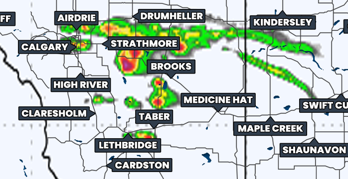
Simulated reflectivity at 2pm, courtesy of weatherbell.
Non-severe thunderstorms have already developed this morning in Central Alberta. As the low continues tracking southeast into Southern Alberta, so too will the thunderstorms and starting in the early afternoon, it’s likely that the storms that develop will become severe.
The bulk of the thunderstorm activity is expected to make its way into Southern Saskatchewan later in the afternoon, around 3-5pm. Behind the initial cluster of storms in this area, additional storms are expected to develop to the west, in Southern Alberta. Most of these storms will likely be severe, but there is a more isolated severe risk that will extend eastward across much of the rest of Southern Saskatchewan.
The thunderstorms will gradually weaken through the evening as they continue tracking into Montana and most of the storms should cross the international border by midnight. However, there is a chance that some storms could linger in Southern Saskatchewan into the early morning hours.
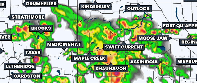
Simulated reflectivity at 6pm, courtesy of weatherbell.
An area that stretches from northwest of Calgary southeastward into Southwestern Saskatchewan, shown in yellow on our forecast map, is where there is the greatest risk for widespread severe thunderstorms today. Across this region, the main threat from thunderstorms today will be strong wind gusts in excess of 100km/h, however there is also the threat that these storms could produce large hail that could be as large as Timbits and maybe even as large as golf balls. Given that at least one tornado is confirmed to have touched down in Northern Alberta from this system last night, the possibility of additional tornadoes today can not be ruled out.


