Edmonton Area in the Crosshairs for Strong Severe Thunderstorms Tuesday with Threat of Very Large Hail and Possible Tornadoes
/
NOTE: YOU CAN CLICK ON THE MAP TO OPEN A ZOOMABLE IMAGE
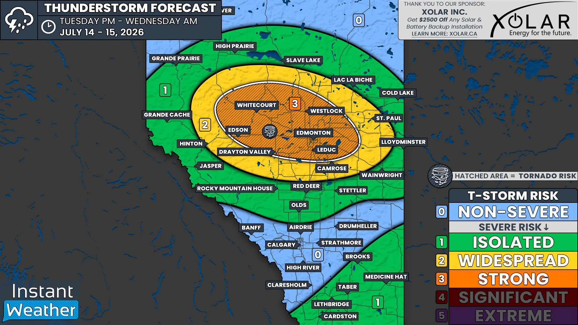
It’ll be yet another day with the threat of strong severe thunderstorms for parts of Alberta. Today’s risk will be along the Highway 43 corridor between Whitecourt and Edmonton, and throughout the surrounding area, including Edson, Drayton Valley, and Westlock.
There will be plenty of instability in the atmosphere across Central Alberta and into parts of Northern Alberta today, with upwards of 3000J/kg of CAPE being shown on weather models beginning this afternoon. Additionally, ample moisture and shear throughout the region will lead to all the necessary ingredients being in place for some strong severe thunderstorms to develop.
Today’s thunderstorms could possibly begin in the Foothills in the mid-to-late afternoon, but it’s more likely that storms will fire up in this area during the early evening. Once the isolated storms do start to develop, they are expected to rapidly strengthen into strong supercells, which will track mostly eastward across the province through the remainder of the evening and overnight.
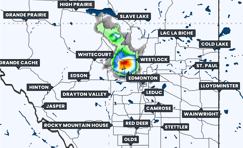
Hourly Precipitation at 1Am MDT, courtesy of weatherbell.
These severe thunderstorms are expected to reach the Edmonton area sometime in the late evening or shortly after midnight, around 11pm-2am. These thunderstorms could very likely maintain their strength up until this point, however there is also the possibility that the storms will weaken to the west, before hitting Edmonton. Regardless, as we progress overnight and into the pre-dawn hours, and the storms continue tracking eastwards, they are expected to weaken considerably and will likely dissipate before reaching the Saskatchewan border.
The greatest threat from the strong supercell thunderstorms today will be very large hail, which could end up being up to tennis ball size. There will also be the risk of damaging wind gusts in excess of 100km/h, intense rainfall, and even the possibility of a tornado or two.
In the meantime, there will be a more isolated severe risk this afternoon and evening in Southeastern Alberta. The storms in this part of the province aren’t expected to be particularly strong, especially when compared to the storms further north, with the main concern being some strong wind gusts, small hail, and pockets of heavy rain.
Given that today’s strong severe thunderstorms will have tornado potential continuing after dark, especially in such a populated area, it’s crucial to ensure that you have all of your devices charged and that you have more than one way to receive critical alerts. We expect to be live-streaming today’s storms once they begin to develop, along with those in Ontario, Quebec, and New Brunswick, so be sure to tune in!