Interestingly, Hurricane Milton did not follow its projected almost directly eastward path overnight. Instead, the storm has wobbled southeastward, bringing it much closer to the Northern Yucatan Peninsula than initially forecasted. As a result, Mexican authorities have issued Hurricane Warnings, anticipating hurricane-force winds to impact the region today. The shift in track has led to a stronger storm approaching the Yucatan, further complicating forecasts and increasing the potential for damage along the coast.
This unexpected change in Milton’s path has also influenced weather models and the official forecast track from the National Hurricane Center (NHC). Despite continued uncertainty regarding Milton’s precise path, the storm is now forecasted to make landfall further south than originally thought, with the Tampa Bay area now directly in its sights. The NHC predicts that Milton will curve northeastward later this afternoon, with an increase in forward speed, leading to a likely landfall on Wednesday evening.
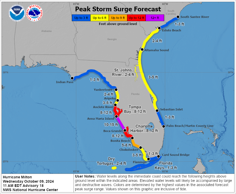
Unfortunately, this is a worst-case scenario for Tampa Bay, as the region is still recovering from storm surge damage caused by Hurricane Helene less than two weeks ago. Now, with Milton’s stronger winds and greater storm surge, the area faces an even more dangerous situation. With plenty of loose debris still scattered along the coast, the hurricane-force winds could easily turn these remnants into dangerous projectiles when the storm hits. The NHC is currently forecasting storm surges of 8-12 feet from the Anclote River to Englewood, including Tampa Bay itself. Due to Milton’s angle of approach, the surge could be more severe than what was seen with Helene, posing an even greater threat to life and property.
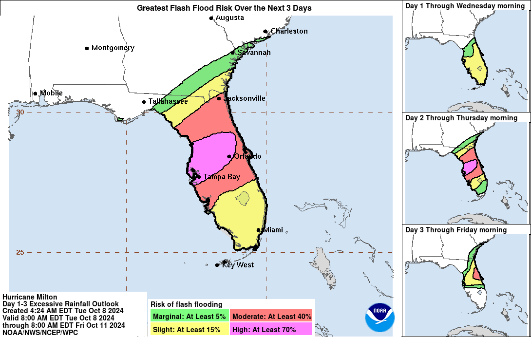
In addition to storm surge concerns, much of the Florida Peninsula and the Florida Keys could see 5-10 inches (127-254 mm) of rainfall, with localized totals potentially reaching 15 inches (381 mm). These heavy rains elevate the risk of flash flooding, especially in low-lying areas and along rivers.
After landfall, Milton is expected to track across the Florida Peninsula and emerge into the Atlantic, where it will briefly remain a hurricane before transitioning into a post-tropical storm. However, the impacts to Florida and surrounding areas will be significant long before the storm weakens.