Massive Tennis Ball Hail and Tornado Threat from Strong Severe Thunderstorms Across All Three Prairie Provinces Thursday
/
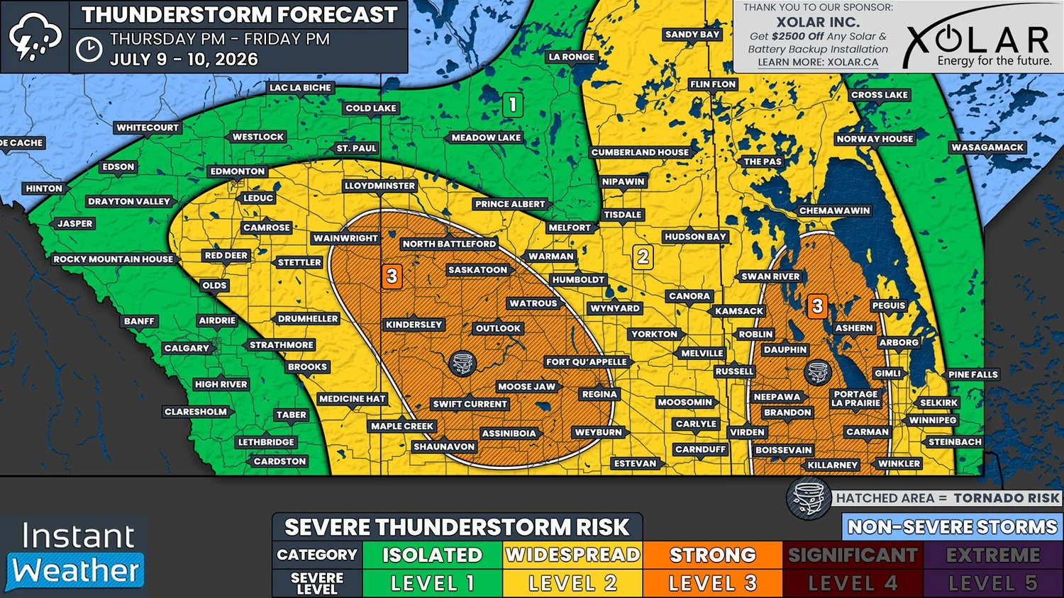
NOTE: YOU CAN CLICK ON THE MAP TO OPEN A ZOOMABLE IMAGE
Yesterday, two tornadoes have been confirmed to have touched near the Alberta-Saskatchewan border, south of Lloydminster. So far, no damage has been reported from the first tornado that began southwest of Paradise Valley, Alberta. The same can not be said for the second tornado, which tracked through Dillberry Lake Provincial Park, where it damaged trees, flipped a trailer, and caused minor injuries.
Unfortunately, this area will once again be at risk for tornadoes today, as we are looking at two particular regions in the Prairies where there could be strong severe thunderstorms capable of producing very large hail and tornadoes. The first area of concern will be in Southwestern Manitoba and extending northward into the Parkland and Interlake Regions. The second area is further west, extending southeastward from Wainwright, through Kindersley, to the Moose Jaw and Regina area.
To start things off, we’ll take a look at the severe risk in Eastern Saskatchewan and into Manitoba. As discussed in yesterday’s forecast, last night’s storms did manage to track across Saskatchewan overnight and persist through to the daylight hours today. They weakened considerably after crossing the Manitoba border and have gradually dissipated this morning.
Despite the lingering storms, the same low and frontal boundary setup that triggered yesterday’s tornadoes is positioned over Southern Saskatchewan and it will continue tracking eastward today.
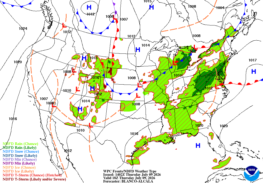
Future Surface weather map with the positions of highs, lows, and fronts displayed for 12pm cst/1pm CDT on Thursday, courtesy of the national weather service.
Temperatures will climb into the mid-to-upper 20s and dewpoints into the low 20s across much of Southeastern Saskatchewan and Southern Manitoba today, meaning there will be plenty of moisture. The environment will also be quite unstable, with CAPE values possibly as high as 3000J/kg. Along with a decent amount of shear, all of the ingredients will be in place for strong severe thunderstorms to develop this afternoon as the low tracks through the region.
Thunderstorms could start to develop in the early afternoon in Southeastern Saskatchewan, along the warm and occluded fronts. However it’s looking more likely that storm initiation will occur on the other side of the Saskatchewan-Manitoba border in the mid-afternoon.
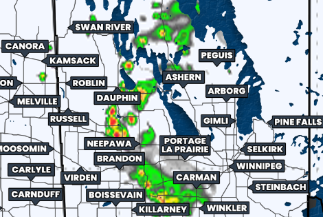
Simulated reflectivity at 3pm CdT, courtesy of weatherbell.
Given the extensive north-south orientation of the warm and occluded fronts, it’s possible that there could be widespread severe thunderstorm development that extends northwards from the international border to north of Flin Flon. While there is this large severe risk, the strongest severe thunderstorms are expected to remain further south.
The storms in Southern Manitoba are expected to strengthen quickly once they develop, especially if they interact with any lingering outflow boundaries from this mornings thunderstorms. If this were to happen, we could see some fairly explosive development in the region. There could be a few supercell storms, but it’s mostly looking like the storms will be multicellular in nature.
As the front slowly continues to track eastward and crosses Manitoba through the afternoon and evening, so too will the storms. In fact, these slow moving, moisture-laden storms could dump a lot of rain over an area that has already been dealing with major flooding issues, so be prepared.
Other than exacerbating the flooding concerns, if things really ramp up this afternoon and evening, the strong severe thunderstorms could potentially produce some massive hail today, with estimates of hail as large as tennis balls being possible. Damaging wind gusts up to 120km/h are also likely with these strong storms, and there will also be a threat of tornadoes if we end up seeing some of that explosive development.
The severe weather threat could possibly move into Winnipeg and the Red River Valley in the evening, but most models are showing the storms tracking southeastward into the States. The possibility of storms in this region is still a bit questionable, so we’re forecasting a widespread risk to the east of the area of strongest storms.
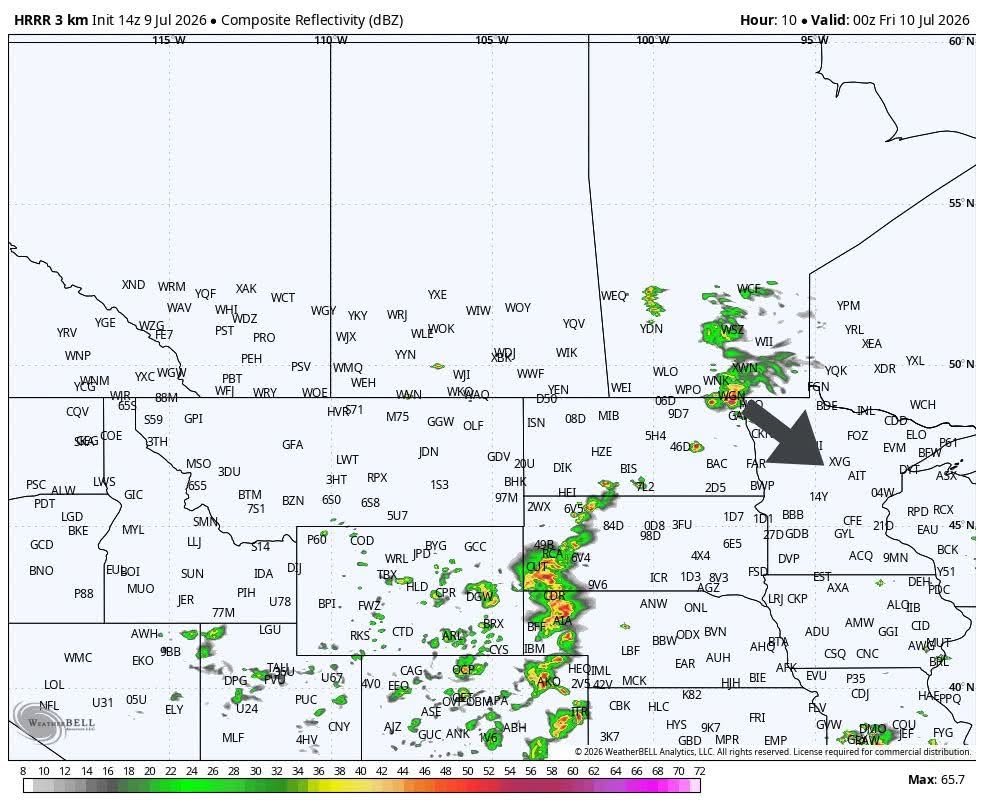
Simulated reflectivity, with added storm motion, at 7pm CdT, courtesy of weatherbell.
While storms are impacting Southern Manitoba, there will also be the risk of some severe thunderstorms further west.
A new low has been forming over Southern Alberta and it could trigger thunderstorms to develop this afternoon, but it’s looking like a boom or bust situation in this region. There will be plenty of moisture and a decent amount of instability, but there could actually be too much shear for thunderstorms to survive.
If storms are able to develop today and they aren’t over-sheared, they will likely be supercells that could start up in Central Alberta and track southeastward across West Central and Southwestern Saskatchewan. Models that are showing thunderstorm development are suggesting that these could end up being long-lived storms again, which could continue into the overnight and early morning hours as they approach the Montana border.
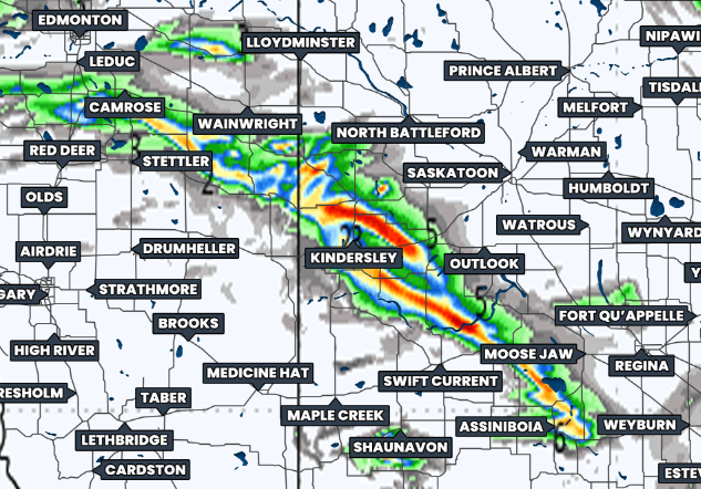
total Precipitation as of 3pm MDT/CST shows possible tracks of long-lived thunderstorms, courtesy of weatherbell.
The greatest risk of strong severe thunderstorms in Alberta and Western Saskatchewan today will exist from Wainwright to Moose Jaw and if these strong storms do develop, it could be a similar situation as yesterday. Very large hail, that could be tennis ball size or larger, would once again be the main severe threat. Damaging wind gusts well in excess of 100km/h will also be possible and there will be the threat of tornadoes, too.
Beyond the two areas we’ve highlighted as having the strongest severe thunderstorms today, there will also be a widespread severe risk across much of the Southern Prairies as a result of a favourable environmental conditions.
Shortly after 10:30am local time, Environment Canada has issued a Yellow Severe Thunderstorm Watch for parts of Central and Southern Alberta. Similar Watches will likely be issued in Saskatchewan and Manitoba in the coming hours.
As always, we will be monitoring today’s thunderstorm development very closely. We intend on live streaming today’s storms, as well as the risk in Southern Ontario, so please be sure to tune in and stay safe!